TopoQuest Logo
Do you find TopoQuest useful?
Help keep TopoQuest running and adding new maps/features by donating!
Bitcoin:  19c7KJd3qBynnjoSw5npx9KScwjBe4ifkT
Litecoin:  LXs6TkuXGGXo1vDsWCkWVdjQX94eUKd6ui
Home View Maps Find Maps Find Places Resources & Links


Duluth, Kansas Topographic Map

USGS Map Title: Duluth, KS
USGS Map MRC: 39096E2
DRG (GeoTIFF) Download: o39096e2.tif


Neighboring USGS Topographic Map Quads:


  Vermillion, KS  
39096F3
 

  Centralia, KS  
39096F2
 

  Corning, KS  
39096F1
 

  Wheaton, KS  
39096E3
 

  Duluth, KS  
39096E2
 

  Havensville, KS  
39096E1
 

  Westmoreland NE, KS  
39096D3
 

  Onaga, KS  
39096D2
 

  Onaga NE, KS  
39096D1


Map MRC Location:

N40°
W97°
N40°
W96°
H8 H7 H6 H5 H4 H3 H2 H1
G8 G7 G6 G5 G4 G3 G2 G1
F8 F7 F6 F5 F4 F3 F2 F1
E8 E7 E6 E5 E4 E3 E2 E1
D8 D7 D6 D5 D4 D3 D2 D1
C8 C7 C6 C5 C4 C3 C2 C1
B8 B7 B6 B5 B4 B3 B2 B1
A8 A7 A6 A5 A4 A3 A2 A1
N39°
W97°
N39°
W96°

Duluth, KS USGS 1:24K Topographic Map Preview:
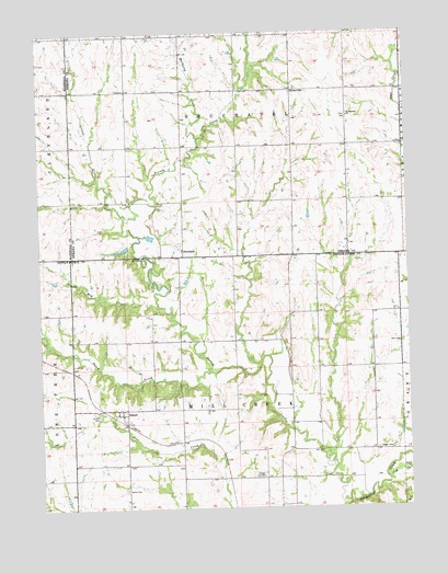
Duluth, KS USGS Topographic Map
Click on map above to begin viewing in our Map Viewer.

This topographic map contains these locations and features:
Feature Name Type Latitude Longitude GNIS ID View Map
BeckervillePopulated PlaceN39.6097°W96.1639°484640View Map
Cool Springs Golf CourseLocaleN39.5042°W96.1768°2694556View Map
Cow CreekStreamN39.5089°W96.1336°473434View Map
DuluthPopulated PlaceN39.5247°W96.2231°473431View Map
Duluth CemeteryCemeteryN39.5244°W96.2309°473430View Map
Dutch CreekStreamN39.5364°W96.1919°484345View Map
French CreekStreamN39.5011°W96.1489°473211View Map
Gilson CreekStreamN39.5761°W96.2214°473438View Map
Home CemeteryCemeteryN39.5047°W96.2220°473429View Map
Mud CreekStreamN39.5528°W96.2094°473422View Map
Mulberry CreekStreamN39.5972°W96.1958°473212View Map
NeuchatelPopulated PlaceN39.5681°W96.2019°484639View Map
Neuchatel CemeteryCemeteryN39.5686°W96.2022°2673329View Map
Onaga CemeteryCemeteryN39.5085°W96.1765°473432View Map
Regard CemeteryCemeteryN39.5153°W96.1361°473433View Map
Saint Patricks CemeteryCemeteryN39.6029°W96.1462°2673332View Map
Saint Patricks ChurchChurchN39.6028°W96.1447°473436View Map
Saint Pauls Lutheran ChurchChurchN39.5263°W96.2215°2690309View Map
Township of Mill CreekCivilN39.5153°W96.1837°473435View Map
Township of NeuchatelCivilN39.6098°W96.1830°473210View Map

Note: Coordinates in the location and feature list above are referenced to NAD83 datum.


Copyright (C) 2008-2024 Ryan Niemi / Sunset Dynamics ... All Rights Reserved