TopoQuest Logo
Do you find TopoQuest useful?
Help keep TopoQuest running and adding new maps/features by donating!
Bitcoin:  19c7KJd3qBynnjoSw5npx9KScwjBe4ifkT
Litecoin:  LXs6TkuXGGXo1vDsWCkWVdjQX94eUKd6ui
Home View Maps Find Maps Find Places Resources & Links


Wheaton, Kansas Topographic Map

USGS Map Title: Wheaton, KS
USGS Map MRC: 39096E3
DRG (GeoTIFF) Download: o39096e3.tif


Neighboring USGS Topographic Map Quads:


  Frankfort, KS  
39096F4
 

  Vermillion, KS  
39096F3
 

  Centralia, KS  
39096F2
 

  Frankfort SW, KS  
39096E4
 

  Wheaton, KS  
39096E3
 

  Duluth, KS  
39096E2
 

  Westmoreland, KS  
39096D4
 

  Westmoreland NE, KS  
39096D3
 

  Onaga, KS  
39096D2


Map MRC Location:

N40°
W97°
N40°
W96°
H8 H7 H6 H5 H4 H3 H2 H1
G8 G7 G6 G5 G4 G3 G2 G1
F8 F7 F6 F5 F4 F3 F2 F1
E8 E7 E6 E5 E4 E3 E2 E1
D8 D7 D6 D5 D4 D3 D2 D1
C8 C7 C6 C5 C4 C3 C2 C1
B8 B7 B6 B5 B4 B3 B2 B1
A8 A7 A6 A5 A4 A3 A2 A1
N39°
W97°
N39°
W96°

Wheaton, KS USGS 1:24K Topographic Map Preview:
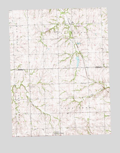
Wheaton, KS USGS Topographic Map
Click on map above to begin viewing in our Map Viewer.

This topographic map contains these locations and features:
Feature Name Type Latitude Longitude GNIS ID View Map
City of WheatonCivilN39.5022°W96.3188°2397297View Map
Clear Creek CemeteryCemeteryN39.5233°W96.3594°473423View Map
LillisPopulated PlaceN39.6097°W96.2961°473425View Map
NolanPopulated PlaceN39.5667°W96.2781°484638View Map
Pavilion (historical)LocaleN39.6125°W96.3267°481970View Map
Pleasant Hill CemeteryCemeteryN39.5507°W96.2865°473424View Map
Pottawatomie County Fire District 4 WheatonBuildingN39.5030°W96.3187°2111739View Map
Saint Josephs Catholic CemeteryCemeteryN39.6020°W96.3121°2673310View Map
Saint Josephs ChurchChurchN39.6023°W96.3147°473426View Map
Saint Luke Lutheran ChurchChurchN39.5015°W96.3212°2690306View Map
Saint Luke Lutheran North CemeteryCemeteryN39.5044°W96.3145°2673346View Map
Township of ClevelandCivilN39.6097°W96.2954°473201View Map
Township of Lone TreeCivilN39.5224°W96.2954°473428View Map
WheatonPopulated PlaceN39.5022°W96.3208°473427View Map
Wheaton Elementary SchoolSchoolN39.5006°W96.3200°480266View Map
Wheaton Wastewater PlantLocaleN39.5064°W96.3226°2691917View Map
Wyoming (historical)LocaleN39.6131°W96.2961°482044View Map

Note: Coordinates in the location and feature list above are referenced to NAD83 datum.


Copyright (C) 2008-2025 Ryan Niemi / Sunset Dynamics ... All Rights Reserved