TopoQuest Logo
Do you find TopoQuest useful?
Help keep TopoQuest running and adding new maps/features by donating!
Bitcoin:  19c7KJd3qBynnjoSw5npx9KScwjBe4ifkT
Litecoin:  LXs6TkuXGGXo1vDsWCkWVdjQX94eUKd6ui
Home View Maps Find Maps Find Places Resources & Links


Dunlap NE, New Mexico Topographic Map

USGS Map Title: Dunlap NE, NM
USGS Map MRC: 34104B5
DRG (GeoTIFF) Download: o34104b5.tif


Neighboring USGS Topographic Map Quads:


  El Morro Mesa, NM  
34104C6
 

  Horney Ranch, NM  
34104C5
 

  West Camp, NM  
34104C4
 

  The Old Dry Lake, NM  
34104B6
 

  Dunlap NE, NM  
34104B5
 

  Conejo Creek West, NM  
34104B4
 

  Devils Well, NM  
34104A6
 

  Dunlap, NM  
34104A5
 

  Lovelady Draw, NM  
34104A4


Map MRC Location:

N35°
W105°
N35°
W104°
H8 H7 H6 H5 H4 H3 H2 H1
G8 G7 G6 G5 G4 G3 G2 G1
F8 F7 F6 F5 F4 F3 F2 F1
E8 E7 E6 E5 E4 E3 E2 E1
D8 D7 D6 D5 D4 D3 D2 D1
C8 C7 C6 C5 C4 C3 C2 C1
B8 B7 B6 B5 B4 B3 B2 B1
A8 A7 A6 A5 A4 A3 A2 A1
N34°
W105°
N34°
W104°

Dunlap NE, NM USGS 1:24K Topographic Map Preview:
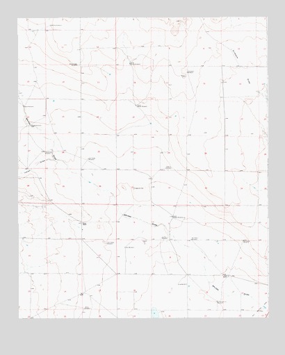
Dunlap NE, NM USGS Topographic Map
Click on map above to begin viewing in our Map Viewer.

This topographic map contains these locations and features:
Feature Name Type Latitude Longitude GNIS ID View Map
Atwood WindmillLocaleN34.2054°W104.6183°896898View Map
Cook RanchLocaleN34.1429°W104.5197°896955View Map
Cullen WindmillLocaleN34.1584°W104.5530°896964View Map
Engleville CemeteryCemeteryN34.1794°W104.5672°897003View Map
First Presbyterian ChurchChurchN34.1862°W104.5230°919872View Map
First United Methodist ChurchChurchN34.1862°W104.5230°919871View Map
Hutchinson WindmillLocaleN34.1945°W104.6116°897055View Map
Indian DrawValleyN34.1909°W104.6066°897057View Map
Key RanchLocaleN34.1354°W104.5922°897070View Map
Killo WindmillLocaleN34.1545°W104.5714°897071View Map
Law WindmillLocaleN34.1390°W104.5450°897078View Map
Lee Haney WindmillLocaleN34.1912°W104.5897°897079View Map
McClure WindmillLocaleN34.2467°W104.6083°897109View Map
North Markel WindmillLocaleN34.2309°W104.5678°897136View Map
Northeast WindmillLocaleN34.1570°W104.5128°897150View Map
Northwest WindmillLocaleN34.1576°W104.5386°897152View Map
School Section WindmillLocaleN34.1317°W104.5258°897211View Map
SoRelle WindmillLocaleN34.1873°W104.5508°897229View Map
South Markel WindmillLocaleN34.2134°W104.5650°897231View Map
South SoRelle WindmillLocaleN34.1670°W104.5475°897235View Map
Stark WindmillLocaleN34.2131°W104.6222°897242View Map
Steele RanchLocaleN34.1651°W104.5928°897243View Map
Thompson WindmillLocaleN34.2270°W104.5397°897252View Map
Tom Haney WindmillLocaleN34.1562°W104.5805°897255View Map
White WindmillLocaleN34.1292°W104.5919°897287View Map
Windy Ridge WindmillLocaleN34.2304°W104.5947°897291View Map

Note: Coordinates in the location and feature list above are referenced to NAD83 datum.


Copyright (C) 2008-2025 Ryan Niemi / Sunset Dynamics ... All Rights Reserved