TopoQuest Logo
Do you find TopoQuest useful?
Help keep TopoQuest running and adding new maps/features by donating!
Bitcoin:  19c7KJd3qBynnjoSw5npx9KScwjBe4ifkT
Litecoin:  LXs6TkuXGGXo1vDsWCkWVdjQX94eUKd6ui
Home View Maps Find Maps Find Places Resources & Links


Duquesne, Arizona Topographic Map

USGS Map Title: Duquesne, AZ
USGS Map MRC: 31110C6
DRG (GeoTIFF) Download: o31110c6.tif


Neighboring USGS Topographic Map Quads:


  Cumero Canyon, AZ  
31110D7
 

  Harshaw, AZ  
31110D6
 

  Canelo Pass, AZ  
31110D5
 

  Kino Springs, AZ  
31110C7
 

  Duquesne, AZ  
31110C6
 

  Lochiel, AZ  
31110C5


Map MRC Location:

N32°
W111°
N32°
W110°
H8 H7 H6 H5 H4 H3 H2 H1
G8 G7 G6 G5 G4 G3 G2 G1
F8 F7 F6 F5 F4 F3 F2 F1
E8 E7 E6 E5 E4 E3 E2 E1
D8 D7 D6 D5 D4 D3 D2 D1
C8 C7 C6 C5 C4 C3 C2 C1
B8 B7 B6 B5 B4 B3 B2 B1
A8 A7 A6 A5 A4 A3 A2 A1
N31°
W111°
N31°
W110°

Duquesne, AZ USGS 1:24K Topographic Map Preview:
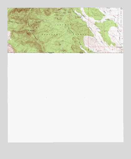
Duquesne, AZ USGS Topographic Map
Click on map above to begin viewing in our Map Viewer.

This topographic map contains these locations and features:
Feature Name Type Latitude Longitude GNIS ID View Map
Antonio CanyonValleyN31.3420°W110.6645°45613View Map
Antonio TankReservoirN31.3345°W110.6626°36525View Map
Belmont MineMineN31.3682°W110.6956°26208View Map
Benches SpringSpringN31.3564°W110.7444°2680481View Map
Benton MineMineN31.3407°W110.6948°26225View Map
Benton SpringSpringN31.3443°W110.6925°36549View Map
Bonanza MineMineN31.3732°W110.6865°26587View Map
Callahan CorralLocaleN31.3683°W110.6678°2680488View Map
Dudley MineMineN31.3732°W110.6937°28661View Map
DuquesnePopulated PlaceN31.3709°W110.6854°28680View Map
Duquesne CorralLocaleN31.3614°W110.6922°2680483View Map
Duquesne MineMineN31.3698°W110.6901°28681View Map
East Ten TankReservoirN31.3723°W110.6400°36618View Map
Empire MineMineN31.3679°W110.6934°28900View Map
Everett WindmillWellN31.3734°W110.6412°36627View Map
Fray Marcos de Niza Historical MonumentParkN31.3387°W110.6273°29171View Map
Government CorralLocaleN31.3505°W110.6897°2680484View Map
Heady-Ashburn RanchLocaleN31.3632°W110.6398°29836View Map
Holland MineMineN31.3707°W110.6956°30066View Map
Line Boy MineMineN31.3357°W110.6909°31007View Map
Line Boy SpringSpringN31.3362°W110.6906°36691View Map
Lower One TankReservoirN31.3639°W110.6549°36704View Map
Lower Thirteen TankReservoirN31.3481°W110.6527°36708View Map
Lower Three TankReservoirN31.3481°W110.6529°42403View Map
Lower Two TankReservoirN31.3680°W110.6501°36710View Map
Mount WashingtonSummitN31.3534°W110.7254°35911View Map
North Fourteen TankReservoirN31.3503°W110.6636°36750View Map
North TankReservoirN31.3612°W110.6659°36752View Map
Paradise Canyon MineMineN31.3345°W110.6537°32671View Map
San Antonio CanyonValleyN31.3195°W110.6256°45606View Map
San Rafael State ParkParkN31.3508°W110.6292°2680487View Map
Santa Niņo CorralLocaleN31.3628°W110.7047°2680482View Map
Santo Niņo MineMineN31.3612°W110.7181°34079View Map
South Fourteen TankReservoirN31.3421°W110.6585°36851View Map
Texas MineMineN31.3748°W110.6906°35204View Map
Trask RanchLocaleN31.3657°W110.6698°35451View Map
Twelve TankReservoirN31.3639°W110.6446°36885View Map
Upper One TankReservoirN31.3740°W110.6674°36890View Map
Upper Thirteen TankReservoirN31.3549°W110.6544°36893View Map
Washington GulchValleyN31.3645°W110.6673°35907View Map

Note: Coordinates in the location and feature list above are referenced to NAD83 datum.


Copyright (C) 2008-2024 Ryan Niemi / Sunset Dynamics ... All Rights Reserved