TopoQuest Logo
Do you find TopoQuest useful?
Help keep TopoQuest running and adding new maps/features by donating!
Bitcoin:  19c7KJd3qBynnjoSw5npx9KScwjBe4ifkT
Litecoin:  LXs6TkuXGGXo1vDsWCkWVdjQX94eUKd6ui
Home View Maps Find Maps Find Places Resources & Links


Durand, Michigan Topographic Map

USGS Map Title: Durand, MI
USGS Map MRC: 42083H8
DRG (GeoTIFF) Download: o42083h8.tif


Neighboring USGS Topographic Map Quads:


  Easton, MI  
43084A1
 

  New Lothrop, MI  
43083A8
 

  Flushing, MI  
43083A7
 

  Corunna, MI  
42084H1
 

  Durand, MI  
42083H8
 

  Swartz Creek, MI  
42083H7
 

  Corunna SE, MI  
42084G1
 

  Byron, MI  
42083G8
 

  Linden, MI  
42083G7


Map MRC Location:

N43°
W84°
N43°
W83°
H8 H7 H6 H5 H4 H3 H2 H1
G8 G7 G6 G5 G4 G3 G2 G1
F8 F7 F6 F5 F4 F3 F2 F1
E8 E7 E6 E5 E4 E3 E2 E1
D8 D7 D6 D5 D4 D3 D2 D1
C8 C7 C6 C5 C4 C3 C2 C1
B8 B7 B6 B5 B4 B3 B2 B1
A8 A7 A6 A5 A4 A3 A2 A1
N42°
W84°
N42°
W83°

Durand, MI USGS 1:24K Topographic Map Preview:
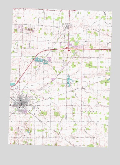
Durand, MI USGS Topographic Map
Click on map above to begin viewing in our Map Viewer.

This topographic map contains these locations and features:
Feature Name Type Latitude Longitude GNIS ID View Map
Atherton DrainStreamN42.9023°W83.8994°620300View Map
Brown DrainCanalN42.9309°W83.9686°622077View Map
Calvary Baptist ChurchChurchN42.9125°W83.8847°2611686View Map
Chalker CemeteryCemeteryN42.9405°W83.9889°2576142View Map
Chalker DrainCanalN42.9634°W83.9433°623043View Map
Church of the NazareneChurchN42.9183°W83.9744°2576084View Map
City of DurandCivilN42.9137°W83.9887°1626198View Map
Congregational ChurchChurchN42.9147°W83.9850°2576086View Map
Corrigall DrainCanalN42.9020°W83.9208°623854View Map
Davison DrainCanalN42.9489°W83.9158°624359View Map
Doyle Knight Elementary SchoolSchoolN42.9861°W83.9331°2575932View Map
DuffieldPopulated PlaceN42.9281°W83.9100°624967View Map
Duffield Post Office (historical)Post OfficeN42.9281°W83.9100°2585857View Map
Duffield StationLocaleN42.9289°W83.9100°2585834View Map
DurandPopulated PlaceN42.9120°W83.9847°625016View Map
Durand Area High SchoolSchoolN42.9197°W83.9789°2576197View Map
Durand Assembly of God ChurchChurchN42.9175°W83.9878°2576087View Map
Durand Church of GodChurchN42.9125°W83.9611°2576094View Map
Durand City HallBuildingN42.9128°W83.9878°2576112View Map
Durand Family Health CareHospitalN42.9256°W83.9861°2576104View Map
Durand Fire DepartmentBuildingN42.9122°W83.9869°2576113View Map
Durand Memorial LibraryBuildingN42.9175°W83.9844°2576114View Map
Durand Middle SchoolSchoolN42.9239°W83.9758°2576117View Map
Durand Police DepartmentBuildingN42.9120°W83.9866°2737574View Map
Durand Post OfficePost OfficeN42.9133°W83.9881°2576115View Map
Durand Railroad History Historical MarkerParkN42.9120°W83.9860°2571280View Map
Durand StationLocaleN42.9092°W83.9825°2576196View Map
Durand Union Station Historical MarkerParkN42.9096°W83.9827°2571282View Map
Durand Vernon AmbulanceBuildingN42.9135°W83.9843°2662038View Map
Durant Convalescent CenterHospitalN42.9208°W83.9922°2576106View Map
Dutch Hollow Golf ClubLocaleN42.9211°W83.9944°2576116View Map
Faith Baptist ChurchChurchN42.9153°W83.9917°2576089View Map
First Baptist ChurchChurchN42.9111°W83.9964°2576101View Map
Fitch ParkParkN42.9111°W83.9778°2576202View Map
Free Methodist ChurchChurchN42.9039°W83.9881°2576097View Map
Fullmer DrainCanalN42.9025°W83.9602°626560View Map
Gansley DrainCanalN42.9845°W83.9405°626625View Map
Grace ChurchChurchN42.9373°W83.9880°627045View Map
Guest DrainCanalN42.9300°W83.9472°627498View Map
Holiday Meadows Golf CourseLocaleN42.9550°W83.9558°2576199View Map
Interchange 123CrossingN42.9642°W83.9286°2582658View Map
Jones CreekStreamN42.9364°W83.9344°629368View Map
Kingdom Hall of Jehovah's WitnessesChurchN42.9256°W83.9719°2576083View Map
Knights Templar Special Historical MarkerParkN42.9120°W83.9860°2571281View Map
Leisure LakeLakeN42.9527°W83.9650°630292View Map
Leisure Lake CampgroundLocaleN42.9547°W83.9611°2576198View Map
LennonPopulated PlaceN42.9844°W83.9300°630312View Map
Lennon DrainCanalN42.9825°W83.9050°630313View Map
Lennon Police DepartmentBuildingN42.9846°W83.9296°2737400View Map
Lennon Post OfficePost OfficeN42.9817°W83.9294°2575930View Map
Lennon StationLocaleN42.9833°W83.9319°2576191View Map
Lennon United Methodist ChurchChurchN42.9836°W83.9333°2575931View Map
Lennon Village HallBuildingN42.9842°W83.9300°2575929View Map
Light of Faith FellowshipChurchN42.9072°W83.9869°2576096View Map
Limbarg DrainCanalN42.9995°W83.9616°630414View Map
Lovejoy CemeteryCemeteryN42.8811°W83.9919°631141View Map
Michigan History Railroad MuseumBuildingN42.9094°W83.9825°2576204View Map
Mikan DrainCanalN42.9078°W83.9419°632296View Map
Monroe Medical ClinicHospitalN42.9211°W83.9925°2576107View Map
Monroe PlazaLocaleN42.9231°W83.9906°2576221View Map
Neal SchoolSchoolN42.9111°W83.9986°633248View Map
Oak Street Baptist ChurchChurchN42.9036°W83.9867°2576099View Map
Optimist ParkParkN42.9028°W83.9847°2576200View Map
Perkins LibraryBuildingN42.9842°W83.9300°2575933View Map
Pilgrim ChurchChurchN42.9839°W83.9416°634882View Map
Porter DrainStreamN42.8948°W83.8802°635302View Map
Robert Kerr Elementary SchoolSchoolN42.9186°W83.9775°2576119View Map
Saint Joseph CemeteryCemeteryN42.8831°W83.9202°636767View Map
Saint Mary's ChurchChurchN42.9150°W83.9767°2576085View Map
Saint Mary's SchoolSchoolN42.9147°W83.9758°2576103View Map
Shaw ParkParkN42.9050°W83.9831°2576201View Map
Sickles DrainCanalN42.8845°W83.9391°637874View Map
South Fire HallBuildingN42.8990°W83.9863°2635993View Map
Swartz Creek City WellsWellN42.9498°W83.9605°1614478View Map
Terry DrainCanalN42.9195°W83.8936°1614687View Map
Threemile CreekStreamN42.9286°W83.9997°1614829View Map
Township of VernonCivilN42.8854°W83.9870°1627196View Map
Trumble ParkParkN42.9175°W83.9839°2576203View Map
United Methodist ChurchChurchN42.9111°W83.9672°2576092View Map
Venice Township Fire DepartmentBuildingN42.9854°W83.9675°2636131View Map
Village of LennonCivilN42.9854°W83.9325°2398419View Map
Waite FieldAirportN42.8919°W83.9316°2717698View Map
Yerian CemeteryCemeteryN42.9628°W83.9925°1616882View Map

Note: Coordinates in the location and feature list above are referenced to NAD83 datum.


Copyright (C) 2008-2024 Ryan Niemi / Sunset Dynamics ... All Rights Reserved