TopoQuest Logo
Do you find TopoQuest useful?
Help keep TopoQuest running and adding new maps/features by donating!
Bitcoin:  19c7KJd3qBynnjoSw5npx9KScwjBe4ifkT
Litecoin:  LXs6TkuXGGXo1vDsWCkWVdjQX94eUKd6ui
Home View Maps Find Maps Find Places Resources & Links


Arbuckle, California Topographic Map

USGS Map Title: Arbuckle, CA
USGS Map MRC: 39122A1
DRG (GeoTIFF) Download: o39122a1.tif


Neighboring USGS Topographic Map Quads:


  Williams, CA  
39122B2
 

  Colusa, CA  
39122B1
 

  Meridian, CA  
39121B8
 

  Cortina Creek, CA  
39122A2
 

  Arbuckle, CA  
39122A1
 

  Grimes, CA  
39121A8
 

  Rumsey, CA  
38122H2
 

  Wildwood School, CA  
38122H1
 

  Dunnigan, CA  
38121H8


Map MRC Location:

N40°
W123°
N40°
W122°
H8 H7 H6 H5 H4 H3 H2 H1
G8 G7 G6 G5 G4 G3 G2 G1
F8 F7 F6 F5 F4 F3 F2 F1
E8 E7 E6 E5 E4 E3 E2 E1
D8 D7 D6 D5 D4 D3 D2 D1
C8 C7 C6 C5 C4 C3 C2 C1
B8 B7 B6 B5 B4 B3 B2 B1
A8 A7 A6 A5 A4 A3 A2 A1
N39°
W123°
N39°
W122°

Arbuckle, CA USGS 1:24K Topographic Map Preview:
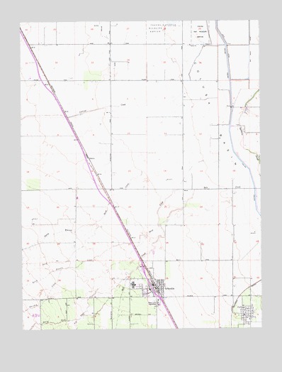
Arbuckle, CA USGS Topographic Map
Click on map above to begin viewing in our Map Viewer.

This topographic map contains these locations and features:
Feature Name Type Latitude Longitude GNIS ID View Map
ArbucklePopulated PlaceN39.0174°W122.0577°1657943View Map
Arbuckle Census Designated PlaceCensusN39.0142°W122.0611°2407755View Map
Arbuckle Elementary SchoolSchoolN39.0159°W122.0600°1703015View Map
Arbuckle Post OfficePost OfficeN39.0168°W122.0573°1703014View Map
Arbuckle United Methodist ChurchChurchN39.0141°W122.0611°1703016View Map
Arbuckle Volunteer Fire DepartmentBuildingN39.0181°W122.0587°2621847View Map
College CityPopulated PlaceN39.0057°W122.0094°1658299View Map
College City Census Designated PlaceCensusN39.0063°W122.0068°2582979View Map
College City Post OfficePost OfficeN39.0080°W122.0066°1703018View Map
Colusa TroughCanalN39.0607°W122.0058°233705View Map
Cortina CreekStreamN39.0902°W122.0416°221602View Map
Elk CreekStreamN39.0227°W122.0697°253885View Map
GenevraPopulated PlaceN39.0699°W122.0916°1658604View Map
Mc Cabe Ranch AirportAirportN39.0102°W122.0986°1653226View Map
North Branch Sand CreekStreamN39.0671°W122.0344°229609View Map
North Fork Elk CreekStreamN39.0041°W122.0961°255114View Map
Pierce Christian College (historical)SchoolN39.0038°W122.0086°1723370View Map
Pierce High SchoolSchoolN39.0102°W122.0552°230637View Map
Pierce Joint Union High School (historical)SchoolN39.0038°W122.0089°1723371View Map
Prize (historical)Populated PlaceN39.0566°W122.0158°1670440View Map
Salt CreekStreamN39.0566°W122.0044°234612View Map
Sand CreekStreamN39.0674°W122.0114°232494View Map
South Branch Sand CreekStreamN39.0271°W122.0947°234941View Map
Strain Ranch AirportAirportN39.0532°W122.0964°2770480View Map
Whisky CreekStreamN39.0238°W122.1064°237621View Map

Note: Coordinates in the location and feature list above are referenced to NAD83 datum.


Copyright (C) 2008-2025 Ryan Niemi / Sunset Dynamics ... All Rights Reserved