TopoQuest Logo
Do you find TopoQuest useful?
Help keep TopoQuest running and adding new maps/features by donating!
Bitcoin:  19c7KJd3qBynnjoSw5npx9KScwjBe4ifkT
Litecoin:  LXs6TkuXGGXo1vDsWCkWVdjQX94eUKd6ui
Home View Maps Find Maps Find Places Resources & Links


Grimes, California Topographic Map

USGS Map Title: Grimes, CA
USGS Map MRC: 39121A8
DRG (GeoTIFF) Download: o39121a8.tif


Neighboring USGS Topographic Map Quads:


  Colusa, CA  
39122B1
 

  Meridian, CA  
39121B8
 

  Sutter Buttes, CA  
39121B7
 

  Arbuckle, CA  
39122A1
 

  Grimes, CA  
39121A8
 

  Tisdale Weir, CA  
39121A7
 

  Wildwood School, CA  
38122H1
 

  Dunnigan, CA  
38121H8
 

  Kirkville, CA  
38121H7


Map MRC Location:

N40°
W122°
N40°
W121°
H8 H7 H6 H5 H4 H3 H2 H1
G8 G7 G6 G5 G4 G3 G2 G1
F8 F7 F6 F5 F4 F3 F2 F1
E8 E7 E6 E5 E4 E3 E2 E1
D8 D7 D6 D5 D4 D3 D2 D1
C8 C7 C6 C5 C4 C3 C2 C1
B8 B7 B6 B5 B4 B3 B2 B1
A8 A7 A6 A5 A4 A3 A2 A1
N39°
W122°
N39°
W121°

Grimes, CA USGS 1:24K Topographic Map Preview:
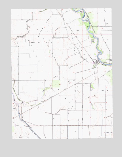
Grimes, CA USGS Topographic Map
Click on map above to begin viewing in our Map Viewer.

This topographic map contains these locations and features:
Feature Name Type Latitude Longitude GNIS ID View Map
Balsdon AirportAirportN39.0499°W121.9521°2770481View Map
Byers SloughGutN39.0396°W121.9030°220330View Map
Cecil LakeLakeN39.0928°W121.9012°220751View Map
Dry SloughGutN39.0993°W121.9480°222662View Map
Farnsworth Ranch AirstripAirportN39.1062°W121.9367°1653498View Map
Farnsworth Ranch AirstripAirportN39.1061°W121.9374°2770482View Map
Girdner BendBendN39.0818°W121.8908°224188View Map
GrainoPopulated PlaceN39.0357°W121.9622°1658642View Map
Grand Island CemeteryCemeteryN39.0968°W121.9419°224388View Map
Grand Island Elementary SchoolSchoolN39.0695°W121.8968°224389View Map
Gravel PointBendN39.1138°W121.9072°224487View Map
GrimesPopulated PlaceN39.0743°W121.8939°224619View Map
Grimes Census Designated PlaceCensusN39.0742°W121.8988°2583030View Map
Grimes Post OfficePost OfficeN39.0748°W121.8938°1703030View Map
Hannum Bridge (historical)BridgeN39.0213°W121.9916°1670434View Map
JimenoCivilN39.0843°W121.9175°266863View Map
Mormon BasinBasinN39.1093°W121.9600°229059View Map
Munson BasinBasinN39.0902°W121.9250°229335View Map
Ogden BendBendN39.1224°W121.9130°229938View Map
Sacramento River Fire Protection District Grand Island StationBuildingN39.0733°W121.8954°2621848View Map
Sanborn AirportAirportN39.1119°W121.8850°1653739View Map
Sills LakeLakeN39.0747°W121.8761°233118View Map
Sycamore SidingLocaleN39.1160°W121.9383°235928View Map
Sycamore SloughStreamN39.0338°W121.9936°235930View Map
Thayer AviationAirportN39.0777°W121.9213°1653499View Map
Twentymile BarBarN39.1074°W121.9050°236679View Map

Note: Coordinates in the location and feature list above are referenced to NAD83 datum.


Copyright (C) 2008-2024 Ryan Niemi / Sunset Dynamics ... All Rights Reserved