TopoQuest Logo
Do you find TopoQuest useful?
Help keep TopoQuest running and adding new maps/features by donating!
Bitcoin:  19c7KJd3qBynnjoSw5npx9KScwjBe4ifkT
Litecoin:  LXs6TkuXGGXo1vDsWCkWVdjQX94eUKd6ui
Home View Maps Find Maps Find Places Resources & Links


Eastport, Idaho Topographic Map

USGS Map Title: Eastport, ID
USGS Map MRC: 48116H2
DRG (GeoTIFF) Download: o48116h2.tif


Neighboring USGS Topographic Map Quads:


  Hall Mountain, ID  
48116H3
 

  Eastport, ID  
48116H2
 

  Canuck Peak, MT  
48116H1
 

  Ritz, ID  
48116G3
 

  Meadow Creek, ID  
48116G2
 

  Line Point, ID  
48116G1


Map MRC Location:

N49°
W117°
N49°
W116°
H8 H7 H6 H5 H4 H3 H2 H1
G8 G7 G6 G5 G4 G3 G2 G1
F8 F7 F6 F5 F4 F3 F2 F1
E8 E7 E6 E5 E4 E3 E2 E1
D8 D7 D6 D5 D4 D3 D2 D1
C8 C7 C6 C5 C4 C3 C2 C1
B8 B7 B6 B5 B4 B3 B2 B1
A8 A7 A6 A5 A4 A3 A2 A1
N48°
W117°
N48°
W116°

Eastport, ID USGS 1:24K Topographic Map Preview:
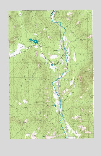
Eastport, ID USGS Topographic Map
Click on map above to begin viewing in our Map Viewer.

This topographic map contains these locations and features:
Feature Name Type Latitude Longitude GNIS ID View Map
AddiePopulated PlaceN48.9536°W116.1663°396026View Map
Border MountainSummitN48.9925°W116.2141°396164View Map
Brass CreekStreamN48.9794°W116.1658°378192View Map
Bussard CreekStreamN48.8991°W116.1755°378583View Map
Bussard LakeLakeN48.9070°W116.1821°378584View Map
Bussard MountainSummitN48.8905°W116.2321°396199View Map
Copper CreekStreamN48.9663°W116.1685°379710View Map
Copper Creek CampgroundLocaleN48.9852°W116.1530°394162View Map
Copper FallsFallsN48.9716°W116.1421°379715View Map
EastportPopulated PlaceN48.9994°W116.1813°396438View Map
Feist CreekStreamN48.9113°W116.1741°381641View Map
Geyselman LakeLakeN48.9608°W116.1776°382259View Map
Gillon CreekStreamN48.9661°W116.2099°382273View Map
Good GriefPopulated PlaceN48.9494°W116.1774°396571View Map
Hall Mountain Volunteer Fire Department Station 3BuildingN48.9476°W116.1777°2619308View Map
Harvey CreekStreamN48.9941°W116.2310°382949View Map
Hellroaring CreekStreamN48.9563°W116.2485°383071View Map
Hellroaring Ridge TrailTrailN48.9374°W116.2260°383073View Map
Hogue MountainSummitN48.9827°W116.1963°399917View Map
Kreist CreekStreamN48.9030°W116.1749°384311View Map
Line CreekStreamN48.9825°W116.1671°384694View Map
Little Hellroaring CreekStreamN48.9519°W116.1941°384858View Map
Movie River Sportsmans AccessLocaleN48.9727°W116.1702°394163View Map
Orser CreekStreamN48.8849°W116.1591°388004View Map
Queen LakeLakeN48.8770°W116.2003°374551View Map
Queen MineMineN48.9063°W116.2235°388989View Map
Queen MountainSummitN48.8780°W116.2149°397076View Map
Queen Mountain TrailTrailN48.9019°W116.2030°388990View Map
Robinson LakeLakeN48.9700°W116.2123°389460View Map
Robinson Lake Boat LaunchLocaleN48.9716°W116.2124°394164View Map
Robinson Lake CampgroundLocaleN48.9697°W116.2169°394159View Map
Round Prairie CreekStreamN48.9313°W116.1824°389665View Map
Sidehill TrailTrailN48.9019°W116.2030°390406View Map
SinclairPopulated PlaceN48.9291°W116.1769°397166View Map
Sinclair LakeLakeN48.9262°W116.1778°390473View Map
Spruce CreekStreamN48.9469°W116.1627°391249View Map
Tilley MineMineN48.9102°W116.2116°392135View Map

Note: Coordinates in the location and feature list above are referenced to NAD83 datum.


Copyright (C) 2008-2025 Ryan Niemi / Sunset Dynamics ... All Rights Reserved