TopoQuest Logo
Do you find TopoQuest useful?
Help keep TopoQuest running and adding new maps/features by donating!
Bitcoin:  19c7KJd3qBynnjoSw5npx9KScwjBe4ifkT
Litecoin:  LXs6TkuXGGXo1vDsWCkWVdjQX94eUKd6ui
Home View Maps Find Maps Find Places Resources & Links


Ebers Camp, Texas Topographic Map

USGS Map Title: Ebers Camp, TX
USGS Map MRC: 30102D6
DRG (GeoTIFF) Download: o30102d6.tif


Neighboring USGS Topographic Map Quads:


  Sierra Madera SE, TX  
30102E7
 

  Panther Tank, TX  
30102E6
 

  Rock House Draw, TX  
30102E5
 

  Reininger Draw, TX  
30102D7
 

  Ebers Camp, TX  
30102D6
 

  Busher Canyon, TX  
30102D5
 

  Cap Rock Butte, TX  
30102C7
 

  F C Ranch, TX  
30102C6
 

  Toms Canyon, TX  
30102C5


Map MRC Location:

N31°
W103°
N31°
W102°
H8 H7 H6 H5 H4 H3 H2 H1
G8 G7 G6 G5 G4 G3 G2 G1
F8 F7 F6 F5 F4 F3 F2 F1
E8 E7 E6 E5 E4 E3 E2 E1
D8 D7 D6 D5 D4 D3 D2 D1
C8 C7 C6 C5 C4 C3 C2 C1
B8 B7 B6 B5 B4 B3 B2 B1
A8 A7 A6 A5 A4 A3 A2 A1
N30°
W103°
N30°
W102°

Ebers Camp, TX USGS 1:24K Topographic Map Preview:
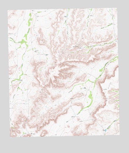
Ebers Camp, TX USGS Topographic Map
Click on map above to begin viewing in our Map Viewer.

This topographic map contains these locations and features:
Feature Name Type Latitude Longitude GNIS ID View Map
Boat HillsSummitN30.4385°W102.7010°1352538View Map
Burnen Tower WindmillLocaleN30.4841°W102.6310°1353340View Map
Carlos TankReservoirN30.4926°W102.6831°1353824View Map
Cinco de Mayo WindmillLocaleN30.4585°W102.7204°1354501View Map
Cox WindmillLocaleN30.4927°W102.6554°1355265View Map
Crawford WindmillsLocaleN30.4766°W102.7468°1355333View Map
Divide WindmillLocaleN30.4199°W102.6418°1356053View Map
Ebers CampLocaleN30.4404°W102.6399°1356787View Map
Ebers TankReservoirN30.4219°W102.6656°1356788View Map
Fife CanyonValleyN30.4267°W102.6531°1357321View Map
Fortyone DrawValleyN30.4323°W102.7379°1357607View Map
Fortyone WindmillLocaleN30.4307°W102.7379°1357608View Map
Hess WindmillLocaleN30.3893°W102.6685°1359090View Map
Javalina TankReservoirN30.4625°W102.6766°1360171View Map
Javalina WellWellN30.4613°W102.6671°1360172View Map
Middle WindmillLocaleN30.3941°W102.6777°1362779View Map
Morales DrawValleyN30.4689°W102.7323°1363135View Map
Nevins DrawValleyN30.4689°W102.7316°1363678View Map
North CampLocaleN30.4988°W102.7204°1364007View Map
Rebecca TankReservoirN30.3801°W102.6415°1366090View Map
Shelton TankReservoirN30.4554°W102.7081°1368121View Map
White WindmillsLocaleN30.3785°W102.7271°1371433View Map

Note: Coordinates in the location and feature list above are referenced to NAD83 datum.


Copyright (C) 2008-2025 Ryan Niemi / Sunset Dynamics ... All Rights Reserved