TopoQuest Logo
Do you find TopoQuest useful?
Help keep TopoQuest running and adding new maps/features by donating!
Bitcoin:  19c7KJd3qBynnjoSw5npx9KScwjBe4ifkT
Litecoin:  LXs6TkuXGGXo1vDsWCkWVdjQX94eUKd6ui
Home View Maps Find Maps Find Places Resources & Links


Edgar, Wisconsin Topographic Map

USGS Map Title: Edgar, WI
USGS Map MRC: 44089H8
DRG (GeoTIFF) Download: o44089h8.tif


Neighboring USGS Topographic Map Quads:


  Athens, WI  
45090A1
 

  Hamburg, WI  
45089A8
 

  Little Chicago, WI  
45089A7
 

  Wien, WI  
44090H1
 

  Edgar, WI  
44089H8
 

  Marathon, WI  
44089H7
 

  Stratford, WI  
44090G1
 

  Marathon SW, WI  
44089G8
 

  Halder, WI  
44089G7


Map MRC Location:

N45°
W90°
N45°
W89°
H8 H7 H6 H5 H4 H3 H2 H1
G8 G7 G6 G5 G4 G3 G2 G1
F8 F7 F6 F5 F4 F3 F2 F1
E8 E7 E6 E5 E4 E3 E2 E1
D8 D7 D6 D5 D4 D3 D2 D1
C8 C7 C6 C5 C4 C3 C2 C1
B8 B7 B6 B5 B4 B3 B2 B1
A8 A7 A6 A5 A4 A3 A2 A1
N44°
W90°
N44°
W89°

Edgar, WI USGS 1:24K Topographic Map Preview:
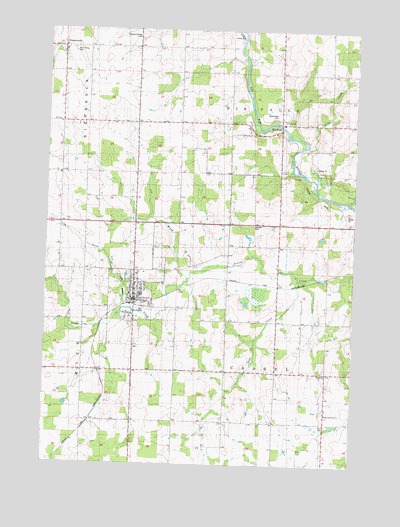
Edgar, WI USGS Topographic Map
Click on map above to begin viewing in our Map Viewer.

This topographic map contains these locations and features:
Feature Name Type Latitude Longitude GNIS ID View Map
Baesemann CemeteryCemeteryN44.9750°W89.9051°1561080View Map
Bonsall FarmsLocaleN44.9006°W89.9925°2726600View Map
Daisy Dell SchoolSchoolN44.9386°W89.9029°1563664View Map
EdgarPopulated PlaceN44.9272°W89.9635°1564442View Map
Edgar Elementary SchoolSchoolN44.9239°W89.9616°2713438View Map
Edgar High SchoolSchoolN44.9239°W89.9616°1844099View Map
Edgar Middle SchoolSchoolN44.9239°W89.9616°2713196View Map
Edgar Police DepartmentBuildingN44.9218°W89.9643°2759731View Map
Edgar Post OfficePost OfficeN44.9223°W89.9652°2768313View Map
Edgar Volunteer Fire DepartmentBuildingN44.9227°W89.9645°2696836View Map
Edgar Wastewater Treatment PlantLocaleN44.9192°W89.9625°2722978View Map
Elder View School (historical)SchoolN44.9727°W89.9946°1876686View Map
Findorf School (historical)SchoolN44.9658°W89.9368°1876689View Map
Holy Trinity CemeteryCemeteryN44.9936°W89.9901°1844159View Map
Kingdom Haven FarmLocaleN44.8992°W89.9586°2726605View Map
Morczynski FarmLocaleN44.9142°W89.9453°2726599View Map
Morgan PitMineN44.9478°W89.8783°2723304View Map
Omar CreekStreamN44.9191°W89.9685°1570812View Map
Pet BrookStreamN44.9289°W89.9415°1571249View Map
Pine CreekStreamN44.9666°W89.8924°1571432View Map
PoniatowskiPopulated PlaceN44.9950°W89.9935°1571749View Map
Rib FallsPopulated PlaceN44.9711°W89.9037°1572234View Map
Sacred Heart ChurchChurchN44.8900°W89.8835°1572789View Map
Sacred Heart School (historical)SchoolN44.8902°W89.8854°1876735View Map
Saint John the Baptist Catholic SchoolSchoolN44.9242°W89.9658°1845250View Map
Soda CreekStreamN44.9283°W89.8951°1574360View Map
Spring Valley FarmLocaleN44.9422°W89.9075°2726608View Map
Sunset AcresLocaleN44.9783°W89.9664°2726603View Map
Sunshine DairyLocaleN44.9867°W89.9664°2726609View Map
Taylor School (historical)SchoolN44.9014°W89.8860°1876745View Map
Tessmer Pioneer CemeteryCemeteryN44.9986°W89.9623°1575319View Map
Town of CasselCivilN44.8998°W89.9040°1582925View Map
Town of Rib FallsCivilN44.9885°W89.9041°1584015View Map
Village of EdgarCivilN44.9227°W89.9628°1583132View Map

Note: Coordinates in the location and feature list above are referenced to NAD83 datum.


Copyright (C) 2008-2024 Ryan Niemi / Sunset Dynamics ... All Rights Reserved