TopoQuest Logo
Do you find TopoQuest useful?
Help keep TopoQuest running and adding new maps/features by donating!
Bitcoin:  19c7KJd3qBynnjoSw5npx9KScwjBe4ifkT
Litecoin:  LXs6TkuXGGXo1vDsWCkWVdjQX94eUKd6ui
Home View Maps Find Maps Find Places Resources & Links


Stratford, Wisconsin Topographic Map

USGS Map Title: Stratford, WI
USGS Map MRC: 44090G1
DRG (GeoTIFF) Download: o44090g1.tif


Neighboring USGS Topographic Map Quads:


  Milan, WI  
44090H2
 

  Wien, WI  
44090H1
 

  Edgar, WI  
44089H8
 

  Little Rose, WI  
44090G2
 

  Stratford, WI  
44090G1
 

  Marathon SW, WI  
44089G8
 

  Marshfield, WI  
44090F2
 

  Hewitt, WI  
44090F1
 

  Honey Island, WI  
44089F8


Map MRC Location:

N45°
W91°
N45°
W90°
H8 H7 H6 H5 H4 H3 H2 H1
G8 G7 G6 G5 G4 G3 G2 G1
F8 F7 F6 F5 F4 F3 F2 F1
E8 E7 E6 E5 E4 E3 E2 E1
D8 D7 D6 D5 D4 D3 D2 D1
C8 C7 C6 C5 C4 C3 C2 C1
B8 B7 B6 B5 B4 B3 B2 B1
A8 A7 A6 A5 A4 A3 A2 A1
N44°
W91°
N44°
W90°

Stratford, WI USGS 1:24K Topographic Map Preview:
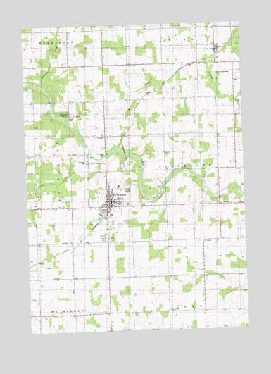
Stratford, WI USGS Topographic Map
Click on map above to begin viewing in our Map Viewer.

This topographic map contains these locations and features:
Feature Name Type Latitude Longitude GNIS ID View Map
1 ReservoirReservoirN44.7888°W90.0951°1792570View Map
1 ReservoirReservoirN44.7989°W90.0254°1792574View Map
Arthur School (historical)SchoolN44.7577°W90.0301°1876667View Map
Balsam School (historical)SchoolN44.7861°W90.0243°1876668View Map
Big Rapids County ParkParkN44.8391°W90.1024°1561755View Map
BradleyPopulated PlaceN44.8011°W90.0149°1562126View Map
Briggs School (historical)SchoolN44.8730°W90.0546°1876671View Map
Brock-Clint E7008 DamDamN44.8000°W90.0251°1792573View Map
Connor Mill CreekStreamN44.8036°W90.0572°2548618View Map
Drake School (historical)SchoolN44.8227°W90.1193°1876682View Map
East Kerwin School (historical)SchoolN44.7572°W90.0993°1876683View Map
Eau Pleine CemeteryCemeteryN44.8194°W90.0910°1564413View Map
Fairchild School (historical)SchoolN44.8730°W90.0990°1876688View Map
FenwoodPopulated PlaceN44.8661°W90.0154°1564913View Map
Grant School (historical)SchoolN44.8227°W90.0354°1876694View Map
Hamann CreekStreamN44.8494°W90.1132°1566008View Map
Johnson School (historical)SchoolN44.8447°W90.0015°1876704View Map
Lloyd Keller E6861 DamDamN44.7900°W90.0935°1792569View Map
Marathon County Public Library Stratford BranchBuildingN44.8042°W90.0744°2722991View Map
Marathon Pride School (historical)SchoolN44.7861°W90.1001°1876713View Map
Noisy CreekStreamN44.8244°W90.0918°1570325View Map
Rock CreekStreamN44.8252°W90.0732°1572433View Map
Saint Joseph SchoolSchoolN44.8043°W90.0728°1845255View Map
Saint Josephs Catholic ChurchChurchN44.8044°W90.0732°1845256View Map
Saint Pauls ChurchChurchN44.7583°W90.0443°1573485View Map
Staadts (historical)Populated PlaceN44.7791°W90.1201°1876741View Map
StratfordPopulated PlaceN44.8011°W90.0793°1574972View Map
Stratford Area Fire Department Station 1BuildingN44.7950°W90.0800°2696937View Map
Stratford Area Fire Department Station 3BuildingN44.8640°W90.0135°2696843View Map
Stratford Area Fire Department Station 4BuildingN44.7572°W90.1202°2696850View Map
Stratford City Police DepartmentBuildingN44.8028°W90.0766°2759674View Map
Stratford Elementary SchoolSchoolN44.8057°W90.0767°1845290View Map
Stratford Junior / Senior High SchoolSchoolN44.8059°W90.0752°1845291View Map
Town of ClevelandCivilN44.8168°W90.0172°1582977View Map
Village of FenwoodCivilN44.8658°W90.0145°1583199View Map
Village of StratfordCivilN44.8009°W90.0722°1584234View Map
WeberPopulated PlaceN44.8216°W90.0904°1876756View Map
Zion CemeteryCemeteryN44.8013°W90.0665°1577149View Map
Zion CemeteryCemeteryN44.8288°W90.0796°1577150View Map

Note: Coordinates in the location and feature list above are referenced to NAD83 datum.


Copyright (C) 2008-2025 Ryan Niemi / Sunset Dynamics ... All Rights Reserved