TopoQuest Logo
Do you find TopoQuest useful?
Help keep TopoQuest running and adding new maps/features by donating!
Bitcoin:  19c7KJd3qBynnjoSw5npx9KScwjBe4ifkT
Litecoin:  LXs6TkuXGGXo1vDsWCkWVdjQX94eUKd6ui
Home View Maps Find Maps Find Places Resources & Links


Edgerton, Kansas Topographic Map

USGS Map Title: Edgerton, KS
USGS Map MRC: 38095G1
DRG (GeoTIFF) Download: o38095g1.tif


Neighboring USGS Topographic Map Quads:


  Lawrence East, KS  
38095H2
 

  Eudora, KS  
38095H1
 

  De Soto, KS  
38094H8
 

  Baldwin City, KS  
38095G2
 

  Edgerton, KS  
38095G1
 

  Gardner, KS  
38094G8
 

  Le Loup, KS  
38095F2
 

  Wellsville, KS  
38095F1
 

  Antioch, KS  
38094F8


Map MRC Location:

N39°
W96°
N39°
W95°
H8 H7 H6 H5 H4 H3 H2 H1
G8 G7 G6 G5 G4 G3 G2 G1
F8 F7 F6 F5 F4 F3 F2 F1
E8 E7 E6 E5 E4 E3 E2 E1
D8 D7 D6 D5 D4 D3 D2 D1
C8 C7 C6 C5 C4 C3 C2 C1
B8 B7 B6 B5 B4 B3 B2 B1
A8 A7 A6 A5 A4 A3 A2 A1
N38°
W96°
N38°
W95°

Edgerton, KS USGS 1:24K Topographic Map Preview:
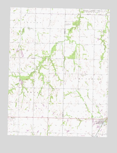
Edgerton, KS USGS Topographic Map
Click on map above to begin viewing in our Map Viewer.

This topographic map contains these locations and features:
Feature Name Type Latitude Longitude GNIS ID View Map
Adams CemeteryCemeteryN38.8580°W95.0384°2098802View Map
Assumption Catholic ChurchChurchN38.7653°W95.0106°2098739View Map
Black JackPopulated PlaceN38.7678°W95.1158°484893View Map
Black Jack CemeteryCemeteryN38.7661°W95.1165°2510256View Map
Captain Creek ChurchChurchN38.8597°W95.0558°479543View Map
ClearfieldPopulated PlaceN38.8261°W95.0936°484894View Map
Clearfield CemeteryCemeteryN38.8265°W95.0928°2673254View Map
Deay CemeteryCemeteryN38.8548°W95.0751°479540View Map
EdgertonPopulated PlaceN38.7647°W95.0080°479534View Map
Edgerton CemeteryCemeteryN38.7527°W95.0020°479535View Map
Edgerton City HallBuildingN38.7650°W95.0067°2099217View Map
Edgerton City LakeLakeN38.7635°W95.0041°2098918View Map
Edgerton Elementary SchoolSchoolN38.7655°W95.0146°480951View Map
Edgerton LibraryBuildingN38.7648°W95.0072°2099291View Map
Edgerton Mobile Home ParkPopulated PlaceN38.7640°W95.0185°2510141View Map
Edgerton Post OfficePost OfficeN38.7651°W95.0071°2098870View Map
Edgerton Southern Baptist ChurchChurchN38.7673°W95.0168°2098604View Map
Edgerton United Methodist ChurchChurchN38.7657°W95.0075°2098603View Map
Edgerton Wastewater PlantLocaleN38.7654°W95.0022°2511212View Map
Johnson County Fire District 1 Station 2BuildingN38.7647°W95.0084°2099251View Map
Konitz Airport (historical)AirportN38.7514°W95.0336°481420View Map
Martin Creek ParkParkN38.7614°W95.0028°2099098View Map
Michael AirportAirportN38.7992°W95.1005°2651064View Map
Old Black Jack CemeteryCemeteryN38.7536°W95.1122°479536View Map
Pleasant Valley CemeteryCemeteryN38.8481°W95.0361°479542View Map
Prairie Center (historical)Populated PlaceN38.8622°W95.0197°484953View Map
Prairie Center ChurchChurchN38.8628°W95.0194°479541View Map
Round Oak School (historical)SchoolN38.8114°W95.0286°479539View Map
Santa Fe LakeReservoirN38.7635°W95.0045°479533View Map
South LakeReservoirN38.7511°W95.0145°479532View Map
Township of McCamishCivilN38.8063°W95.0126°479544View Map
Wymore CreekStreamN38.8289°W95.0727°479538View Map

Note: Coordinates in the location and feature list above are referenced to NAD83 datum.


Copyright (C) 2008-2024 Ryan Niemi / Sunset Dynamics ... All Rights Reserved