TopoQuest Logo
Do you find TopoQuest useful?
Help keep TopoQuest running and adding new maps/features by donating!
Bitcoin:  19c7KJd3qBynnjoSw5npx9KScwjBe4ifkT
Litecoin:  LXs6TkuXGGXo1vDsWCkWVdjQX94eUKd6ui
Home View Maps Find Maps Find Places Resources & Links


Eudora, Kansas Topographic Map

USGS Map Title: Eudora, KS
USGS Map MRC: 38095H1
DRG (GeoTIFF) Download: o38095h1.tif


Neighboring USGS Topographic Map Quads:


  Midland, KS  
39095A2
 

  Tonganoxie, KS  
39095A1
 

  Bonner Springs, KS  
39094A8
 

  Lawrence East, KS  
38095H2
 

  Eudora, KS  
38095H1
 

  De Soto, KS  
38094H8
 

  Baldwin City, KS  
38095G2
 

  Edgerton, KS  
38095G1
 

  Gardner, KS  
38094G8


Map MRC Location:

N39°
W96°
N39°
W95°
H8 H7 H6 H5 H4 H3 H2 H1
G8 G7 G6 G5 G4 G3 G2 G1
F8 F7 F6 F5 F4 F3 F2 F1
E8 E7 E6 E5 E4 E3 E2 E1
D8 D7 D6 D5 D4 D3 D2 D1
C8 C7 C6 C5 C4 C3 C2 C1
B8 B7 B6 B5 B4 B3 B2 B1
A8 A7 A6 A5 A4 A3 A2 A1
N38°
W96°
N38°
W95°

Eudora, KS USGS 1:24K Topographic Map Preview:
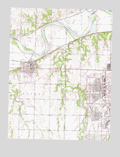
Eudora, KS USGS Topographic Map
Click on map above to begin viewing in our Map Viewer.

This topographic map contains these locations and features:
Feature Name Type Latitude Longitude GNIS ID View Map
Captain CreekStreamN38.9728°W95.0400°479164View Map
Cemetery Beni IsraelCemeteryN38.9282°W95.1126°2673255View Map
Church of ChristChurchN38.9341°W95.1113°2510641View Map
City of EudoraCivilN38.9344°W95.0958°2394705View Map
Clearview Baptist ChurchChurchN38.9441°W95.0006°2509658View Map
Clearview CityPopulated PlaceN38.9458°W95.0030°479182View Map
Clearview City Independent Baptist ChurchChurchN38.9441°W95.0006°2098648View Map
Coleman CreekStreamN38.9233°W95.0580°485509View Map
Delaware CemeteryCemeteryN38.9669°W95.0923°2509999View Map
DeSoto Water Treatment PlantLocaleN38.9220°W95.0064°2511210View Map
EudoraPopulated PlaceN38.9433°W95.0986°479162View Map
Eudora CemeteryCemeteryN38.9456°W95.0894°479163View Map
Eudora Community Learning Center SchoolSchoolN38.9367°W95.1096°2506590View Map
Eudora Elementary SchoolSchoolN38.9408°W95.0871°2720286View Map
Eudora Fire DepartmentBuildingN38.9423°W95.0983°2111196View Map
Eudora High SchoolSchoolN38.9239°W95.0945°2506515View Map
Eudora Middle SchoolSchoolN38.9174°W95.0966°2506643View Map
Eudora Nursing CenterBuildingN38.9351°W95.1005°2510497View Map
Eudora Police DepartmentBuildingN38.9424°W95.0983°2504079View Map
Eudora Post OfficePost OfficeN38.9461°W95.0991°2509639View Map
Eudora Public LibraryBuildingN38.9439°W95.0986°2510409View Map
Eudora Riverview Golf CourseLocaleN38.9610°W95.1108°2509962View Map
Eudora School District Central OfficeSchoolN38.9416°W95.0975°2506427View Map
Eudora Township Fire DepartmentBuildingN38.9281°W95.0954°2111307View Map
Eudora United Methodist ChurchChurchN38.9271°W95.1154°2509932View Map
Eudora Water Treatment FaciltyLocaleN38.9468°W95.1053°2511213View Map
Fall LeafPopulated PlaceN38.9742°W95.1105°479165View Map
First Southern Baptist ChurchChurchN38.9402°W95.0991°2510386View Map
Grandview Mobile Home ParkPopulated PlaceN38.9404°W95.0926°2510247View Map
HesperPopulated PlaceN38.8986°W95.0747°479160View Map
Hesper Friends CemeteryCemeteryN38.8982°W95.0627°2510022View Map
Hesper Friends ChurchChurchN38.8981°W95.0637°2510023View Map
Holy Family Catholic CemeteryCemeteryN38.9439°W95.0934°2673403View Map
Holy Family Catholic ChurchChurchN38.9444°W95.0947°2511068View Map
Kent CreekStreamN38.9708°W95.1216°479166View Map
Nottingham Elementary SchoolSchoolN38.9349°W95.0976°2506581View Map
Observation BluffSummitN38.9078°W95.0483°482655View Map
Prairie Center (historical)LocaleN38.8925°W95.0289°481979View Map
Prairie Center CemeteryCemeteryN38.8923°W95.0288°479161View Map
Roberts LakeReservoirN38.8980°W95.0263°479916View Map
Roberts Lake DamDamN38.8983°W95.0252°479915View Map
Saint Pauls United Church of ChristChurchN38.9459°W95.0957°2509476View Map
Stranger CreekStreamN38.9997°W95.0227°478855View Map
Sunflower Nature ParkParkN38.9412°W95.0163°2099069View Map
Sunflower ParkParkN38.9405°W95.0160°2099073View Map
Sunflower Park LakeLakeN38.9412°W95.0154°2098939View Map
Sunflower Park LakeReservoirN38.9703°W95.0088°2098940View Map
Township of EudoraCivilN38.9104°W95.1086°479530View Map
Wakarusa RiverStreamN38.9561°W95.0822°482756View Map
WeaverPopulated PlaceN38.9619°W95.0672°484879View Map

Note: Coordinates in the location and feature list above are referenced to NAD83 datum.


Copyright (C) 2008-2025 Ryan Niemi / Sunset Dynamics ... All Rights Reserved