TopoQuest Logo
Do you find TopoQuest useful?
Help keep TopoQuest running and adding new maps/features by donating!
Bitcoin:  19c7KJd3qBynnjoSw5npx9KScwjBe4ifkT
Litecoin:  LXs6TkuXGGXo1vDsWCkWVdjQX94eUKd6ui
Home View Maps Find Maps Find Places Resources & Links


Arcola, Indiana Topographic Map

USGS Map Title: Arcola, IN
USGS Map MRC: 41085A3
DRG (GeoTIFF) Download: o41085a3.tif


Neighboring USGS Topographic Map Quads:


  Columbia City, IN  
41085B4
 

  Churubusco, IN  
41085B3
 

  Huntertown, IN  
41085B2
 

  Laud, IN  
41085A4
 

  Arcola, IN  
41085A3
 

  Fort Wayne West, IN  
41085A2
 

  Huntington, IN  
40085H4
 

  Zanesville, IN  
40085H3
 

  Ossian, IN  
40085H2


Map MRC Location:

N42°
W86°
N42°
W85°
H8 H7 H6 H5 H4 H3 H2 H1
G8 G7 G6 G5 G4 G3 G2 G1
F8 F7 F6 F5 F4 F3 F2 F1
E8 E7 E6 E5 E4 E3 E2 E1
D8 D7 D6 D5 D4 D3 D2 D1
C8 C7 C6 C5 C4 C3 C2 C1
B8 B7 B6 B5 B4 B3 B2 B1
A8 A7 A6 A5 A4 A3 A2 A1
N41°
W86°
N41°
W85°

Arcola, IN USGS 1:24K Topographic Map Preview:
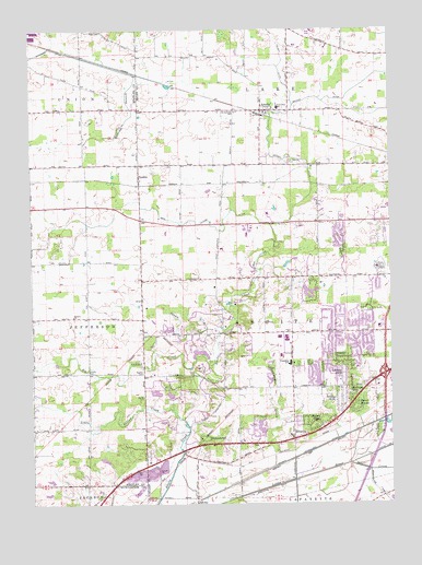
Arcola, IN USGS Topographic Map
Click on map above to begin viewing in our Map Viewer.

This topographic map contains these locations and features:
Feature Name Type Latitude Longitude GNIS ID View Map
AboitePopulated PlaceN41.0009°W85.3180°429991View Map
Aboite Township Fire DepartmentBuildingN41.0446°W85.2913°2701494View Map
Aboite Township Volunteer Fire DepartmentBuildingN41.0446°W85.2912°2625518View Map
ArcolaPopulated PlaceN41.1037°W85.2941°430240View Map
Arcola Elementary SchoolSchoolN41.1042°W85.2889°446574View Map
Arcola Volunteer Fire DepartmentBuildingN41.1028°W85.2932°2626523View Map
Bayless CemeteryCemeteryN41.0345°W85.3364°430594View Map
Beal Taylor DitchCanalN41.0742°W85.3211°430602View Map
Big Indian CreekStreamN41.0364°W85.3125°431039View Map
Broxon CemeteryCemeteryN41.0349°W85.3559°431649View Map
Cook Lougheed Wildlife PondReservoirN41.0201°W85.2962°447214View Map
Cook Lougheed Wildlife Pond DamDamN41.0200°W85.2933°447213View Map
Covington LakeReservoirN41.0556°W85.2785°447210View Map
Covington Lake DamDamN41.0570°W85.2800°447211View Map
Covington Memorial GardensCemeteryN41.0627°W85.2541°433052View Map
Dennis Airport (historical)AirportN41.0023°W85.2964°449087View Map
DunfeePopulated PlaceN41.0867°W85.3372°433778View Map
EllisonPopulated PlaceN41.0278°W85.2558°446648View Map
EllisvillePopulated PlaceN41.0181°W85.2841°434114View Map
Emerick BranchStreamN41.1128°W85.3380°434154View Map
Felger DitchCanalN41.1153°W85.2878°434435View Map
Forest RidgePopulated PlaceN41.0220°W85.2733°434667View Map
Fort Wayne Fire Department Station 18BuildingN41.0301°W85.2834°2626487View Map
Fort Wayne Fire Department Station 19BuildingN41.0600°W85.2741°2626498View Map
Gerig's FieldAirportN41.0099°W85.3724°2676904View Map
Graham McCulloch Ditch Number OneCanalN41.0128°W85.2816°435289View Map
Indiana State Police Department District 22BuildingN41.0310°W85.2547°2758288View Map
Kekingo Shores LakeReservoirN41.0334°W85.2758°447761View Map
Kekionga Lake DamDamN41.0317°W85.2750°447760View Map
Liberty HillsPopulated PlaceN41.0334°W85.2664°437840View Map
Little Indian CreekStreamN41.0223°W85.3222°438076View Map
Manor WoodsPopulated PlaceN41.0253°W85.2622°438532View Map
Parkway HillsPopulated PlaceN41.0284°W85.2644°440906View Map
Pigeon River State Fish and Wildlife AreaParkN41.0734°W85.2653°441122View Map
Rehling DitchCanalN41.1145°W85.3408°441879View Map
Roanoke PitMineN41.0058°W85.3381°2649684View Map
Robinson CreekStreamN41.0103°W85.2647°442176View Map
Rolling HillsPopulated PlaceN41.0273°W85.2680°442264View Map
Saint Patrick Roman Catholic CemeteryCemeteryN41.0898°W85.2846°442751View Map
SaturnPopulated PlaceN41.0348°W85.3555°446649View Map
Saturn ChurchChurchN41.0495°W85.3603°443040View Map
Squaw CreekStreamN41.0450°W85.3091°444034View Map
TimbercrestPopulated PlaceN41.0173°W85.3150°444763View Map
Township of AboiteCivilN41.0471°W85.2830°453072View Map
WKSY-FM (Columbia City)TowerN41.1070°W85.3594°449003View Map

Note: Coordinates in the location and feature list above are referenced to NAD83 datum.


Copyright (C) 2008-2025 Ryan Niemi / Sunset Dynamics ... All Rights Reserved