TopoQuest Logo
Do you find TopoQuest useful?
Help keep TopoQuest running and adding new maps/features by donating!
Bitcoin:  19c7KJd3qBynnjoSw5npx9KScwjBe4ifkT
Litecoin:  LXs6TkuXGGXo1vDsWCkWVdjQX94eUKd6ui
Home View Maps Find Maps Find Places Resources & Links


Edinburg, New York Topographic Map

USGS Map Title: Edinburg, NY
USGS Map MRC: 43074B1
DRG (GeoTIFF) Download: o43074b1.tif


Neighboring USGS Topographic Map Quads:


  Conklingville, NY  
43073C8
 

  Northville, NY  
43074B2
 

  Edinburg, NY  
43074B1
 

  Porter Corners, NY  
43073B8
 

  Broadalbin, NY  
43074A2
 

  Galway, NY  
43074A1
 

  Middle Grove, NY  
43073A8


Map MRC Location:

N44°
W75°
N44°
W74°
H8 H7 H6 H5 H4 H3 H2 H1
G8 G7 G6 G5 G4 G3 G2 G1
F8 F7 F6 F5 F4 F3 F2 F1
E8 E7 E6 E5 E4 E3 E2 E1
D8 D7 D6 D5 D4 D3 D2 D1
C8 C7 C6 C5 C4 C3 C2 C1
B8 B7 B6 B5 B4 B3 B2 B1
A8 A7 A6 A5 A4 A3 A2 A1
N43°
W75°
N43°
W74°

Edinburg, NY USGS 1:24K Topographic Map Preview:
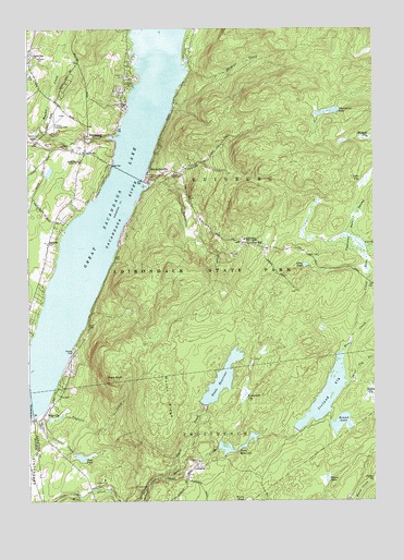
Edinburg, NY USGS Topographic Map
Click on map above to begin viewing in our Map Viewer.

This topographic map contains these locations and features:
Feature Name Type Latitude Longitude GNIS ID View Map
Adirondack Bible CollegeSchoolN43.1942°W74.0471°942186View Map
Albia PondLakeN43.1875°W74.0246°942245View Map
Anderson CemeteryCemeteryN43.1646°W74.1088°944855View Map
Bald BluffSummitN43.1573°W74.0946°942849View Map
Batcheller CreekStreamN43.2084°W74.0821°943155View Map
BatchellervillePopulated PlaceN43.2117°W74.0818°943156View Map
Batchellerville Presbyterian ChurchChurchN43.2093°W74.0814°2615567View Map
Beecher CreekStreamN43.2215°W74.0960°974186View Map
Blodgett VlySwampN43.2209°W74.0029°969895View Map
Circle K Ranch AirportAirportN43.1372°W74.1154°977922View Map
ClarkvillePopulated PlaceN43.2434°W74.1229°972321View Map
Cloutler CreekStreamN43.1490°W74.1187°946918View Map
Consolidated School Number 1 (historical)SchoolN43.2151°W74.1065°947321View Map
Cooks ReservoirReservoirN43.1390°W74.0565°947362View Map
Copeland Covered BridgeBridgeN43.2208°W74.1003°2097337View Map
Deming CreekStreamN43.2106°W74.0760°948287View Map
EdinburgPopulated PlaceN43.2217°W74.1040°949389View Map
Edinburg Bible ChapelChurchN43.2166°W74.1041°2615867View Map
Edinburg Emergency SquadBuildingN43.2199°W74.1035°2720212View Map
Edinburg Town HallBuildingN43.2281°W74.1037°2617610View Map
Edinburg United Methodist ChurchChurchN43.2174°W74.1043°2615868View Map
Edinburg Volunteer Emergency SquadBuildingN43.2199°W74.1034°2735208View Map
Edinburg Volunteer Fire CompanyBuildingN43.2178°W74.1042°2735207View Map
FayvillePopulated PlaceN43.1470°W74.1204°949945View Map
Fayville CreekStreamN43.1465°W74.1168°949946View Map
Fox HillPopulated PlaceN43.1931°W74.0449°950558View Map
GlenwildPopulated PlaceN43.1342°W74.0649°972550View Map
Gordons CreekStreamN43.2387°W74.0668°951388View Map
Ireland VlyReservoirN43.1531°W74.0170°953753View Map
Johnnycake LakeLakeN43.2283°W74.0137°954094View Map
Lewis FieldAirportN43.1312°W74.1243°2770583View Map
Little Hans CreekStreamN43.1692°W74.0076°955548View Map
Loon VlySwampN43.2098°W74.0023°955986View Map
Maxon RidgeRidgeN43.1526°W74.0751°956694View Map
Partridge CemeteryCemeteryN43.1933°W74.1170°959955View Map
Plateau Sky Ranch AirportAirportN43.2261°W74.1143°978000View Map
Ronna PondLakeN43.1306°W74.0170°962856View Map
Round LakeLakeN43.1455°W74.0121°962976View Map
Sacandaga Reservoir BridgeBridgeN43.2119°W74.0889°2614977View Map
School Number 1 (historical)SchoolN43.1461°W74.1244°2105866View Map
Shew PondReservoirN43.1367°W74.1065°965105View Map
Steele CreekStreamN43.1317°W74.0765°966326View Map
Steele ReservoirReservoirN43.1574°W74.0547°966329View Map
Tamarack VlySwampN43.1534°W74.0468°967028View Map
The Farm AirportAirportN43.1334°W74.1157°977923View Map
Thousand Acre SwampSwampN43.1956°W74.0065°967446View Map
Town of EdinburgCivilN43.2262°W74.0686°978925View Map
West Vly CreekStreamN43.1567°W74.0090°970887View Map

Note: Coordinates in the location and feature list above are referenced to NAD83 datum.


Copyright (C) 2008-2025 Ryan Niemi / Sunset Dynamics ... All Rights Reserved