TopoQuest Logo
Do you find TopoQuest useful?
Help keep TopoQuest running and adding new maps/features by donating!
Bitcoin:  19c7KJd3qBynnjoSw5npx9KScwjBe4ifkT
Litecoin:  LXs6TkuXGGXo1vDsWCkWVdjQX94eUKd6ui
Home View Maps Find Maps Find Places Resources & Links


El Nido, California Topographic Map

USGS Map Title: El Nido, CA
USGS Map MRC: 37120B4
DRG (GeoTIFF) Download: o37120b4.tif


Neighboring USGS Topographic Map Quads:


  Atwater, CA  
37120C5
 

  Merced, CA  
37120C4
 

  Planada, CA  
37120C3
 

  Sandy Mush, CA  
37120B5
 

  El Nido, CA  
37120B4
 

  Plainsburg, CA  
37120B3
 

  Santa Rita Bridge, CA  
37120A5
 

  Bliss Ranch, CA  
37120A4
 

  Chowchilla, CA  
37120A3


Map MRC Location:

N38°
W121°
N38°
W120°
H8 H7 H6 H5 H4 H3 H2 H1
G8 G7 G6 G5 G4 G3 G2 G1
F8 F7 F6 F5 F4 F3 F2 F1
E8 E7 E6 E5 E4 E3 E2 E1
D8 D7 D6 D5 D4 D3 D2 D1
C8 C7 C6 C5 C4 C3 C2 C1
B8 B7 B6 B5 B4 B3 B2 B1
A8 A7 A6 A5 A4 A3 A2 A1
N37°
W121°
N37°
W120°

El Nido, CA USGS 1:24K Topographic Map Preview:
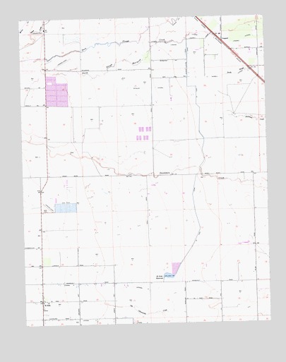
El Nido, CA USGS Topographic Map
Click on map above to begin viewing in our Map Viewer.

This topographic map contains these locations and features:
Feature Name Type Latitude Longitude GNIS ID View Map
59 Ranch AirportAirportN37.2307°W120.4815°1653737View Map
Double D DairyLocaleN37.2344°W120.3836°2707901View Map
Dutchman CreekStreamN37.1930°W120.4649°233810View Map
El NidoPopulated PlaceN37.1349°W120.4921°233836View Map
El Nido CanalCanalN37.2119°W120.4094°233837View Map
El Nido Census Designated PlaceCensusN37.1324°W120.4986°2583007View Map
El Nido Elementary SchoolSchoolN37.1344°W120.4887°1661976View Map
El Nido Missionary Baptist ChurchChurchN37.1419°W120.4924°1813094View Map
El Nido Post OfficePost OfficeN37.1367°W120.4917°2769357View Map
El Nido ReservoirReservoirN37.1443°W120.4274°233839View Map
Five H FarmsLocaleN37.2050°W120.4950°2707844View Map
Hoogendam DairyLocaleN37.2314°W120.4550°2707854View Map
Lateral FiveCanalN37.1391°W120.4399°255093View Map
Lateral FourCanalN37.1266°W120.4677°255090View Map
LingardPopulated PlaceN37.2402°W120.3974°1656309View Map
Merced County Fire Department Station 83 El NidoBuildingN37.1343°W120.4925°2624295View Map
North Slough Mariposa CreekGutN37.2333°W120.4471°234385View Map
Old Chowchilla CreekStreamN37.1336°W120.4624°234407View Map
Rock - Shar DairyLocaleN37.1819°W120.4344°2707861View Map
Russel LateralCanalN37.2258°W120.3977°234596View Map
Russell School (historical)SchoolN37.2152°W120.4888°1662006View Map
South SloughGutN37.2297°W120.3819°235115View Map
Tetzlaff LateralCanalN37.2216°W120.4355°236133View Map
V and R DairyLocaleN37.1764°W120.4864°2707908View Map
Vista Verde DairyLocaleN37.1556°W120.3886°2707265View Map

Note: Coordinates in the location and feature list above are referenced to NAD83 datum.


Copyright (C) 2008-2024 Ryan Niemi / Sunset Dynamics ... All Rights Reserved