TopoQuest Logo
Do you find TopoQuest useful?
Help keep TopoQuest running and adding new maps/features by donating!
Bitcoin:  19c7KJd3qBynnjoSw5npx9KScwjBe4ifkT
Litecoin:  LXs6TkuXGGXo1vDsWCkWVdjQX94eUKd6ui
Home View Maps Find Maps Find Places Resources & Links


Santa Rita Bridge, California Topographic Map

USGS Map Title: Santa Rita Bridge, CA
USGS Map MRC: 37120A5
DRG (GeoTIFF) Download: o37120a5.tif


Neighboring USGS Topographic Map Quads:


  Turner Ranch, CA  
37120B6
 

  Sandy Mush, CA  
37120B5
 

  El Nido, CA  
37120B4
 

  Delta Ranch, CA  
37120A6
 

  Santa Rita Bridge, CA  
37120A5
 

  Bliss Ranch, CA  
37120A4
 

  Dos Palos, CA  
36120H6
 

  Oxalis, CA  
36120H5
 

  Poso Farm, CA  
36120H4


Map MRC Location:

N38°
W121°
N38°
W120°
H8 H7 H6 H5 H4 H3 H2 H1
G8 G7 G6 G5 G4 G3 G2 G1
F8 F7 F6 F5 F4 F3 F2 F1
E8 E7 E6 E5 E4 E3 E2 E1
D8 D7 D6 D5 D4 D3 D2 D1
C8 C7 C6 C5 C4 C3 C2 C1
B8 B7 B6 B5 B4 B3 B2 B1
A8 A7 A6 A5 A4 A3 A2 A1
N37°
W121°
N37°
W120°

Santa Rita Bridge, CA USGS 1:24K Topographic Map Preview:
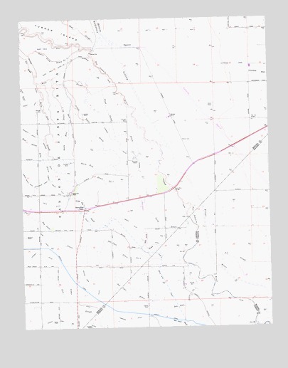
Santa Rita Bridge, CA USGS Topographic Map
Click on map above to begin viewing in our Map Viewer.

This topographic map contains these locations and features:
Feature Name Type Latitude Longitude GNIS ID View Map
Ash SloughGutN37.0252°W120.5121°218430View Map
Azevedo Landing Strip (historical)AirportN37.0497°W120.5669°1653985View Map
Belmont RanchLocaleN37.0372°W120.6241°219016View Map
Chowchilla RiverStreamN37.1058°W120.5105°255078View Map
Colony FarmLocaleN37.0024°W120.6085°221405View Map
Cowden DitchCanalN37.0302°W120.6157°221714View Map
Dairy Field DitchCanalN37.1138°W120.6105°221975View Map
Dairy Field Ditch Number OneCanalN37.1052°W120.6074°253656View Map
Dairy Field Drain Number TwoCanalN37.1083°W120.6088°253657View Map
Diversion CanalCanalN37.1058°W120.5185°222420View Map
Durham RanchLocaleN37.0005°W120.5921°222746View Map
Eastside BypassCanalN37.0872°W120.5349°233827View Map
Escano Branch Number One DitchCanalN37.0952°W120.6246°223242View Map
Escano DitchCanalN37.0905°W120.6205°223243View Map
Field DrainCanalN37.0405°W120.5552°223486View Map
Fresno RiverStreamN37.0755°W120.5607°253591View Map
Helm DitchCanalN37.0508°W120.6121°225145View Map
Island Field DrainCanalN37.0813°W120.5907°261828View Map
Liberty FarmLocaleN37.0083°W120.5638°227059View Map
Lucerne DitchCanalN37.0755°W120.5777°227813View Map
Lucerne RanchLocaleN37.0866°W120.5949°227814View Map
Orchard DitchCanalN37.1041°W120.6174°230075View Map
Riverside CanalCanalN37.0961°W120.5791°231645View Map
Riverside RanchLocaleN37.0686°W120.5705°231649View Map
Salt SloughGutN37.1094°W120.6235°232331View Map
San Juan DrainCanalN37.0458°W120.6230°232420View Map
San Juan Drain Number FourCanalN37.0097°W120.5427°253819View Map
San Juan Drain Number ThreeCanalN37.0305°W120.5774°253818View Map
Santa Rita BridgeBridgeN37.0558°W120.5502°252052View Map
Santa Rita DitchCanalN37.0811°W120.6005°232557View Map
Santa Rita DrainCanalN37.0816°W120.6041°232558View Map
Santa Rita ParkPopulated PlaceN37.0474°W120.5952°1659599View Map
Santa Rita RanchLocaleN37.0547°W120.6013°232559View Map
Santa Rita SloughGutN37.0461°W120.5930°232562View Map
Schmidt DitchCanalN37.0113°W120.6002°232655View Map
Temple Gun Club (historical)LocaleN37.0424°W120.5824°1662008View Map
Temple RanchLocaleN37.0241°W120.5427°1665671View Map
Temple Santa Rita CanalCanalN37.0591°W120.6110°236097View Map
Willis Ranch Airport (historical)AirportN37.0652°W120.5677°1653407View Map
Willow Tree DitchCanalN37.0177°W120.5927°237954View Map
Wood SloughGutN37.1002°W120.6027°238119View Map
Wood Slough DrainCanalN37.0816°W120.5802°238120View Map

Note: Coordinates in the location and feature list above are referenced to NAD83 datum.


Copyright (C) 2008-2025 Ryan Niemi / Sunset Dynamics ... All Rights Reserved