TopoQuest Logo
Do you find TopoQuest useful?
Help keep TopoQuest running and adding new maps/features by donating!
Bitcoin:  19c7KJd3qBynnjoSw5npx9KScwjBe4ifkT
Litecoin:  LXs6TkuXGGXo1vDsWCkWVdjQX94eUKd6ui
Home View Maps Find Maps Find Places Resources & Links


Elephant Butte, Utah Topographic Map

USGS Map Title: Elephant Butte, UT
USGS Map MRC: 37112A7
DRG (GeoTIFF) Download: o37112a7.tif


Neighboring USGS Topographic Map Quads:


  Springdale East, UT  
37112B8
 

  The Barracks, UT  
37112B7
 

  Mount Carmel, UT  
37112B6
 

  Hildale, UT  
37112A8
 

  Elephant Butte, UT  
37112A7
 

  Yellowjacket Canyon, UT  
37112A6
 

  Colorado City, AZ  
36112H8
 

  Moccasin, AZ  
36112H7
 

  Kaibab, AZ  
36112H6


Map MRC Location:

N38°
W113°
N38°
W112°
H8 H7 H6 H5 H4 H3 H2 H1
G8 G7 G6 G5 G4 G3 G2 G1
F8 F7 F6 F5 F4 F3 F2 F1
E8 E7 E6 E5 E4 E3 E2 E1
D8 D7 D6 D5 D4 D3 D2 D1
C8 C7 C6 C5 C4 C3 C2 C1
B8 B7 B6 B5 B4 B3 B2 B1
A8 A7 A6 A5 A4 A3 A2 A1
N37°
W113°
N37°
W112°

Elephant Butte, UT USGS 1:24K Topographic Map Preview:
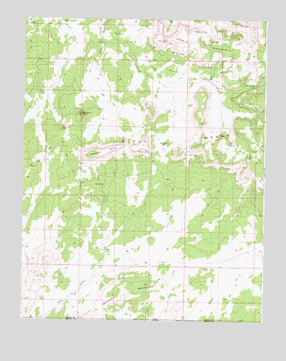
Elephant Butte, UT USGS Topographic Map
Click on map above to begin viewing in our Map Viewer.

This topographic map contains these locations and features:
Feature Name Type Latitude Longitude GNIS ID View Map
Block MesasSummitN37.1167°W112.7508°1425771View Map
Dixie KnollSummitN37.0214°W112.7819°1427428View Map
Elephant ButteSummitN37.0700°W112.8322°1427783View Map
Elephant GapGapN37.0736°W112.8019°1427787View Map
Esplin SpringSpringN37.0517°W112.7602°1435515View Map
Harris FlatFlatN37.0914°W112.7910°1428546View Map
Harris MountainSummitN37.1122°W112.7830°1428551View Map
Harris PointSummitN37.1161°W112.8052°1435649View Map
Hise-Willow SpringSpringN37.0561°W112.8360°1428728View Map
Kane SpringLocaleN37.0803°W112.8524°1435803View Map
Kane SpringSpringN37.0792°W112.8530°1429281View Map
Langston Willow SpringSpringN37.1229°W112.8729°1429474View Map
Moccasin MountainsRangeN37.0117°W112.8208°1435969View Map
Oak FlatFlatN37.0914°W112.8324°1436058View Map
Pine SpringSpringN37.0292°W112.8330°1431268View Map
Rosy CanyonValleyN37.0022°W112.8610°1436268View Map
Sandstone ButteSummitN37.0855°W112.8452°1432224View Map
Shunesburg Mail TrailTrailN37.1122°W112.8341°1436352View Map
Wyatt SpringSpringN37.0939°W112.8644°1434481View Map

Note: Coordinates in the location and feature list above are referenced to NAD83 datum.


Copyright (C) 2008-2024 Ryan Niemi / Sunset Dynamics ... All Rights Reserved