TopoQuest Logo
Do you find TopoQuest useful?
Help keep TopoQuest running and adding new maps/features by donating!
Bitcoin:  19c7KJd3qBynnjoSw5npx9KScwjBe4ifkT
Litecoin:  LXs6TkuXGGXo1vDsWCkWVdjQX94eUKd6ui
Home View Maps Find Maps Find Places Resources & Links


Hildale, Utah Topographic Map

USGS Map Title: Hildale, UT
USGS Map MRC: 37112A8
DRG (GeoTIFF) Download: o37112a8.tif


Neighboring USGS Topographic Map Quads:


  Springdale West, UT  
37113B1
 

  Springdale East, UT  
37112B8
 

  The Barracks, UT  
37112B7
 

  Smithsonian Butte, UT  
37113A1
 

  Hildale, UT  
37112A8
 

  Elephant Butte, UT  
37112A7
 

  Lost Spring Mountain East, AZ  
36113H1
 

  Colorado City, AZ  
36112H8
 

  Moccasin, AZ  
36112H7


Map MRC Location:

N38°
W113°
N38°
W112°
H8 H7 H6 H5 H4 H3 H2 H1
G8 G7 G6 G5 G4 G3 G2 G1
F8 F7 F6 F5 F4 F3 F2 F1
E8 E7 E6 E5 E4 E3 E2 E1
D8 D7 D6 D5 D4 D3 D2 D1
C8 C7 C6 C5 C4 C3 C2 C1
B8 B7 B6 B5 B4 B3 B2 B1
A8 A7 A6 A5 A4 A3 A2 A1
N37°
W113°
N37°
W112°

Hildale, UT USGS 1:24K Topographic Map Preview:
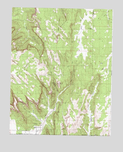
Hildale, UT USGS Topographic Map
Click on map above to begin viewing in our Map Viewer.

This topographic map contains these locations and features:
Feature Name Type Latitude Longitude GNIS ID View Map
Birch CreekStreamN37.0605°W112.9241°1435145View Map
Canaan Mountain RV Closure AreaAreaN37.0833°W112.9591°1435241View Map
Canaan Mountain WildernessReserveN37.0823°W112.9831°2760091View Map
Cappies Rock SpringSpringN37.1054°W112.9007°1435250View Map
City of HildaleCivilN37.0091°W112.9995°2410763View Map
Goat SpringsSpringN37.0658°W112.8851°1428217View Map
HildalePopulated PlaceN37.0036°W112.9669°1450387View Map
Hildale Fire DepartmentBuildingN37.0057°W112.9658°2627112View Map
Maxwell CanyonValleyN37.0108°W112.9602°1430148View Map
Phelps SchoolSchoolN37.0486°W112.9688°1436122View Map
Ronso SpringSpringN37.0718°W112.8867°1436266View Map
Skunk CanyonValleyN37.0119°W112.9558°24098View Map
Skunk CanyonValleyN37.0105°W112.9555°1455515View Map
South MountainSummitN37.0894°W112.9520°1432741View Map
Squirrel CreekStreamN37.0400°W112.9399°1432897View Map
The BeehiveSummitN37.0511°W112.9408°1435112View Map
Water CanyonValleyN37.0219°W112.9516°1433991View Map

Note: Coordinates in the location and feature list above are referenced to NAD83 datum.


Copyright (C) 2008-2024 Ryan Niemi / Sunset Dynamics ... All Rights Reserved