TopoQuest Logo
Do you find TopoQuest useful?
Help keep TopoQuest running and adding new maps/features by donating!
Bitcoin:  19c7KJd3qBynnjoSw5npx9KScwjBe4ifkT
Litecoin:  LXs6TkuXGGXo1vDsWCkWVdjQX94eUKd6ui
Home View Maps Find Maps Find Places Resources & Links


Eliza, Illinois Topographic Map

USGS Map Title: Eliza, IL
USGS Map MRC: 41090C8
DRG (GeoTIFF) Download: o41090c8.tif


Neighboring USGS Topographic Map Quads:


  Muscatine, IA  
41091D1
 

  Illinois City, IL  
41090D8
 

  Montpelier, IA  
41090D7
 

  Blanchard Island, IL  
41091C1
 

  Eliza, IL  
41090C8
 

  Buffalo Prairie, IL  
41090C7
 

  Toolesboro, IA  
41091B1
 

  Joy, IL  
41090B8
 

  Aledo West, IL  
41090B7


Map MRC Location:

N42°
W91°
N42°
W90°
H8 H7 H6 H5 H4 H3 H2 H1
G8 G7 G6 G5 G4 G3 G2 G1
F8 F7 F6 F5 F4 F3 F2 F1
E8 E7 E6 E5 E4 E3 E2 E1
D8 D7 D6 D5 D4 D3 D2 D1
C8 C7 C6 C5 C4 C3 C2 C1
B8 B7 B6 B5 B4 B3 B2 B1
A8 A7 A6 A5 A4 A3 A2 A1
N41°
W91°
N41°
W90°

Eliza, IL USGS 1:24K Topographic Map Preview:
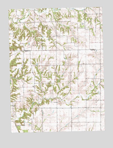
Eliza, IL USGS Topographic Map
Click on map above to begin viewing in our Map Viewer.

This topographic map contains these locations and features:
Feature Name Type Latitude Longitude GNIS ID View Map
Center School (historical)SchoolN41.3103°W90.9196°424029View Map
Deerlick BranchStreamN41.2950°W90.8871°407091View Map
ElizaPopulated PlaceN41.2959°W90.9676°407865View Map
Eliza Creek CemeteryCemeteryN41.2772°W90.9982°407867View Map
Eliza Creek School (historical)SchoolN41.2661°W90.9965°424037View Map
French School (historical)SchoolN41.3436°W90.9379°424042View Map
Glancey School (historical)SchoolN41.3048°W90.9988°424044View Map
Hazel Dell School (historical)SchoolN41.3539°W90.9090°424051View Map
Irwin BranchStreamN41.2850°W90.9565°410942View Map
Leech CemeteryCemeteryN41.3175°W90.9024°425822View Map
Miller CemeteryCemeteryN41.3181°W90.9824°413578View Map
New Boston - Eliza Fire Protection District Station 2BuildingN41.2961°W90.9706°2640789View Map
Oak Dale School (historical)SchoolN41.3103°W90.9704°424080View Map
PetersvillePopulated PlaceN41.2795°W90.9385°423065View Map
Point Pleasant School (historical)SchoolN41.3178°W90.8782°424087View Map
Thornton School (historical)SchoolN41.3467°W90.9951°424102View Map
Township of ElizaCivilN41.2872°W90.9950°428949View Map
Union ChurchChurchN41.2775°W90.9968°420061View Map
White Eagle School (historical)SchoolN41.2745°W90.9599°424107View Map
Winters Creek School (historical)SchoolN41.2661°W90.9193°424111View Map
Wrayville Church (historical)ChurchN41.3725°W90.9668°424112View Map
Yankee BranchStreamN41.2853°W90.9379°421553View Map

Note: Coordinates in the location and feature list above are referenced to NAD83 datum.


Copyright (C) 2008-2025 Ryan Niemi / Sunset Dynamics ... All Rights Reserved