TopoQuest Logo
Do you find TopoQuest useful?
Help keep TopoQuest running and adding new maps/features by donating!
Bitcoin:  19c7KJd3qBynnjoSw5npx9KScwjBe4ifkT
Litecoin:  LXs6TkuXGGXo1vDsWCkWVdjQX94eUKd6ui
Home View Maps Find Maps Find Places Resources & Links


Elkhorn Peak, Wyoming Topographic Map

USGS Map Title: Elkhorn Peak, WY
USGS Map MRC: 44109F5
DRG (GeoTIFF) Download: o44109f5.tif


Neighboring USGS Topographic Map Quads:


  Hunter Peak, WY  
44109G6
 

  Windy Mountain, WY  
44109G5
 

  Dillworth Bench, WY  
44109G4
 

  Geers Point, WY  
44109F6
 

  Elkhorn Peak, WY  
44109F5
 

  Dead Indian Meadows, WY  
44109F4
 

  Jaggar Peak, WY  
44109E6
 

  Dead Indian Peak, WY  
44109E5
 

  Jim Mountain, WY  
44109E4


Map MRC Location:

N45°
W110°
N45°
W109°
H8 H7 H6 H5 H4 H3 H2 H1
G8 G7 G6 G5 G4 G3 G2 G1
F8 F7 F6 F5 F4 F3 F2 F1
E8 E7 E6 E5 E4 E3 E2 E1
D8 D7 D6 D5 D4 D3 D2 D1
C8 C7 C6 C5 C4 C3 C2 C1
B8 B7 B6 B5 B4 B3 B2 B1
A8 A7 A6 A5 A4 A3 A2 A1
N44°
W110°
N44°
W109°

Elkhorn Peak, WY USGS 1:24K Topographic Map Preview:
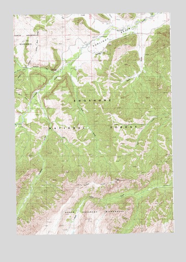
Elkhorn Peak, WY USGS Topographic Map
Click on map above to begin viewing in our Map Viewer.

This topographic map contains these locations and features:
Feature Name Type Latitude Longitude GNIS ID View Map
Beem GulchValleyN44.7319°W109.5235°1585356View Map
Burnt GulchValleyN44.6997°W109.6143°1586173View Map
Deweys GatewayGapN44.7166°W109.5868°1597077View Map
Double Spearhead Bar RanchLocaleN44.7183°W109.5763°1587742View Map
Elkhorn PeakSummitN44.6549°W109.5432°1588258View Map
Gravelbar CreekStreamN44.7058°W109.6060°1600054View Map
Huff GulchValleyN44.7091°W109.5777°1589790View Map
Lazy Open ALocaleN44.7205°W109.5935°1590600View Map
Little Bald RidgeRidgeN44.7380°W109.6046°1590731View Map
Little Sulphur CreekStreamN44.7199°W109.6191°1601046View Map
Little Sunlight CampgroundLocaleN44.7186°W109.5904°1605592View Map
Little Sunlight CreekStreamN44.7180°W109.5879°1601047View Map
Macy RanchLocaleN44.6972°W109.6085°1591156View Map
Painter GulchValleyN44.7452°W109.5388°1601997View Map
Quarter Circle RanchLocaleN44.7219°W109.5799°1593088View Map
Riddle RanchLocaleN44.7433°W109.5263°1593447View Map
Spink RanchLocaleN44.7149°W109.5268°1594787View Map
Sunlight BasinBasinN44.7386°W109.5427°1603442View Map
Sunlight RanchLocaleN44.7422°W109.5307°1595206View Map
Sunlight Ranger StationLocaleN44.7277°W109.5554°1595207View Map
Trail CreekStreamN44.7488°W109.5718°1604516View Map
White Mountain GulchValleyN44.7483°W109.5141°1603569View Map

Note: Coordinates in the location and feature list above are referenced to NAD83 datum.


Copyright (C) 2008-2025 Ryan Niemi / Sunset Dynamics ... All Rights Reserved