TopoQuest Logo
Do you find TopoQuest useful?
Help keep TopoQuest running and adding new maps/features by donating!
Bitcoin:  19c7KJd3qBynnjoSw5npx9KScwjBe4ifkT
Litecoin:  LXs6TkuXGGXo1vDsWCkWVdjQX94eUKd6ui
Home View Maps Find Maps Find Places Resources & Links


Windy Mountain, Wyoming Topographic Map

USGS Map Title: Windy Mountain, WY
USGS Map MRC: 44109G5
DRG (GeoTIFF) Download: o44109g5.tif


Neighboring USGS Topographic Map Quads:


  Muddy Creek, WY  
44109H6
 

  Beartooth Butte, WY  
44109H5
 

  Deep Lake, WY  
44109H4
 

  Hunter Peak, WY  
44109G6
 

  Windy Mountain, WY  
44109G5
 

  Dillworth Bench, WY  
44109G4
 

  Geers Point, WY  
44109F6
 

  Elkhorn Peak, WY  
44109F5
 

  Dead Indian Meadows, WY  
44109F4


Map MRC Location:

N45°
W110°
N45°
W109°
H8 H7 H6 H5 H4 H3 H2 H1
G8 G7 G6 G5 G4 G3 G2 G1
F8 F7 F6 F5 F4 F3 F2 F1
E8 E7 E6 E5 E4 E3 E2 E1
D8 D7 D6 D5 D4 D3 D2 D1
C8 C7 C6 C5 C4 C3 C2 C1
B8 B7 B6 B5 B4 B3 B2 B1
A8 A7 A6 A5 A4 A3 A2 A1
N44°
W110°
N44°
W109°

Windy Mountain, WY USGS 1:24K Topographic Map Preview:
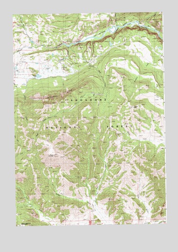
Windy Mountain, WY USGS Topographic Map
Click on map above to begin viewing in our Map Viewer.

This topographic map contains these locations and features:
Feature Name Type Latitude Longitude GNIS ID View Map
Beartooth CreekStreamN44.8636°W109.6141°1598035View Map
Camp Creek QuarryMineN44.8369°W109.5041°1725949View Map
Canyon CreekStreamN44.8658°W109.5124°1598616View Map
Cathedral CliffsCliffN44.8261°W109.5877°1598668View Map
Corral CreekStreamN44.8555°W109.5804°1598908View Map
Crandall CreekStreamN44.8561°W109.6052°1598999View Map
Deadman CreekStreamN44.8477°W109.5049°1599159View Map
Dodd RanchLocaleN44.7999°W109.5091°1599279View Map
East Fork Painter GulchValleyN44.7652°W109.5591°1599482View Map
K Bar Z RanchLocaleN44.8369°W109.6085°1600672View Map
Lewis and Clark TrailTrailN44.8652°W109.5504°1600900View Map
Luckinbill AirstripAirportN44.8381°W109.6220°2443879View Map
Luckinbill AirstripAirportN44.8380°W109.6221°806394View Map
Marguerite DrawValleyN44.7511°W109.5254°1604635View Map
Reef CreekStreamN44.8563°W109.5779°1602478View Map
Reef Creek CampgroundLocaleN44.8466°W109.5588°1602479View Map
Reef Creek TrailTrailN44.8188°W109.5813°1602480View Map
Rocky FordLocaleN44.8463°W109.5866°1602610View Map
Russell PeakSummitN44.8191°W109.5263°1602652View Map
Swamp LakeLakeN44.8383°W109.6044°1603473View Map
Table CreekStreamN44.8666°W109.5385°1603506View Map
Windy MountainSummitN44.7913°W109.5938°1604245View Map

Note: Coordinates in the location and feature list above are referenced to NAD83 datum.


Copyright (C) 2008-2025 Ryan Niemi / Sunset Dynamics ... All Rights Reserved