TopoQuest Logo
Do you find TopoQuest useful?
Help keep TopoQuest running and adding new maps/features by donating!
Bitcoin:  19c7KJd3qBynnjoSw5npx9KScwjBe4ifkT
Litecoin:  LXs6TkuXGGXo1vDsWCkWVdjQX94eUKd6ui
Home View Maps Find Maps Find Places Resources & Links


Ariel, Washington Topographic Map

USGS Map Title: Ariel, WA
USGS Map MRC: 45122H5
DRG (GeoTIFF) Download: o45122h5.tif


Neighboring USGS Topographic Map Quads:


  Woolford Creek, WA  
46122A6
 

  Georges Peak, WA  
46122A5
 

  Lakeview Peak, WA  
46122A4
 

  Woodland, WA  
45122H6
 

  Ariel, WA  
45122H5
 

  Amboy, WA  
45122H4
 

  Ridgefield, WA  
45122G6
 

  Battle Ground, WA  
45122G5
 

  Yacolt, WA  
45122G4


Map MRC Location:

N46°
W123°
N46°
W122°
H8 H7 H6 H5 H4 H3 H2 H1
G8 G7 G6 G5 G4 G3 G2 G1
F8 F7 F6 F5 F4 F3 F2 F1
E8 E7 E6 E5 E4 E3 E2 E1
D8 D7 D6 D5 D4 D3 D2 D1
C8 C7 C6 C5 C4 C3 C2 C1
B8 B7 B6 B5 B4 B3 B2 B1
A8 A7 A6 A5 A4 A3 A2 A1
N45°
W123°
N45°
W122°

Ariel, WA USGS 1:24K Topographic Map Preview:
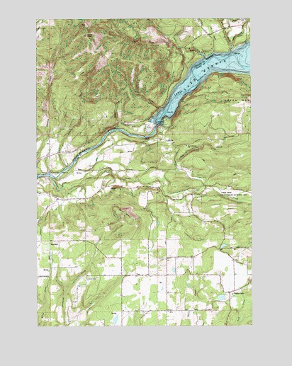
Ariel, WA USGS Topographic Map
Click on map above to begin viewing in our Map Viewer.

This topographic map contains these locations and features:
Feature Name Type Latitude Longitude GNIS ID View Map
ArielPopulated PlaceN45.9568°W122.5709°1510787View Map
Ariel Post OfficePost OfficeN45.9573°W122.5670°2781643View Map
Bald MountainSummitN45.9193°W122.5729°1503141View Map
Cape Horn CreekStreamN45.9857°W122.5309°1503798View Map
Cedar CreekStreamN45.9359°W122.6187°1517540View Map
Cedar Creek State Wildlife Recreation AreaParkN45.9265°W122.5257°1514050View Map
CedarvillePopulated PlaceN45.9287°W122.5293°1514000View Map
Clark County Fire District 10 Station 103BuildingN45.8937°W122.5512°2643368View Map
Clark County Fire District 10 Station 104BuildingN45.9306°W122.5717°2643369View Map
Clark County Fire District 10 Station 5BuildingN45.8896°W122.5102°2643912View Map
Colvin CreekStreamN45.9393°W122.6084°1513086View Map
Colvin Creek DamDamN45.9398°W122.6095°1532570View Map
Davis PeakSummitN45.9932°W122.5962°1504344View Map
Day CreekStreamN45.9865°W122.5226°1504353View Map
DaytonPopulated PlaceN45.9315°W122.5273°1513991View Map
Elmer DamDamN45.8982°W122.5462°1532571View Map
Erickson DamDamN45.8865°W122.5179°1532063View Map
EtnaPopulated PlaceN45.9382°W122.5984°1510952View Map
Fargher LakePopulated PlaceN45.8884°W122.5143°1504828View Map
Fargher PondLakeN45.8863°W122.5192°1514736View Map
Fargher PondReservoirN45.9073°W122.5178°1532731View Map
Fargher Pond DamDamN45.9065°W122.5195°1532730View Map
Green Mountain SchoolSchoolN45.9481°W122.5390°1530912View Map
HallPopulated PlaceN45.9484°W122.5395°1513999View Map
HighlandPopulated PlaceN45.9096°W122.6187°1511033View Map
Husky CreekStreamN45.9551°W122.5787°1513131View Map
Indian George CreekStreamN45.9893°W122.5120°1521185View Map
Jim CreekStreamN45.9865°W122.5126°1505810View Map
La Center DivisionCivilN45.8839°W122.6101°1939533View Map
La Center View-Air AirportAirportN45.8944°W122.5943°1533810View Map
Lone Pine CemeteryCemeteryN45.9987°W122.5039°1506263View Map
Marble CreekStreamN45.9632°W122.5537°1506461View Map
Mc Clellan FieldAirportN45.8943°W122.5482°1533659View Map
MerwinLocaleN45.9559°W122.5604°1513990View Map
Merwin DamDamN45.9568°W122.5551°1511644View Map
Mountain View CemeteryCemeteryN45.9023°W122.5512°1506840View Map
North Country Emergency Medical Services Fire Station 2BuildingN45.8879°W122.5138°2619677View Map
North Country Emergency Medical Services Station 2BuildingN45.8879°W122.5139°2643856View Map
Pup CreekStreamN45.9340°W122.5526°1524694View Map
Reid MountainSummitN45.9962°W122.6232°1512835View Map
Tsugawa Brothers ReservoirReservoirN45.8774°W122.5807°1532065View Map
Tsugawa Brothers Reservoir DamDamN45.8765°W122.5812°1532064View Map
ViewPopulated PlaceN45.8954°W122.5684°1531163View Map

Note: Coordinates in the location and feature list above are referenced to NAD83 datum.


Copyright (C) 2008-2024 Ryan Niemi / Sunset Dynamics ... All Rights Reserved