TopoQuest Logo
Do you find TopoQuest useful?
Help keep TopoQuest running and adding new maps/features by donating!
Bitcoin:  19c7KJd3qBynnjoSw5npx9KScwjBe4ifkT
Litecoin:  LXs6TkuXGGXo1vDsWCkWVdjQX94eUKd6ui
Home View Maps Find Maps Find Places Resources & Links


Woodland, Washington Topographic Map

USGS Map Title: Woodland, WA
USGS Map MRC: 45122H6
DRG (GeoTIFF) Download: o45122h6.tif


Neighboring USGS Topographic Map Quads:


  Kalama, WA  
46122A7
 

  Woolford Creek, WA  
46122A6
 

  Georges Peak, WA  
46122A5
 

  Deer Island, OR  
45122H7
 

  Woodland, WA  
45122H6
 

  Ariel, WA  
45122H5
 

  Saint Helens, OR  
45122G7
 

  Ridgefield, WA  
45122G6
 

  Battle Ground, WA  
45122G5


Map MRC Location:

N46°
W123°
N46°
W122°
H8 H7 H6 H5 H4 H3 H2 H1
G8 G7 G6 G5 G4 G3 G2 G1
F8 F7 F6 F5 F4 F3 F2 F1
E8 E7 E6 E5 E4 E3 E2 E1
D8 D7 D6 D5 D4 D3 D2 D1
C8 C7 C6 C5 C4 C3 C2 C1
B8 B7 B6 B5 B4 B3 B2 B1
A8 A7 A6 A5 A4 A3 A2 A1
N45°
W123°
N45°
W122°

Woodland, WA USGS 1:24K Topographic Map Preview:
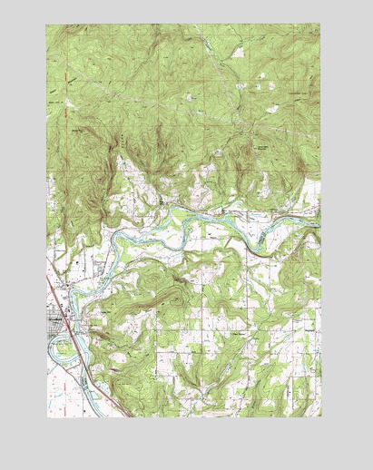
Woodland, WA USGS Topographic Map
Click on map above to begin viewing in our Map Viewer.

This topographic map contains these locations and features:
Feature Name Type Latitude Longitude GNIS ID View Map
Binford ReservoirReservoirN45.8900°W122.6341°1532569View Map
Binford Reservoir DamDamN45.8882°W122.6345°1532568View Map
Butte HillCapeN45.9571°W122.7143°1503685View Map
Cardai HillCapeN45.9076°W122.7284°1503808View Map
Cedar Creek SchoolSchoolN45.9240°W122.6437°1503879View Map
Clark County Fire and Rescue Station 25 Woodland Fire DepartmentBuildingN45.9028°W122.6752°2643354View Map
Clark County Fire and Rescue Station 28 Woodland Fire DepartmentBuildingN45.9175°W122.7400°2619678View Map
Clark County Fire District 12 Ridgefield/la Center Station 5BuildingN45.9007°W122.6285°2619665View Map
Clark County Fire Rescue Station 29BuildingN45.9012°W122.7473°2619484View Map
Clover ValleyValleyN45.9387°W122.6668°1504029View Map
Cowlitz County Fire Protection District 1BuildingN45.8907°W122.7379°2643349View Map
Cowlitz County Fire Protection District 1BuildingN45.9401°W122.6692°2643350View Map
Cowlitz County Fire Protection District 1BuildingN45.9648°W122.6699°2643351View Map
Dee CreekStreamN45.9879°W122.6707°1504384View Map
Devils PeakSummitN45.9659°W122.7337°1504461View Map
Finn HallLocaleN45.9429°W122.6959°1504881View Map
Goose HillSummitN45.9084°W122.7009°1505187View Map
HayesPopulated PlaceN45.9315°W122.6773°1511028View Map
Hayes CreekStreamN45.9283°W122.6897°2440031View Map
Highland CemeteryCemeteryN45.9054°W122.6384°1505507View Map
Horseshoe LakeLakeN45.8959°W122.7490°1505619View Map
Houghton CreekStreamN45.9379°W122.6695°1505636View Map
Interchange 21CrossingN45.9056°W122.7424°2474602View Map
Johnson CreekStreamN45.9359°W122.6268°1505843View Map
Lewis River Golf Course Airport (historical)AirportN45.9357°W122.6554°1534044View Map
Pine GrovePopulated PlaceN45.9023°W122.6593°1511229View Map
RenoLocaleN45.9393°W122.6293°1512834View Map
Robinson CreekStreamN45.9307°W122.7215°1507831View Map
Ross CreekStreamN45.9334°W122.7043°1507925View Map
Ross PeakSummitN45.9698°W122.7087°1512840View Map
Schumaker MountainSummitN45.9604°W122.6545°1508162View Map
Staples CreekStreamN45.9387°W122.6701°1512849View Map
WoodlandPopulated PlaceN45.9046°W122.7440°1512812View Map
Woodland Middle SchoolSchoolN45.9042°W122.7483°1515149View Map
Woodland Police DepartmentBuildingN45.9012°W122.7472°2722046View Map
Woodland Post OfficePost OfficeN45.9022°W122.7477°2781639View Map
Woodland State AirportAirportN45.9007°W122.7385°1534043View Map

Note: Coordinates in the location and feature list above are referenced to NAD83 datum.


Copyright (C) 2008-2024 Ryan Niemi / Sunset Dynamics ... All Rights Reserved