TopoQuest Logo
Do you find TopoQuest useful?
Help keep TopoQuest running and adding new maps/features by donating!
Bitcoin:  19c7KJd3qBynnjoSw5npx9KScwjBe4ifkT
Litecoin:  LXs6TkuXGGXo1vDsWCkWVdjQX94eUKd6ui
Home View Maps Find Maps Find Places Resources & Links


Ellaville North, Georgia Topographic Map

USGS Map Title: Ellaville North, GA
USGS Map MRC: 32084C3
DRG (GeoTIFF) Download: o32084c3.tif


Neighboring USGS Topographic Map Quads:


  Tazewell North, GA  
32084D4
 

  Rupert, GA  
32084D3
 

  Ideal North, GA  
32084D2
 

  Tazewell South, GA  
32084C4
 

  Ellaville North, GA  
32084C3
 

  Ideal South, GA  
32084C2
 

  Draneville, GA  
32084B4
 

  Ellaville South, GA  
32084B3
 

  Andersonville, GA  
32084B2


Map MRC Location:

N33°
W85°
N33°
W84°
H8 H7 H6 H5 H4 H3 H2 H1
G8 G7 G6 G5 G4 G3 G2 G1
F8 F7 F6 F5 F4 F3 F2 F1
E8 E7 E6 E5 E4 E3 E2 E1
D8 D7 D6 D5 D4 D3 D2 D1
C8 C7 C6 C5 C4 C3 C2 C1
B8 B7 B6 B5 B4 B3 B2 B1
A8 A7 A6 A5 A4 A3 A2 A1
N32°
W85°
N32°
W84°

Ellaville North, GA USGS 1:24K Topographic Map Preview:
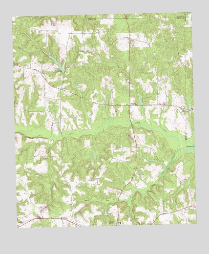
Ellaville North, GA USGS Topographic Map
Click on map above to begin viewing in our Map Viewer.

This topographic map contains these locations and features:
Feature Name Type Latitude Longitude GNIS ID View Map
American Legion DamDamN32.3035°W84.2949°341036View Map
American Legion LakeReservoirN32.3017°W84.2944°341037View Map
Beaver RunStreamN32.2646°W84.2974°354509View Map
Brays Mill PondReservoirN32.3196°W84.2529°346941View Map
Cedar ChurchChurchN32.3563°W84.3691°312447View Map
ConcordPopulated PlaceN32.3313°W84.3424°355255View Map
Concord Methodist ChurchChurchN32.3313°W84.3427°344124View Map
Coon CreekStreamN32.3088°W84.3199°312940View Map
Deer CreekStreamN32.2940°W84.2619°313422View Map
Ellaville North DivisionCivilN32.3080°W84.3194°1936247View Map
Fox BranchStreamN32.2988°W84.3502°314331View Map
Hill DamDamN32.3585°W84.3049°340334View Map
Hill LakeReservoirN32.3599°W84.3070°340335View Map
Hills MillpondReservoirN32.3425°W84.3404°315437View Map
Hills Millpond DamDamN32.3418°W84.3399°341034View Map
Hopewell ChurchChurchN32.2590°W84.3577°315650View Map
Lanceford LakeReservoirN32.3233°W84.2867°337588View Map
Lanceford Lake DamDamN32.3202°W84.2866°337587View Map
Mount Vernon ChurchChurchN32.3179°W84.2563°318904View Map
Murrays CrossroadsPopulated PlaceN32.3210°W84.2944°326414View Map
Owens LakeReservoirN32.2968°W84.3516°341043View Map
Owens Lake DamDamN32.2968°W84.3516°341042View Map
Philippi ChurchChurchN32.3477°W84.3546°320448View Map
Pleasant Hill ChurchChurchN32.3599°W84.2941°320885View Map
Rice BranchStreamN32.3018°W84.3460°321555View Map
Rock Hill ChurchChurchN32.2979°W84.3416°344128View Map
Rufus Peepe Dam NorthDamN32.2635°W84.3249°341040View Map
Rufus Peepe Dam SouthDamN32.2602°W84.3316°341038View Map
Rufus Peepe Lake NorthReservoirN32.2619°W84.3262°341041View Map
Rufus Peepe Lake SuthReservoirN32.2585°W84.3311°341039View Map
Schley CountyCivilN32.2617°W84.3147°344129View Map
Sellars StoreLocaleN32.3213°W84.2685°322707View Map
Trice LakeReservoirN32.2902°W84.3532°341045View Map
Trice Lake DamDamN32.2902°W84.3532°341044View Map
Usry CreekStreamN32.3099°W84.2841°324638View Map
Walls CrossingPopulated PlaceN32.2538°W84.3705°333355View Map
Walls Fish PondReservoirN32.3231°W84.3102°344131View Map
Zion Hill ChurchChurchN32.3199°W84.2682°325695View Map

Note: Coordinates in the location and feature list above are referenced to NAD83 datum.


Copyright (C) 2008-2024 Ryan Niemi / Sunset Dynamics ... All Rights Reserved