TopoQuest Logo
Do you find TopoQuest useful?
Help keep TopoQuest running and adding new maps/features by donating!
Bitcoin:  19c7KJd3qBynnjoSw5npx9KScwjBe4ifkT
Litecoin:  LXs6TkuXGGXo1vDsWCkWVdjQX94eUKd6ui
Home View Maps Find Maps Find Places Resources & Links


Ellaville South, Georgia Topographic Map

USGS Map Title: Ellaville South, GA
USGS Map MRC: 32084B3
DRG (GeoTIFF) Download: o32084b3.tif


Neighboring USGS Topographic Map Quads:


  Tazewell South, GA  
32084C4
 

  Ellaville North, GA  
32084C3
 

  Ideal South, GA  
32084C2
 

  Draneville, GA  
32084B4
 

  Ellaville South, GA  
32084B3
 

  Andersonville, GA  
32084B2
 

  Plains, GA  
32084A4
 

  Lake Collins, GA  
32084A3
 

  Americus, GA  
32084A2


Map MRC Location:

N33°
W85°
N33°
W84°
H8 H7 H6 H5 H4 H3 H2 H1
G8 G7 G6 G5 G4 G3 G2 G1
F8 F7 F6 F5 F4 F3 F2 F1
E8 E7 E6 E5 E4 E3 E2 E1
D8 D7 D6 D5 D4 D3 D2 D1
C8 C7 C6 C5 C4 C3 C2 C1
B8 B7 B6 B5 B4 B3 B2 B1
A8 A7 A6 A5 A4 A3 A2 A1
N32°
W85°
N32°
W84°

Ellaville South, GA USGS 1:24K Topographic Map Preview:
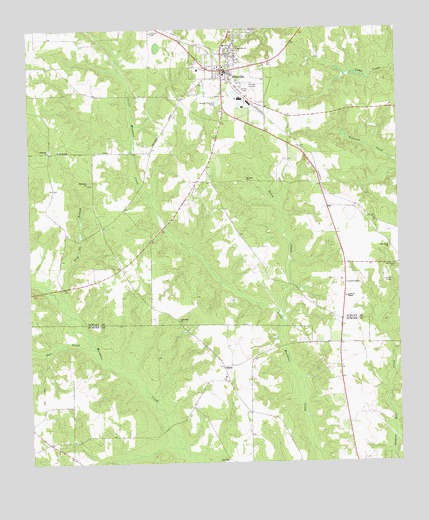
Ellaville South, GA USGS Topographic Map
Click on map above to begin viewing in our Map Viewer.

This topographic map contains these locations and features:
Feature Name Type Latitude Longitude GNIS ID View Map
Andrews ChapelChurchN32.1727°W84.2677°354312View Map
City of EllavilleCivilN32.2380°W84.3089°2403558View Map
Corinth ChurchChurchN32.1290°W84.3660°343431View Map
Deer CreekStreamN32.1579°W84.3524°313421View Map
Ebenezer ChurchChurchN32.2152°W84.3680°313829View Map
Ebenezer ChurchChurchN32.2065°W84.3549°355617View Map
EllavillePopulated PlaceN32.2382°W84.3091°355674View Map
Ellaville Baptist ChurchChurchN32.2390°W84.3085°344125View Map
Ellaville Police DepartmentBuildingN32.2390°W84.3102°2733503View Map
Ellaville Post OfficePost OfficeN32.2385°W84.3082°352181View Map
Ellaville South DivisionCivilN32.2006°W84.3085°1936248View Map
Galey CreekStreamN32.1668°W84.2896°314484View Map
Gill Strip (historical)AirportN32.2346°W84.2996°351756View Map
Jerusalem ChurchChurchN32.1663°W84.3244°316097View Map
Jorden DamDamN32.2168°W84.3182°341046View Map
Jorden LakeReservoirN32.2179°W84.3169°341047View Map
Mount Zion ChurchChurchN32.2065°W84.3013°318970View Map
Myrtle Springs (historical)Populated PlaceN32.1260°W84.3091°343474View Map
Ninemile BranchStreamN32.1290°W84.3260°319599View Map
Oak Grove CemeteryCemeteryN32.1818°W84.2507°319750View Map
Oak Grove ChurchChurchN32.1871°W84.2527°319788View Map
Schley County CourthouseBuildingN32.2382°W84.3094°344130View Map
Schley County Fire and Emergency Medical ServicesBuildingN32.2393°W84.3102°2603875View Map
Schley County JailBuildingN32.2390°W84.3102°2733980View Map
Schley County Sheriff's OfficeBuildingN32.2390°W84.3102°2733657View Map
ShilohPopulated PlaceN32.1527°W84.3096°326513View Map
Shiloh Baptist ChurchChurchN32.1490°W84.3094°343500View Map
Shiloh CemeteryCemeteryN32.1490°W84.3099°343501View Map
Shiloh School (historical)SchoolN32.1496°W84.3091°343502View Map
Theus LakeReservoirN32.1918°W84.3299°337586View Map
Theus Lake DamDamN32.1918°W84.3299°337585View Map
Trip Up BranchStreamN32.1690°W84.3632°324322View Map
Union Hill ChurchChurchN32.2443°W84.3044°324567View Map

Note: Coordinates in the location and feature list above are referenced to NAD83 datum.


Copyright (C) 2008-2025 Ryan Niemi / Sunset Dynamics ... All Rights Reserved