TopoQuest Logo
Do you find TopoQuest useful?
Help keep TopoQuest running and adding new maps/features by donating!
Bitcoin:  19c7KJd3qBynnjoSw5npx9KScwjBe4ifkT
Litecoin:  LXs6TkuXGGXo1vDsWCkWVdjQX94eUKd6ui
Home View Maps Find Maps Find Places Resources & Links


Elliott Key, Florida Topographic Map

USGS Map Title: Elliott Key, FL
USGS Map MRC: 25080D2
DRG (GeoTIFF) Download: o25080d2.tif


Neighboring USGS Topographic Map Quads:


  Perrine, FL  
25080E3
 

  Soldier Key, FL  
25080E2


  Arsenicker Keys, FL  
25080D3
 

  Elliott Key, FL  
25080D2


  Card Sound, FL  
25080C3
 

  Pacific Reef, FL  
25080C2


Map MRC Location:

N26°
W81°
N26°
W80°
H8 H7 H6 H5 H4 H3 H2 H1
G8 G7 G6 G5 G4 G3 G2 G1
F8 F7 F6 F5 F4 F3 F2 F1
E8 E7 E6 E5 E4 E3 E2 E1
D8 D7 D6 D5 D4 D3 D2 D1
C8 C7 C6 C5 C4 C3 C2 C1
B8 B7 B6 B5 B4 B3 B2 B1
A8 A7 A6 A5 A4 A3 A2 A1
N25°
W81°
N25°
W80°

Elliott Key, FL USGS 1:24K Topographic Map Preview:
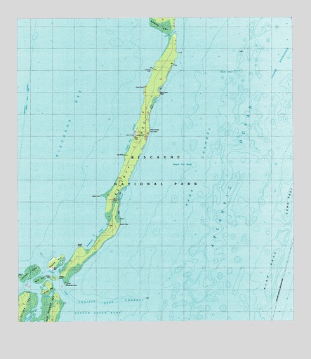
Elliott Key, FL USGS Topographic Map
Click on map above to begin viewing in our Map Viewer.

This topographic map contains these locations and features:
Feature Name Type Latitude Longitude GNIS ID View Map
Adams KeyIslandN25.4001°W80.2328°277677View Map
Ajax ReefBarN25.3965°W80.1364°277707View Map
Bache ShoalBarN25.4776°W80.1514°293919View Map
Billys PointCapeN25.4276°W80.2120°278779View Map
Biscayne National ParkParkN25.4905°W80.2102°294450View Map
Caesar CreekChannelN25.3890°W80.2295°293951View Map
Caesar Creek BankBarN25.3779°W80.2142°279814View Map
Caesar RockIslandN25.3937°W80.2323°279815View Map
Christmas PointCapeN25.3904°W80.2278°280436View Map
City of Islandia (historical)CivilN25.4278°W80.1851°2404770View Map
Coon PointCapeN25.4721°W80.1920°280768View Map
Elliott KeyIslandN25.4432°W80.1973°282174View Map
Elliott Key HarborHarborN25.4532°W80.1964°307698View Map
Elliott Key Park Harbor Light 2LocaleN25.4537°W80.1964°297635View Map
Elliott Key Visitor CenterLocaleN25.4523°W80.1964°304705View Map
Hurricane CreekBayN25.3877°W80.2341°284424View Map
Jones PointCapeN25.4059°W80.2214°304704View Map
Legare AnchorageHarborN25.4826°W80.1317°285445View Map
Log PointCapeN25.4837°W80.1831°1877546View Map
Long ReefBarN25.4240°W80.1267°304706View Map
Margot Fish ShoalBarN25.4401°W80.1698°286416View Map
Meigs KeyIslandN25.3932°W80.2342°286682View Map
Ott PointCapeN25.4434°W80.2012°304703View Map
Pacific Reef ChannelChannelN25.3834°W80.2089°288358View Map
Petrel PointCapeN25.4154°W80.2037°288749View Map
Point AdelleCapeN25.4540°W80.1898°289114View Map
Porgy KeyIslandN25.3893°W80.2359°294124View Map
Reid KeyIslandN25.3926°W80.2401°294131View Map
Rubicon KeysIslandN25.3962°W80.2437°290045View Map
Sands CutChannelN25.4937°W80.1803°290607View Map
Sandwich CoveBayN25.4124°W80.2141°297447View Map
Sawyer CoveBayN25.4282°W80.2026°290731View Map
Sea Grape PointCapeN25.4696°W80.1850°290779View Map
Totten KeyIslandN25.3815°W80.2489°294176View Map
University DockLocaleN25.4796°W80.1884°304702View Map

Note: Coordinates in the location and feature list above are referenced to NAD83 datum.


Copyright (C) 2008-2024 Ryan Niemi / Sunset Dynamics ... All Rights Reserved