TopoQuest Logo
Do you find TopoQuest useful?
Help keep TopoQuest running and adding new maps/features by donating!
Bitcoin:  19c7KJd3qBynnjoSw5npx9KScwjBe4ifkT
Litecoin:  LXs6TkuXGGXo1vDsWCkWVdjQX94eUKd6ui
Home View Maps Find Maps Find Places Resources & Links


Aripeka, Florida Topographic Map

USGS Map Title: Aripeka, FL
USGS Map MRC: 28082D6
DRG (GeoTIFF) Download: o28082d6.tif


Neighboring USGS Topographic Map Quads:


  Bayport, FL  
28082E6
 

  Weeki Wachee Spring, FL  
28082E5


  Aripeka, FL  
28082D6
 

  Port Richey NE, FL  
28082D5


  Port Richey, FL  
28082C6
 

  Fivay Junction, FL  
28082C5


Map MRC Location:

N29°
W83°
N29°
W82°
H8 H7 H6 H5 H4 H3 H2 H1
G8 G7 G6 G5 G4 G3 G2 G1
F8 F7 F6 F5 F4 F3 F2 F1
E8 E7 E6 E5 E4 E3 E2 E1
D8 D7 D6 D5 D4 D3 D2 D1
C8 C7 C6 C5 C4 C3 C2 C1
B8 B7 B6 B5 B4 B3 B2 B1
A8 A7 A6 A5 A4 A3 A2 A1
N28°
W83°
N28°
W82°

Aripeka, FL USGS 1:24K Topographic Map Preview:
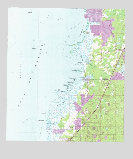
Aripeka, FL USGS Topographic Map
Click on map above to begin viewing in our Map Viewer.

This topographic map contains these locations and features:
Feature Name Type Latitude Longitude GNIS ID View Map
AripekaPopulated PlaceN28.4322°W82.6643°293914View Map
Aripeka Census Designated PlaceCensusN28.4308°W82.6668°2583324View Map
Aripeka Post OfficePost OfficeN28.4324°W82.6653°2768050View Map
Bathhouse IslandIslandN28.4489°W82.6698°278173View Map
Bluefish RocksIslandN28.4375°W82.7215°293941View Map
Cabbage IslandIslandN28.4481°W82.6737°279794View Map
Cedar IslandCapeN28.3775°W82.7054°280205View Map
Devils Rock YardIslandN28.3958°W82.7082°281538View Map
Dinner PointCapeN28.4653°W82.6845°281575View Map
Fillman BayouBayN28.4104°W82.6903°294010View Map
First PointCapeN28.4344°W82.6773°282467View Map
Ghost CreekStreamN28.3875°W82.7065°283048View Map
Gomez RockIslandN28.4961°W82.7290°283167View Map
Grace Memorial GardensCemeteryN28.4065°W82.6591°298223View Map
Gun PointCapeN28.4419°W82.6743°283561View Map
Gun Point KeyIslandN28.4419°W82.6759°283562View Map
Hammock CreekStreamN28.4356°W82.6743°283651View Map
Hammock PointCapeN28.4203°W82.6965°283657View Map
Heritage Pines Census Designated PlaceCensusN28.4267°W82.6254°2583352View Map
Hernando BeachPopulated PlaceN28.4694°W82.6593°1867152View Map
Hernando BeachBeachN28.4928°W82.6665°299048View Map
Hernando Beach Census Designated PlaceCensusN28.4756°W82.6614°2402579View Map
Hernando Beach Volunteer Fire Department Station 6BuildingN28.4854°W82.6507°2644665View Map
Hernando County Sheriff's Office Hernando Beach SubstationBuildingN28.4897°W82.6506°2333646View Map
Hernando County Sheriff's Office Hernando Beach SubstationBuildingN28.4901°W82.6508°2333704View Map
Horse IslandIslandN28.4019°W82.7057°284278View Map
Immaculate Conception ChurchChurchN28.3823°W82.6750°2481691View Map
Indian BayBayN28.4533°W82.6704°284481View Map
Indian CreekStreamN28.4500°W82.6665°284495View Map
Indian KeyIslandN28.4550°W82.6857°284509View Map
Little Pine IslandIslandN28.4775°W82.6662°285757View Map
Little Pine Island BayBayN28.4797°W82.6693°285760View Map
Long PointCapeN28.4128°W82.6995°286034View Map
Low RockIslandN28.4622°W82.7198°286160View Map
Minnow CreekStreamN28.4967°W82.6687°286966View Map
Notre Dame Interparochial Catholic SchoolSchoolN28.4400°W82.6379°2025511View Map
Palm IslandIslandN28.4344°W82.6662°288404View Map
Rock Yard CreekGutN28.3919°W82.7007°289860View Map
Rocky CreekStreamN28.4856°W82.6651°289885View Map
Second PointCapeN28.4303°W82.6787°290811View Map
The CutoffChannelN28.4164°W82.6909°292156View Map
Third PointCapeN28.4281°W82.6840°292192View Map
Weekiwachee GardensPopulated PlaceN28.4942°W82.6279°302711View Map
West Hernando Junior High SchoolSchoolN28.4661°W82.6257°297840View Map
Westside Elementary SchoolSchoolN28.4526°W82.6263°297839View Map

Note: Coordinates in the location and feature list above are referenced to NAD83 datum.


Copyright (C) 2008-2025 Ryan Niemi / Sunset Dynamics ... All Rights Reserved