TopoQuest Logo
Do you find TopoQuest useful?
Help keep TopoQuest running and adding new maps/features by donating!
Bitcoin:  19c7KJd3qBynnjoSw5npx9KScwjBe4ifkT
Litecoin:  LXs6TkuXGGXo1vDsWCkWVdjQX94eUKd6ui
Home View Maps Find Maps Find Places Resources & Links


Elsmore, Kansas Topographic Map

USGS Map Title: Elsmore, KS
USGS Map MRC: 37095G2
DRG (GeoTIFF) Download: o37095g2.tif


Neighboring USGS Topographic Map Quads:


  La Harpe, KS  
37095H3
 

  Moran, KS  
37095H2
 

  Bronson, KS  
37095H1
 

  Iola SE, KS  
37095G3
 

  Elsmore, KS  
37095G2
 

  Moran SE, KS  
37095G1
 

  Rollin, KS  
37095F3
 

  Stark, KS  
37095F2
 

  Porterville, KS  
37095F1


Map MRC Location:

N38°
W96°
N38°
W95°
H8 H7 H6 H5 H4 H3 H2 H1
G8 G7 G6 G5 G4 G3 G2 G1
F8 F7 F6 F5 F4 F3 F2 F1
E8 E7 E6 E5 E4 E3 E2 E1
D8 D7 D6 D5 D4 D3 D2 D1
C8 C7 C6 C5 C4 C3 C2 C1
B8 B7 B6 B5 B4 B3 B2 B1
A8 A7 A6 A5 A4 A3 A2 A1
N37°
W96°
N37°
W95°

Elsmore, KS USGS 1:24K Topographic Map Preview:
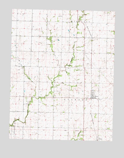
Elsmore, KS USGS Topographic Map
Click on map above to begin viewing in our Map Viewer.

This topographic map contains these locations and features:
Feature Name Type Latitude Longitude GNIS ID View Map
Allen County Rural Fire District 3 Elsmore StationBuildingN37.7916°W95.1498°2111093View Map
City of ElsmoreCivilN37.7942°W95.1498°2394679View Map
East Liberty School (historical)SchoolN37.7906°W95.1786°482774View Map
East Union School (historical)SchoolN37.8195°W95.1286°482776View Map
ElsmorePopulated PlaceN37.7945°W95.1503°474737View Map
Elsmore CemeteryCemeteryN37.7903°W95.1440°474736View Map
Elsmore Elementary School (historical)SchoolN37.7912°W95.1469°480980View Map
Elsmore United Methodist ChurchChurchN37.7939°W95.1506°2690223View Map
Elsmore Wastewater PlantLocaleN37.7945°W95.1454°2693398View Map
Little CreekStreamN37.8000°W95.1900°474734View Map
Mud CreekStreamN37.7923°W95.2219°474733View Map
Old Elsmore CemeteryCemeteryN37.8196°W95.1791°474738View Map
Old Elsmore School (historical)SchoolN37.8195°W95.1875°482794View Map
Olive Branch School (historical)SchoolN37.8500°W95.1522°482795View Map
Prairie Chapel Church (historical)ChurchN37.8561°W95.1622°482801View Map
Prairie Rose Community HallBuildingN37.8689°W95.1897°474735View Map
Prairie Rose School (historical)SchoolN37.8689°W95.1894°482803View Map
Savonburg Wastewater Treatment PlantLocaleN37.7552°W95.1408°2691968View Map
Sky Rocket School (historical)SchoolN37.7912°W95.2341°482812View Map
Township of ElsmoreCivilN37.7910°W95.1589°474741View Map

Note: Coordinates in the location and feature list above are referenced to NAD83 datum.


Copyright (C) 2008-2025 Ryan Niemi / Sunset Dynamics ... All Rights Reserved