TopoQuest Logo
Do you find TopoQuest useful?
Help keep TopoQuest running and adding new maps/features by donating!
Bitcoin:  19c7KJd3qBynnjoSw5npx9KScwjBe4ifkT
Litecoin:  LXs6TkuXGGXo1vDsWCkWVdjQX94eUKd6ui
Home View Maps Find Maps Find Places Resources & Links


Elso, Montana Topographic Map

USGS Map Title: Elso, MT
USGS Map MRC: 46108C6
DRG (GeoTIFF) Download: o46108c6.tif


Neighboring USGS Topographic Map Quads:


  Timber Buttes South, MT  
46108D7
 

  Horsethief Creek, MT  
46108D6
 

  Roundup, MT  
46108D5
 

  Bundy, MT  
46108C7
 

  Elso, MT  
46108C6
 

  Harper Coulee, MT  
46108C5
 

  Broadview NE, MT  
46108B7
 

  Hay Basin North, MT  
46108B6
 

  Hay Basin NE, MT  
46108B5


Map MRC Location:

N47°
W109°
N47°
W108°
H8 H7 H6 H5 H4 H3 H2 H1
G8 G7 G6 G5 G4 G3 G2 G1
F8 F7 F6 F5 F4 F3 F2 F1
E8 E7 E6 E5 E4 E3 E2 E1
D8 D7 D6 D5 D4 D3 D2 D1
C8 C7 C6 C5 C4 C3 C2 C1
B8 B7 B6 B5 B4 B3 B2 B1
A8 A7 A6 A5 A4 A3 A2 A1
N46°
W109°
N46°
W108°

Elso, MT USGS 1:24K Topographic Map Preview:
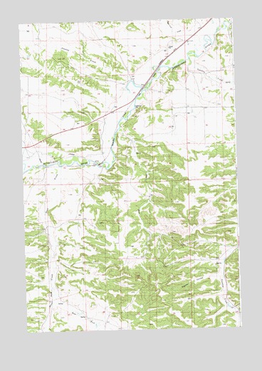
Elso, MT USGS Topographic Map
Click on map above to begin viewing in our Map Viewer.

This topographic map contains these locations and features:
Feature Name Type Latitude Longitude GNIS ID View Map
06N24E04DDAB01 WellWellN46.2972°W108.7221°815199View Map
06N24E08AABA01 WellWellN46.2927°W108.7396°815145View Map
06N24E14CDDB01 WellWellN46.2650°W108.6871°814919View Map
07N24E13AACC01 WellWellN46.3658°W108.6585°815769View Map
07N24E13BDAA01 WellWellN46.3680°W108.6674°815785View Map
07N24E13BDDD01 WellWellN46.3630°W108.6643°815745View Map
07N24E14ADDA01 WellWellN46.3619°W108.6738°815734View Map
07N24E15BAA_01 WellWellN46.3680°W108.7076°815786View Map
07N24E24DCCA01 WellWellN46.3402°W108.6632°815592View Map
07N24E24DDDD01 WellWellN46.3400°W108.6546°815588View Map
07N24E28ADBA01 WellWellN46.3344°W108.7176°815537View Map
07N25E19DDDA01 WellWellN46.3400°W108.6338°815587View Map
18N23E12CBC_01 WellWellN46.3319°W108.7368°815517View Map
Barott Post Office (historical)Post OfficeN46.3208°W108.7257°1723112View Map
Currant CreekStreamN46.3664°W108.6418°782000View Map
Dean CreekStreamN46.3166°W108.7279°770538View Map
East Fork Dean CreekStreamN46.2633°W108.7329°771035View Map
ElsoPopulated PlaceN46.3486°W108.6774°771212View Map
Elso (historical)LocaleN46.3486°W108.6774°1723102View Map
Elso Post Office (historical)Post OfficeN46.3486°W108.6774°1723103View Map
Elso School (historical)SchoolN46.3486°W108.6774°1723161View Map
Goulding CreekStreamN46.3600°W108.6471°771880View Map
Naderman DamDamN46.3406°W108.6837°774542View Map
Road CouleeValleyN46.2822°W108.6251°805567View Map
Sjandy CouleeValleyN46.2725°W108.6354°776603View Map
Stag RunGapN46.3316°W108.6929°777145View Map
Stanley CreekStreamN46.3508°W108.6851°777155View Map

Note: Coordinates in the location and feature list above are referenced to NAD83 datum.


Copyright (C) 2008-2025 Ryan Niemi / Sunset Dynamics ... All Rights Reserved