TopoQuest Logo
Do you find TopoQuest useful?
Help keep TopoQuest running and adding new maps/features by donating!
Bitcoin:  19c7KJd3qBynnjoSw5npx9KScwjBe4ifkT
Litecoin:  LXs6TkuXGGXo1vDsWCkWVdjQX94eUKd6ui
Home View Maps Find Maps Find Places Resources & Links


Bundy, Montana Topographic Map

USGS Map Title: Bundy, MT
USGS Map MRC: 46108C7
DRG (GeoTIFF) Download: o46108c7.tif


Neighboring USGS Topographic Map Quads:


  Lavina NW, MT  
46108D8
 

  Timber Buttes South, MT  
46108D7
 

  Horsethief Creek, MT  
46108D6
 

  Lavina, MT  
46108C8
 

  Bundy, MT  
46108C7
 

  Elso, MT  
46108C6
 

  Belmont, MT  
46108B8
 

  Broadview NE, MT  
46108B7
 

  Hay Basin North, MT  
46108B6


Map MRC Location:

N47°
W109°
N47°
W108°
H8 H7 H6 H5 H4 H3 H2 H1
G8 G7 G6 G5 G4 G3 G2 G1
F8 F7 F6 F5 F4 F3 F2 F1
E8 E7 E6 E5 E4 E3 E2 E1
D8 D7 D6 D5 D4 D3 D2 D1
C8 C7 C6 C5 C4 C3 C2 C1
B8 B7 B6 B5 B4 B3 B2 B1
A8 A7 A6 A5 A4 A3 A2 A1
N46°
W109°
N46°
W108°

Bundy, MT USGS 1:24K Topographic Map Preview:
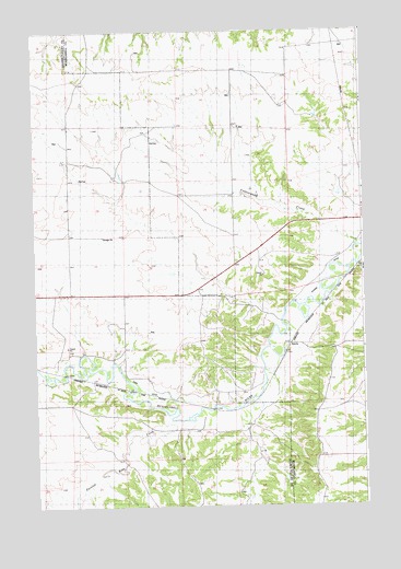
Bundy, MT USGS Topographic Map
Click on map above to begin viewing in our Map Viewer.

This topographic map contains these locations and features:
Feature Name Type Latitude Longitude GNIS ID View Map
06N22E02AC__01 WellWellN46.2958°W108.8129°815184View Map
06N23E01CBDB01 WellWellN46.2977°W108.7957°815203View Map
06N23E02ACAD01 WellWellN46.3013°W108.8057°815250View Map
06N23E02CBAA01 WellWellN46.2983°W108.8157°815209View Map
06N24E06ADDD01 WellWellN46.3002°W108.7593°815244View Map
06N24E08C___01 WellWellN46.2830°W108.7532°815055View Map
06N24E18DCCD01 WellWellN46.2633°W108.7507°814904View Map
07N23E25BBCC01 WellWellN46.3325°W108.7988°815522View Map
07N23E27DBDC01 WellWellN46.3247°W108.8277°815458View Map
07N23E33AABA01 WellWellN46.3211°W108.8435°815416View Map
BundyPopulated PlaceN46.2927°W108.7788°769392View Map
Bundy (historical)LocaleN46.2927°W108.7788°1723109View Map
Bundy Post Office (historical)Post OfficeN46.2927°W108.7788°1723202View Map
Bundy School (historical)SchoolN46.2927°W108.7788°1723122View Map
Cottonwood CreekValleyN46.3183°W108.7521°770157View Map
Dean Creek Community Association Volunteer Fire DepartmentBuildingN46.2632°W108.7666°2546494View Map
Egge DitchCanalN46.2800°W108.8282°771150View Map
Glennie DitchCanalN46.3108°W108.7643°768061View Map
Painted Robe CreekStreamN46.2744°W108.8260°775063View Map

Note: Coordinates in the location and feature list above are referenced to NAD83 datum.


Copyright (C) 2008-2025 Ryan Niemi / Sunset Dynamics ... All Rights Reserved