TopoQuest Logo
Do you find TopoQuest useful?
Help keep TopoQuest running and adding new maps/features by donating!
Bitcoin:  19c7KJd3qBynnjoSw5npx9KScwjBe4ifkT
Litecoin:  LXs6TkuXGGXo1vDsWCkWVdjQX94eUKd6ui
Home View Maps Find Maps Find Places Resources & Links


Emery Peak, New Mexico Topographic Map

USGS Map Title: Emery Peak, NM
USGS Map MRC: 36103H7
DRG (GeoTIFF) Download: o36103h7.tif


Neighboring USGS Topographic Map Quads:


  Branson, CO  
37103A8
 

  Branson SE, CO  
37103A7
 

  Pine Canyon, CO  
37103A6
 

  Alps Mesa, NM  
36103H8
 

  Emery Peak, NM  
36103H7
 

  Cross L Ranch, NM  
36103H6
 

  Folsom, NM  
36103G8
 

  Des Moines, NM  
36103G7
 

  Cross L Ranch SW, NM  
36103G6


Map MRC Location:

N37°
W104°
N37°
W103°
H8 H7 H6 H5 H4 H3 H2 H1
G8 G7 G6 G5 G4 G3 G2 G1
F8 F7 F6 F5 F4 F3 F2 F1
E8 E7 E6 E5 E4 E3 E2 E1
D8 D7 D6 D5 D4 D3 D2 D1
C8 C7 C6 C5 C4 C3 C2 C1
B8 B7 B6 B5 B4 B3 B2 B1
A8 A7 A6 A5 A4 A3 A2 A1
N36°
W104°
N36°
W103°

Emery Peak, NM USGS 1:24K Topographic Map Preview:
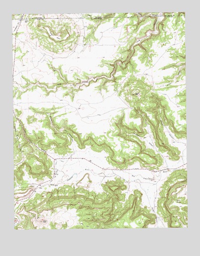
Emery Peak, NM USGS Topographic Map
Click on map above to begin viewing in our Map Viewer.

This topographic map contains these locations and features:
Feature Name Type Latitude Longitude GNIS ID View Map
10136 Water WellWellN36.9095°W103.7863°935394View Map
10138 Water WellWellN36.9189°W103.8400°935395View Map
Alps (historical)LocaleN36.9125°W103.8736°901733View Map
Briggs CanyonValleyN36.8989°W103.7780°886730View Map
Brown Reservoir DamDamN36.9800°W103.7805°924131View Map
Devoys CanyonValleyN36.9234°W103.7511°888355View Map
Devoys PeakSummitN36.9528°W103.7872°888356View Map
Emery GapGapN36.9961°W103.8669°902242View Map
Emery Gap (historical)Populated PlaceN36.9961°W103.8669°901964View Map
Emery Gap Post Office (historical)Post OfficeN36.9961°W103.8669°937814View Map
Emery PeakSummitN36.8795°W103.8550°888867View Map
Gleasons CanyonValleyN36.9206°W103.8300°889426View Map
Johns and Gleason North DitchCanalN36.9075°W103.8452°898342View Map
Madison (historical)Populated PlaceN36.8809°W103.8736°902049View Map
Madison Post OfficePost OfficeN36.8809°W103.8736°937287View Map
Negro CanyonValleyN36.9977°W103.7690°196277View Map
Negro MesaSummitN36.9875°W103.8469°902314View Map
Oak CreekStreamN36.8995°W103.8577°892793View Map
River MesaSummitN36.8878°W103.7566°893979View Map
Sumpters CanyonValleyN36.9117°W103.7650°895436View Map
Toll Gate CanyonValleyN36.9172°W103.8427°895730View Map
VandaveerMineN36.9064°W103.8452°917863View Map

Note: Coordinates in the location and feature list above are referenced to NAD83 datum.


Copyright (C) 2008-2025 Ryan Niemi / Sunset Dynamics ... All Rights Reserved