TopoQuest Logo
Do you find TopoQuest useful?
Help keep TopoQuest running and adding new maps/features by donating!
Bitcoin:  19c7KJd3qBynnjoSw5npx9KScwjBe4ifkT
Litecoin:  LXs6TkuXGGXo1vDsWCkWVdjQX94eUKd6ui
Home View Maps Find Maps Find Places Resources & Links


Arkansaw, Wisconsin Topographic Map

USGS Map Title: Arkansaw, WI
USGS Map MRC: 44092F1
DRG (GeoTIFF) Download: o44092f1.tif


Neighboring USGS Topographic Map Quads:


  Spring Valley, WI  
44092G2
 

  Weston, WI  
44092G1
 

  Menomonie South, WI  
44091G8
 

  Plum City, WI  
44092F2
 

  Arkansaw, WI  
44092F1
 

  Durand North, WI  
44091F8
 

  Nerike Hill, WI  
44092E2
 

  Ella, WI  
44092E1
 

  Durand South, WI  
44091E8


Map MRC Location:

N45°
W93°
N45°
W92°
H8 H7 H6 H5 H4 H3 H2 H1
G8 G7 G6 G5 G4 G3 G2 G1
F8 F7 F6 F5 F4 F3 F2 F1
E8 E7 E6 E5 E4 E3 E2 E1
D8 D7 D6 D5 D4 D3 D2 D1
C8 C7 C6 C5 C4 C3 C2 C1
B8 B7 B6 B5 B4 B3 B2 B1
A8 A7 A6 A5 A4 A3 A2 A1
N44°
W93°
N44°
W92°

Arkansaw, WI USGS 1:24K Topographic Map Preview:
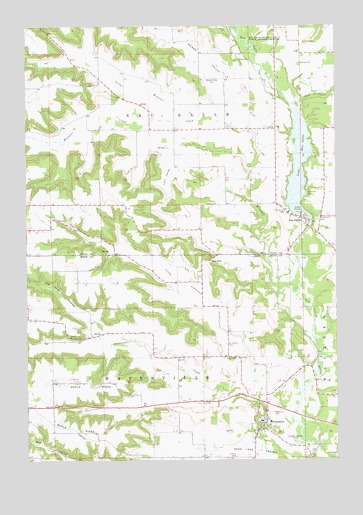
Arkansaw, WI USGS Topographic Map
Click on map above to begin viewing in our Map Viewer.

This topographic map contains these locations and features:
Feature Name Type Latitude Longitude GNIS ID View Map
ArkansawPopulated PlaceN44.6339°W92.0313°1560934View Map
Arkansaw Census Designated PlaceCensusN44.6334°W92.0222°2586450View Map
Arkansaw CreekStreamN44.6255°W92.0127°1560935View Map
Arkansaw Elementary SchoolSchoolN44.6359°W92.0268°2715663View Map
Barnes BranchStreamN44.6830°W92.0288°1578273View Map
Big Arkansaw School (historical)SchoolN44.6583°W92.0746°1578274View Map
Big Coulee School (historical)SchoolN44.6258°W92.1080°1578275View Map
Chase Hill School (historical)SchoolN44.6991°W92.1105°1578220View Map
Clearview CemeteryCemeteryN44.6941°W92.0077°1563166View Map
Coburn RidgeRidgeN44.6769°W92.0896°1578277View Map
Devils GateValleyN44.6578°W92.1236°1563933View Map
Eau GallePopulated PlaceN44.6922°W92.0116°1564409View Map
Eau Galle WP 193 DamDamN44.6939°W92.0102°1791676View Map
Forestvale School (historical)SchoolN44.6416°W92.0693°1578280View Map
French CemeteryCemeteryN44.6264°W92.0407°1565303View Map
Gap HillSummitN44.6822°W92.0513°1565395View Map
Hay CreekStreamN44.7219°W92.0138°1566179View Map
Joe Gray CouleeValleyN44.6627°W92.0943°1567190View Map
Knight School (historical)SchoolN44.6675°W92.0993°1578283View Map
Lake Eau GalleLakeN44.7099°W92.0149°1564412View Map
Lake Eau Galle 173ReservoirN44.6933°W92.0102°1791677View Map
Little Arkansaw CreekStreamN44.6414°W92.0332°1568168View Map
Little Arkansaw School (historical)SchoolN44.6689°W92.0438°1578286View Map
Little Missouri CreekStreamN44.7094°W92.0363°1568321View Map
Maple RidgeRidgeN44.6444°W92.1241°1568998View Map
Maple Ridge School (historical)SchoolN44.6427°W92.1146°1578289View Map
Missouri CreekStreamN44.6736°W92.0157°1569613View Map
Missouri Valley School (historical)SchoolN44.7202°W92.1246°1578250View Map
Pine View ParkParkN44.7019°W92.0127°1571525View Map
Point School (historical)SchoolN44.7275°W92.0780°1578257View Map
Saint Henrys CemeteryCemeteryN44.6975°W92.0210°1572962View Map
Saint Josephs CemeteryCemeteryN44.6583°W92.0452°1573188View Map
Saint Josephs ChurchChurchN44.6541°W92.0446°1573192View Map
Stringer HillSummitN44.7019°W92.0632°1578264View Map
The HogbackRidgeN44.6777°W92.0780°1578281View Map
Town of Eau GalleCivilN44.7278°W92.0547°1583125View Map
Town of WatervilleCivilN44.6404°W92.0673°1584367View Map
Twin ValleyValleyN44.7135°W92.0665°1575820View Map
Webber Valley School (historical)SchoolN44.7344°W92.0443°1578270View Map
Weber ValleyValleyN44.7226°W92.0428°1576378View Map
Weber Valley CemeteryCemeteryN44.7350°W92.0502°1576379View Map
Weisinger HillSummitN44.6652°W92.1096°1578298View Map
Welch Point (historical)Populated PlaceN44.7027°W92.0127°1578271View Map

Note: Coordinates in the location and feature list above are referenced to NAD83 datum.


Copyright (C) 2008-2024 Ryan Niemi / Sunset Dynamics ... All Rights Reserved