TopoQuest Logo
Do you find TopoQuest useful?
Help keep TopoQuest running and adding new maps/features by donating!
Bitcoin:  19c7KJd3qBynnjoSw5npx9KScwjBe4ifkT
Litecoin:  LXs6TkuXGGXo1vDsWCkWVdjQX94eUKd6ui
Home View Maps Find Maps Find Places Resources & Links


Menomonie South, Wisconsin Topographic Map

USGS Map Title: Menomonie South, WI
USGS Map MRC: 44091G8
DRG (GeoTIFF) Download: o44091g8.tif


Neighboring USGS Topographic Map Quads:


  Knapp, WI  
44092H1
 

  Menomonie North, WI  
44091H8
 

  Rusk, WI  
44091H7
 

  Weston, WI  
44092G1
 

  Menomonie South, WI  
44091G8
 

  Falls City, WI  
44091G7
 

  Arkansaw, WI  
44092F1
 

  Durand North, WI  
44091F8
 

  Meridean, WI  
44091F7


Map MRC Location:

N45°
W92°
N45°
W91°
H8 H7 H6 H5 H4 H3 H2 H1
G8 G7 G6 G5 G4 G3 G2 G1
F8 F7 F6 F5 F4 F3 F2 F1
E8 E7 E6 E5 E4 E3 E2 E1
D8 D7 D6 D5 D4 D3 D2 D1
C8 C7 C6 C5 C4 C3 C2 C1
B8 B7 B6 B5 B4 B3 B2 B1
A8 A7 A6 A5 A4 A3 A2 A1
N44°
W92°
N44°
W91°

Menomonie South, WI USGS 1:24K Topographic Map Preview:
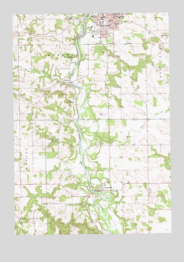
Menomonie South, WI USGS Topographic Map
Click on map above to begin viewing in our Map Viewer.

This topographic map contains these locations and features:
Feature Name Type Latitude Longitude GNIS ID View Map
Beaver Creek School (historical)SchoolN44.8294°W91.9960°1578214View Map
Blodget School (historical)SchoolN44.8580°W91.9955°1578218View Map
Burton E Nelson FieldParkN44.8694°W91.9263°1838207View Map
Coddington SchoolSchoolN44.8700°W91.9227°1563223View Map
Devils Punch Bowl County ParkParkN44.8505°W91.9518°1563947View Map
DownsvillePopulated PlaceN44.7747°W91.9321°1564093View Map
Downsville Census Designated PlaceCensusN44.7709°W91.9258°2586476View Map
Downsville Elementary SchoolSchoolN44.7776°W91.9286°1838213View Map
Evergreen Valley School (historical)SchoolN44.8719°W91.9752°1578225View Map
Ford CemeteryCemeteryN44.8719°W91.9754°1565104View Map
Fowler ParkParkN44.8700°W91.9316°1838224View Map
Gilbert CreekStreamN44.8722°W91.9413°1565513View Map
Grace Episcopal ChurchChurchN44.8736°W91.9230°1838227View Map
Grandview CemeteryCemeteryN44.8036°W91.9679°1565725View Map
Hilltop School (historical)SchoolN44.8308°W91.9138°1578231View Map
Immanuel Baptist ChurchChurchN44.8694°W91.9293°1838231View Map
Immanuel Baptist Church SchoolSchoolN44.8587°W91.9287°2713319View Map
Irving CreekStreamN44.8355°W91.9535°1566982View Map
IrvingtonPopulated PlaceN44.8361°W91.9546°1566989View Map
Jarvis HallBuildingN44.8730°W91.9252°1838232View Map
Johnson FieldhouseBuildingN44.8702°W91.9277°1838233View Map
L Mart Shopping CenterLocaleN44.8691°W91.9188°1838235View Map
Little Elk CreekStreamN44.7961°W91.9455°1568251View Map
Memorial HospitalHospitalN44.8725°W91.9146°1838238View Map
Memorial Student CenterBuildingN44.8736°W91.9268°1838239View Map
Menomonie Church of the NazareneChurchN44.8736°W91.9205°1838240View Map
Menomonie City LandfillLocaleN44.8725°W91.9544°2635481View Map
Menomonie High SchoolSchoolN44.8674°W91.9368°1838244View Map
Menomonie Middle SchoolSchoolN44.8745°W91.8990°2713247View Map
Menomonie Wastewater Treatment FacilityLocaleN44.8742°W91.9361°2729066View Map
Merle M Price CommonsBuildingN44.8725°W91.9291°1838247View Map
North HallBuildingN44.8736°W91.9288°1838249View Map
Oak Ridge Lutheran ChurchChurchN44.8605°W91.9357°1838250View Map
Our Saviors Lutheran ChurchChurchN44.8741°W91.9191°1838251View Map
Peace CemeteryCemeteryN44.8502°W91.9154°1571111View Map
Peace Lutheran ChurchChurchN44.8741°W91.9224°1838252View Map
Pownell CemeteryCemeteryN44.7672°W91.9457°1571860View Map
Ridge Road CemeteryCemeteryN44.8638°W91.9866°1572300View Map
River Heights Elementary SchoolSchoolN44.8619°W91.9358°1572349View Map
Riverside ParkParkN44.8736°W91.9396°1572377View Map
Riverview CemeteryCemeteryN44.7741°W91.9218°1572384View Map
Rosehill CemeteryCemeteryN44.7663°W91.9421°1572608View Map
Saint Johns CemeteryCemeteryN44.8183°W91.9835°1573063View Map
Saint Josephs ConventChurchN44.8747°W91.9191°1838255View Map
Saint Paul's Lutheran SchoolSchoolN44.8723°W91.9186°1573502View Map
Saint Pauls CemeteryCemeteryN44.8533°W91.9202°1573471View Map
Saint Pauls Evangelical Lutheran ChurchChurchN44.8727°W91.9193°1838256View Map
Seventh Day Adventist ChurchChurchN44.8733°W91.9235°1838257View Map
South HallBuildingN44.8716°W91.9288°1838259View Map
Stout Vocational Rehabilitation InstituteSchoolN44.8744°W91.9277°1838260View Map
The PinnacleSummitN44.8252°W91.9560°1575342View Map
Town of DunnCivilN44.7543°W91.9085°1583106View Map
Unitarian Society of MenomonieChurchN44.8669°W91.9180°1838261View Map
WMEQ-FM (Menomonie)TowerN44.8619°W91.8768°1582413View Map
WVSS-FM (Menomonie)TowerN44.8714°W91.9263°1582414View Map

Note: Coordinates in the location and feature list above are referenced to NAD83 datum.


Copyright (C) 2008-2024 Ryan Niemi / Sunset Dynamics ... All Rights Reserved