TopoQuest Logo
Do you find TopoQuest useful?
Help keep TopoQuest running and adding new maps/features by donating!
Bitcoin:  19c7KJd3qBynnjoSw5npx9KScwjBe4ifkT
Litecoin:  LXs6TkuXGGXo1vDsWCkWVdjQX94eUKd6ui
Home View Maps Find Maps Find Places Resources & Links


Emory, South Carolina Topographic Map

USGS Map Title: Emory, SC
USGS Map MRC: 33081H6
DRG (GeoTIFF) Download: o33081h6.tif


Neighboring USGS Topographic Map Quads:


  Saluda North, SC  
34081A7
 

  Denny, SC  
34081A6
 

  Delmar, SC  
34081A5
 

  Saluda South, SC  
33081H7
 

  Emory, SC  
33081H6
 

  Batesburg, SC  
33081H5
 

  Johnston, SC  
33081G7
 

  Ridge Spring, SC  
33081G6
 

  Monetta, SC  
33081G5


Map MRC Location:

N34°
W82°
N34°
W81°
H8 H7 H6 H5 H4 H3 H2 H1
G8 G7 G6 G5 G4 G3 G2 G1
F8 F7 F6 F5 F4 F3 F2 F1
E8 E7 E6 E5 E4 E3 E2 E1
D8 D7 D6 D5 D4 D3 D2 D1
C8 C7 C6 C5 C4 C3 C2 C1
B8 B7 B6 B5 B4 B3 B2 B1
A8 A7 A6 A5 A4 A3 A2 A1
N33°
W82°
N33°
W81°

Emory, SC USGS 1:24K Topographic Map Preview:
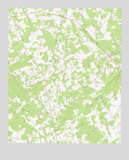
Emory, SC USGS Topographic Map
Click on map above to begin viewing in our Map Viewer.

This topographic map contains these locations and features:
Feature Name Type Latitude Longitude GNIS ID View Map
Amick Grove ChurchChurchN33.9557°W81.6382°1220193View Map
Amicks PondReservoirN33.9585°W81.6348°1239053View Map
Amicks Pond Dam D-1599DamN33.9585°W81.6348°1239052View Map
Asbill PondReservoirN33.9149°W81.6482°1220242View Map
Berrys PondReservoirN33.9406°W81.7034°1239055View Map
Berrys Pond Dam D-1598DamN33.9401°W81.7032°1239054View Map
BlacksPopulated PlaceN33.9165°W81.6768°1227867View Map
Cane Brake School (historical)SchoolN33.9968°W81.7209°1232545View Map
Carver CemeteryCemeteryN33.9396°W81.6670°1221375View Map
Clydes ChapelChurchN33.9671°W81.6309°1247327View Map
Corley BranchStreamN33.9890°W81.6868°1221757View Map
County Memorial CemeteryCemeteryN33.9412°W81.6884°1247403View Map
EmoryPopulated PlaceN33.9874°W81.7034°1231267View Map
Emory CemeteryCemeteryN33.9868°W81.7062°1232562View Map
Emory School (historical)SchoolN33.9876°W81.7068°1232563View Map
Emory United Methodist ChurchChurchN33.9868°W81.7065°1232564View Map
Fair Haven Childrens HomeBuildingN33.9040°W81.7304°1222330View Map
Good Hope CemeteryCemeteryN33.9085°W81.6859°1232576View Map
Good Hope Lutheran ChurchChurchN33.9090°W81.6868°1245766View Map
Good Hope School (historical)SchoolN33.9099°W81.6912°1232578View Map
Harris CemeteryCemeteryN33.9560°W81.6368°1223056View Map
Hart Spring ChurchChurchN33.8965°W81.6821°1223069View Map
Hart Springs School (historical)SchoolN33.8957°W81.6818°1232579View Map
Herlongs PondReservoirN33.9891°W81.7246°1239069View Map
Herlongs Pond Dam D-1597DamN33.9885°W81.7265°1239068View Map
Indian CreekStreamN33.9007°W81.6721°1223435View Map
Jacobs BranchStreamN33.9349°W81.6398°1223503View Map
Johnsons CemeteryCemeteryN33.9504°W81.6968°1223617View Map
Jones CrossroadsPopulated PlaceN33.9682°W81.6534°1246197View Map
McGee CemeteryCemeteryN33.9360°W81.6601°1224407View Map
Mobleys CrossroadsPopulated PlaceN33.9137°W81.7440°1251719View Map
Mount Moses ChurchChurchN33.9999°W81.6701°1249608View Map
Mount Willing School (historical)SchoolN33.9999°W81.6704°1232604View Map
Pine Grove School (historical)SchoolN33.9476°W81.7204°1232613View Map
Poplar BranchStreamN33.9774°W81.6923°1225616View Map
Poplar Branch ChurchChurchN33.9587°W81.6787°1225622View Map
Poplar Branch School (historical)SchoolN33.9587°W81.6796°1232618View Map
Ready Creek School (historical)SchoolN33.9062°W81.7490°1232624View Map
Reedy Branch ChurchChurchN33.9060°W81.7487°1250322View Map
RichlandPopulated PlaceN33.9529°W81.6937°1231725View Map
Richland School (historical)SchoolN33.9526°W81.6929°1232626View Map
Richland Springs CemeteryCemeteryN33.9510°W81.6995°1225870View Map
Richland Springs ChurchChurchN33.9518°W81.6962°1250374View Map
Richland Springs Community HouseBuildingN33.9512°W81.6957°1251720View Map
Ridge Branch ChurchChurchN33.9099°W81.6251°1250378View Map
Ridge Branch Rosenwald School (historical)SchoolN33.9099°W81.6262°1232627View Map
Ridge Spring DivisionCivilN33.8896°W81.6866°1938400View Map
Saint Williams CemeteryCemeteryN33.9307°W81.6998°1226278View Map
Saint Williams ChurchChurchN33.9226°W81.7068°1250712View Map
South Carolina Highway Patrol Troop 2 Post CBuildingN33.9905°W81.7338°2734320View Map
South Carolina Noname 41003 D-1607 DamDamN33.9154°W81.6473°1239088View Map
South Carolina Noname 41005 D-1197 DamDamN33.8985°W81.6448°1239091View Map
South Carolina Noname 41007 D-1194 DamDamN33.9035°W81.7048°1239092View Map
SpeignerPopulated PlaceN33.9043°W81.7323°1227983View Map
Speigner Church (historical)ChurchN33.9046°W81.7318°1232636View Map
Sumter School (historical)SchoolN33.9137°W81.7229°1232638View Map
Traus (historical)Populated PlaceN33.9696°W81.7343°1232641View Map
Willow Branch School (historical)SchoolN33.9368°W81.6562°1232647View Map

Note: Coordinates in the location and feature list above are referenced to NAD83 datum.


Copyright (C) 2008-2025 Ryan Niemi / Sunset Dynamics ... All Rights Reserved