TopoQuest Logo
Do you find TopoQuest useful?
Help keep TopoQuest running and adding new maps/features by donating!
Bitcoin:  19c7KJd3qBynnjoSw5npx9KScwjBe4ifkT
Litecoin:  LXs6TkuXGGXo1vDsWCkWVdjQX94eUKd6ui
Home View Maps Find Maps Find Places Resources & Links


Ennis East, Texas Topographic Map

USGS Map Title: Ennis East, TX
USGS Map MRC: 32096C5
DRG (GeoTIFF) Download: o32096c5.tif


Neighboring USGS Topographic Map Quads:


  Palmer, TX  
32096D6
 

  Bristol, TX  
32096D5
 

  Rosser, TX  
32096D4
 

  Ennis West, TX  
32096C6
 

  Ennis East, TX  
32096C5
 

  Rosser SW, TX  
32096C4
 

  Cryer Creek, TX  
32096B6
 

  Emhouse, TX  
32096B5
 

  Chatfield, TX  
32096B4


Map MRC Location:

N33°
W97°
N33°
W96°
H8 H7 H6 H5 H4 H3 H2 H1
G8 G7 G6 G5 G4 G3 G2 G1
F8 F7 F6 F5 F4 F3 F2 F1
E8 E7 E6 E5 E4 E3 E2 E1
D8 D7 D6 D5 D4 D3 D2 D1
C8 C7 C6 C5 C4 C3 C2 C1
B8 B7 B6 B5 B4 B3 B2 B1
A8 A7 A6 A5 A4 A3 A2 A1
N32°
W97°
N32°
W96°

Ennis East, TX USGS 1:24K Topographic Map Preview:
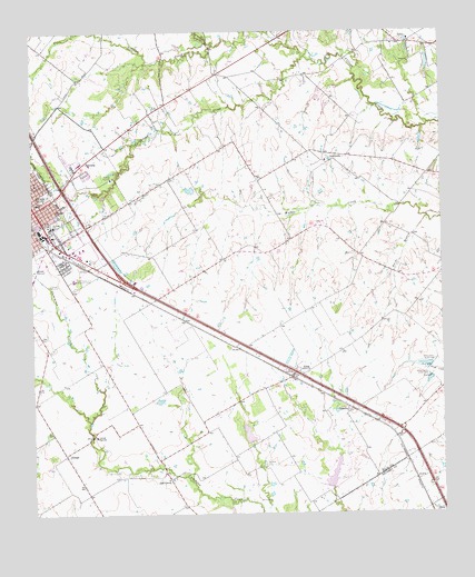
Ennis East, TX USGS Topographic Map
Click on map above to begin viewing in our Map Viewer.

This topographic map contains these locations and features:
Feature Name Type Latitude Longitude GNIS ID View Map
Alamo SchoolSchoolN32.3299°W96.6233°1329308View Map
AlmaPopulated PlaceN32.2854°W96.5461°1377926View Map
Alma Volunteer Fire DepartmentBuildingN32.2842°W96.5460°2551558View Map
Bethel Pentecostal ChurchChurchN32.3210°W96.6244°2018978View Map
Bethlehem Missionary Baptist ChurchChurchN32.3351°W96.6236°2018991View Map
Burns BranchStreamN32.3265°W96.5047°1331703View Map
Central High Rural Volunteer Fire DepartmentBuildingN32.2821°W96.6003°2551769View Map
Central High SchoolSchoolN32.2701°W96.6064°1332570View Map
Church of Christ EnnisChurchN32.3215°W96.6089°2018962View Map
Collins Chapel ChurchChurchN32.3374°W96.6236°2018983View Map
Colmesneil ChurchChurchN32.2765°W96.5283°1333130View Map
Cottonwood CreekStreamN32.3682°W96.5414°1333468View Map
CreechvillePopulated PlaceN32.3426°W96.5292°1378178View Map
Ellis County Constable's Office Precinct 1BuildingN32.3341°W96.6124°2739150View Map
Ennis Cotton CompressBuildingN32.3235°W96.6230°2031246View Map
Ennis Cotton Oil CompanyBuildingN32.3218°W96.6203°2031247View Map
Ennis DivisionCivilN32.3476°W96.5872°1938728View Map
Ennis Fire Department Station 2BuildingN32.3389°W96.6233°2551504View Map
Ennis Railroad and Cultural Heritage MuseumBuildingN32.2865°W96.6017°2014137View Map
EnsignPopulated PlaceN32.2654°W96.6155°1378267View Map
Fairview ParkParkN32.3146°W96.6108°2028393View Map
Farrar HouseBuildingN32.3213°W96.6222°2031242View Map
Fourmile CreekStreamN32.3721°W96.5705°1336118View Map
Garrett Area Rural Volunteer Fire Department SubstationBuildingN32.3722°W96.5856°2551772View Map
Gillespie FarmLocaleN32.3263°W96.6125°2032107View Map
Grace Temple Baptist ChurchChurchN32.3290°W96.6211°2019004View Map
Hosely Chapel Methodist ChurchChurchN32.3351°W96.6239°2018977View Map
IOOF Odd Fellows and Rebekahs Home CemeteryCemeteryN32.3086°W96.6129°2740586View Map
J B Moorhead HouseBuildingN32.3218°W96.6228°2030987View Map
Lummus Memorial ParkParkN32.3332°W96.6203°2029847View Map
Moravian ChurchChurchN32.3288°W96.6180°1341900View Map
New Hope Baptist ChurchChurchN32.3354°W96.6230°2018948View Map
Oak GrovePopulated PlaceN32.2593°W96.5836°1378779View Map
Old Fellows and Rebekahs HomeBuildingN32.3113°W96.6125°1343144View Map
Redwine CemeteryCemeteryN32.2625°W96.5550°1344989View Map
Roger Maise ParkParkN32.3426°W96.6225°2029467View Map
Saint Johns Catholic ChurchChurchN32.3251°W96.6208°2018959View Map
Saint Johns SchoolSchoolN32.3246°W96.6186°1345957View Map
Soil Conservation Service Site 125 DamDamN32.2685°W96.5586°1856771View Map
Soil Conservation Service Site 125 ReservoirReservoirN32.2685°W96.5586°1856772View Map
Soil Conservation Service Site 126 DamDamN32.2568°W96.5336°1856773View Map
Soil Conservation Service Site 126 ReservoirReservoirN32.2568°W96.5336°1856774View Map
SonomaPopulated PlaceN32.3404°W96.6100°1347382View Map
TelicoPopulated PlaceN32.3721°W96.5125°1379145View Map
Telico ChurchChurchN32.3671°W96.5097°1348346View Map
Telico Volunteer Fire DepartmentBuildingN32.3723°W96.5084°2551776View Map
Town of AlmaCivilN32.2813°W96.5507°2412351View Map
Travis Elementary SchoolSchoolN32.3301°W96.6233°2005867View Map
Travis SchoolSchoolN32.3307°W96.6239°1348728View Map

Note: Coordinates in the location and feature list above are referenced to NAD83 datum.


Copyright (C) 2008-2024 Ryan Niemi / Sunset Dynamics ... All Rights Reserved