TopoQuest Logo
Do you find TopoQuest useful?
Help keep TopoQuest running and adding new maps/features by donating!
Bitcoin:  19c7KJd3qBynnjoSw5npx9KScwjBe4ifkT
Litecoin:  LXs6TkuXGGXo1vDsWCkWVdjQX94eUKd6ui
Home View Maps Find Maps Find Places Resources & Links


Emhouse, Texas Topographic Map

USGS Map Title: Emhouse, TX
USGS Map MRC: 32096B5
DRG (GeoTIFF) Download: o32096b5.tif


Neighboring USGS Topographic Map Quads:


  Ennis West, TX  
32096C6
 

  Ennis East, TX  
32096C5
 

  Rosser SW, TX  
32096C4
 

  Cryer Creek, TX  
32096B6
 

  Emhouse, TX  
32096B5
 

  Chatfield, TX  
32096B4
 

  Blooming Grove, TX  
32096A6
 

  Corbet, TX  
32096A5
 

  Corsicana, TX  
32096A4


Map MRC Location:

N33°
W97°
N33°
W96°
H8 H7 H6 H5 H4 H3 H2 H1
G8 G7 G6 G5 G4 G3 G2 G1
F8 F7 F6 F5 F4 F3 F2 F1
E8 E7 E6 E5 E4 E3 E2 E1
D8 D7 D6 D5 D4 D3 D2 D1
C8 C7 C6 C5 C4 C3 C2 C1
B8 B7 B6 B5 B4 B3 B2 B1
A8 A7 A6 A5 A4 A3 A2 A1
N32°
W97°
N32°
W96°

Emhouse, TX USGS 1:24K Topographic Map Preview:
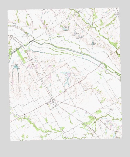
Emhouse, TX USGS Topographic Map
Click on map above to begin viewing in our Map Viewer.

This topographic map contains these locations and features:
Feature Name Type Latitude Longitude GNIS ID View Map
Allison LakeReservoirN32.1385°W96.5119°1864194View Map
Allison Lake DamDamN32.1385°W96.5119°1864193View Map
Clear CreekStreamN32.2129°W96.6136°1332933View Map
Corsicana Country ClubLocaleN32.1257°W96.5067°1384348View Map
Corsicana Country Club Lake DamDamN32.1302°W96.5069°1859376View Map
Country Club LakeReservoirN32.1302°W96.5069°1859377View Map
Coyote FieldAirportN32.1359°W96.5215°2675835View Map
EmhousePopulated PlaceN32.1627°W96.5772°1335439View Map
Oak BranchStreamN32.2165°W96.5772°1342944View Map
Onion CreekPopulated PlaceN32.2243°W96.6217°1378805View Map
Onion CreekStreamN32.2163°W96.6083°1343283View Map
Pattison CemeteryCemeteryN32.1493°W96.5969°1343687View Map
Reservoir Number One Hundred TwentyfourReservoirN32.1870°W96.5591°1345060View Map
Reservoir Number One Hundred TwentyoneReservoirN32.1957°W96.6173°1345055View Map
Reservoir Number One Hundred Twentyone CReservoirN32.2306°W96.5615°1345056View Map
Reservoir Number One Hundred Twentyone DReservoirN32.2258°W96.5505°1345057View Map
Reservoir Number One Hundred Twentyone D2ReservoirN32.2227°W96.5458°1345058View Map
Reservoir Number One Hundred Twentyone EReservoirN32.2159°W96.5307°1345059View Map
Soil Conservation Service Site 121 DamDamN32.1968°W96.6169°1859388View Map
Soil Conservation Service Site 121a DamDamN32.2368°W96.5853°1856671View Map
Soil Conservation Service Site 121a ReservoirReservoirN32.2368°W96.5853°1856672View Map
Soil Conservation Service Site 121c DamDamN32.2301°W96.5603°1859386View Map
Soil Conservation Service Site 121d1 DamDamN32.2251°W96.5503°1859384View Map
Soil Conservation Service Site 121d1 ReservoirReservoirN32.2251°W96.5503°1859385View Map
Soil Conservation Service Site 121d2 DamDamN32.2218°W96.5436°1859382View Map
Soil Conservation Service Site 121e DamDamN32.2151°W96.5303°1859380View Map
Soil Conservation Service Site 122-B DamDamN32.1985°W96.5986°1859374View Map
Soil Conservation Service Site 122-B ReservoirReservoirN32.1985°W96.5986°1859375View Map
Soil Conservation Service Site 122a DamDamN32.1985°W96.5936°1859378View Map
Soil Conservation Service Site 122a ReservoirReservoirN32.1985°W96.5936°1859379View Map
Soil Conservation Service Site 123-A DamDamN32.1951°W96.5786°1859372View Map
Soil Conservation Service Site 123-A ReservoirReservoirN32.1951°W96.5786°1859373View Map
Soil Conservation Service Site 123-B DamDamN32.1885°W96.5803°1859370View Map
Soil Conservation Service Site 123-B ReservoirReservoirN32.1885°W96.5803°1859371View Map
Soil Conservation Service Site 124 DamDamN32.1868°W96.5569°1859368View Map
Soil Conservation Service Site 124a-1 DamDamN32.1718°W96.5319°1863130View Map
Soil Conservation Service Site 124a-1 ReservoirReservoirN32.1718°W96.5319°1863131View Map
Soil Conservation Service Site 127a DamDamN32.2435°W96.5186°1863132View Map
Soil Conservation Service Site 127a ReservoirReservoirN32.2435°W96.5186°1863133View Map
Town of EmhouseCivilN32.1607°W96.5772°2412484View Map
Waxahachie CreekStreamN32.2199°W96.5997°1376662View Map
Waxahachie SloughGutN32.1999°W96.5111°1349561View Map

Note: Coordinates in the location and feature list above are referenced to NAD83 datum.


Copyright (C) 2008-2024 Ryan Niemi / Sunset Dynamics ... All Rights Reserved