TopoQuest Logo
Do you find TopoQuest useful?
Help keep TopoQuest running and adding new maps/features by donating!
Bitcoin:  19c7KJd3qBynnjoSw5npx9KScwjBe4ifkT
Litecoin:  LXs6TkuXGGXo1vDsWCkWVdjQX94eUKd6ui
Home View Maps Find Maps Find Places Resources & Links


Ensign Lake East, Minnesota Topographic Map

USGS Map Title: Ensign Lake East, MN
USGS Map MRC: 48091A3
DRG (GeoTIFF) Download: o48091a3.tif


Neighboring USGS Topographic Map Quads:


  Dutton Lake, MN  
48091B2
 

  Ensign Lake West, MN  
48091A4
 

  Ensign Lake East, MN  
48091A3
 

  Kekekabic Lake, MN  
48091A2
 

  Snowbank Lake, MN  
47091H4
 

  Lake Insula, MN  
47091H3
 

  Alice Lake, MN  
47091H2


Map MRC Location:

N49°
W92°
N49°
W91°
H8 H7 H6 H5 H4 H3 H2 H1
G8 G7 G6 G5 G4 G3 G2 G1
F8 F7 F6 F5 F4 F3 F2 F1
E8 E7 E6 E5 E4 E3 E2 E1
D8 D7 D6 D5 D4 D3 D2 D1
C8 C7 C6 C5 C4 C3 C2 C1
B8 B7 B6 B5 B4 B3 B2 B1
A8 A7 A6 A5 A4 A3 A2 A1
N48°
W92°
N48°
W91°

Ensign Lake East, MN USGS 1:24K Topographic Map Preview:
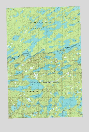
Ensign Lake East, MN USGS Topographic Map
Click on map above to begin viewing in our Map Viewer.

This topographic map contains these locations and features:
Feature Name Type Latitude Longitude GNIS ID View Map
Abinodji LakeLakeN48.0126°W91.3414°655071View Map
Adventure LakeLakeN48.0073°W91.3191°655080View Map
Ahsub LakeLakeN48.0019°W91.3432°655093View Map
Alworth LakeLakeN48.0020°W91.2833°655116View Map
Arkose LakeLakeN48.0626°W91.2771°655153View Map
Ashigan LakeLakeN48.0248°W91.3260°655166View Map
Bedford LakeLakeN48.0532°W91.2610°655318View Map
Boot LakeLakeN48.0141°W91.3594°655482View Map
Carp LakeLakeN48.0693°W91.3417°663194View Map
Carp PortageLocaleN48.0666°W91.3501°663193View Map
Cattyman LakeLakeN48.0133°W91.3186°655670View Map
Ensign LakeLakeN48.0328°W91.3595°656162View Map
Explorer LakeLakeN48.0496°W91.2857°656184View Map
Frog LakeLakeN48.0599°W91.3593°656330View Map
Gibson LakeLakeN48.0165°W91.3253°656374View Map
Hatchet LakeLakeN48.0159°W91.2519°656542View Map
Haven LakeLakeN48.0154°W91.3504°656546View Map
Ima LakeLakeN48.0167°W91.2748°656691View Map
Isles of PineIslandN48.0732°W91.2871°656742View Map
Jitterbug LakeLakeN48.0029°W91.3297°656795View Map
Jordan LakeLakeN48.0109°W91.3057°656816View Map
Knife RiverStreamN48.0699°W91.3334°656911View Map
Magnet LakeLakeN48.0001°W91.3017°657283View Map
Melon LakeLakeN48.0699°W91.3301°657377View Map
Missionary LakeLakeN48.0567°W91.2764°657425View Map
Neglige LakeLakeN48.0497°W91.3025°657577View Map
Portage LakeLakeN48.0681°W91.3066°657918View Map
Reflection LakeLakeN48.0285°W91.2580°658011View Map
Robbins IslandIslandN48.0741°W91.2804°658064View Map
Seed LakeLakeN48.0751°W91.3172°658218View Map
Shallow LakeLakeN48.0610°W91.2879°658226View Map
Skoota LakeLakeN48.0644°W91.2513°658294View Map
Snatch LakeLakeN48.0271°W91.2715°658325View Map
Solitude LakeLakeN48.0265°W91.2939°658347View Map
Swing LakeLakeN48.0135°W91.3316°658583View Map
Three Eagle LakeLakeN48.0194°W91.3040°659248View Map
Trader LakeLakeN48.0544°W91.2899°658730View Map
Trident LakeLakeN48.0515°W91.3565°658747View Map
Vera LakeLakeN48.0561°W91.3119°658844View Map

Note: Coordinates in the location and feature list above are referenced to NAD83 datum.


Copyright (C) 2008-2024 Ryan Niemi / Sunset Dynamics ... All Rights Reserved