TopoQuest Logo
Do you find TopoQuest useful?
Help keep TopoQuest running and adding new maps/features by donating!
Bitcoin:  19c7KJd3qBynnjoSw5npx9KScwjBe4ifkT
Litecoin:  LXs6TkuXGGXo1vDsWCkWVdjQX94eUKd6ui
Home View Maps Find Maps Find Places Resources & Links


Snowbank Lake, Minnesota Topographic Map

USGS Map Title: Snowbank Lake, MN
USGS Map MRC: 47091H4
DRG (GeoTIFF) Download: o47091h4.tif


Neighboring USGS Topographic Map Quads:


  Basswood Lake East, MN  
48091A5
 

  Ensign Lake West, MN  
48091A4
 

  Ensign Lake East, MN  
48091A3
 

  Ojibway Lake, MN  
47091H5
 

  Snowbank Lake, MN  
47091H4
 

  Lake Insula, MN  
47091H3
 

  Gabbro Lake, MN  
47091G5
 

  Quadga Lake, MN  
47091G4
 

  Isabella Lake, MN  
47091G3


Map MRC Location:

N48°
W92°
N48°
W91°
H8 H7 H6 H5 H4 H3 H2 H1
G8 G7 G6 G5 G4 G3 G2 G1
F8 F7 F6 F5 F4 F3 F2 F1
E8 E7 E6 E5 E4 E3 E2 E1
D8 D7 D6 D5 D4 D3 D2 D1
C8 C7 C6 C5 C4 C3 C2 C1
B8 B7 B6 B5 B4 B3 B2 B1
A8 A7 A6 A5 A4 A3 A2 A1
N47°
W92°
N47°
W91°

Snowbank Lake, MN USGS 1:24K Topographic Map Preview:
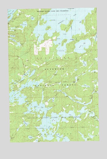
Snowbank Lake, MN USGS Topographic Map
Click on map above to begin viewing in our Map Viewer.

This topographic map contains these locations and features:
Feature Name Type Latitude Longitude GNIS ID View Map
Becoosin LakeLakeN47.9480°W91.3942°655316View Map
Birch IslandIslandN47.9818°W91.4435°659233View Map
Blackstone LakeLakeN47.9823°W91.4935°659180View Map
Bridge LakeLakeN47.9210°W91.4260°659221View Map
Burnt IslandIslandN47.9688°W91.4223°659230View Map
Camp IslandIslandN47.9660°W91.4287°659231View Map
Center IslandIslandN47.9882°W91.4404°659232View Map
Climax LakeLakeN47.9297°W91.4293°655758View Map
Delta LakeLakeN47.9332°W91.4059°655973View Map
Discovery LakeLakeN47.9668°W91.4852°656006View Map
Drumstick CreekStreamN47.9093°W91.3932°656047View Map
East IslandIslandN47.9868°W91.3951°659222View Map
Ennis LakeLakeN47.9748°W91.4936°659229View Map
Fernberg Lookout TowerTowerN47.9446°W91.4962°659833View Map
Fire IslandIslandN47.9757°W91.4229°659223View Map
Flash LakeLakeN47.9850°W91.4777°656264View Map
Griddle LakeLakeN47.9910°W91.4653°659235View Map
Harri IslandIslandN47.9810°W91.4162°659227View Map
Holiday LakeLakeN47.8796°W91.4714°656611View Map
Judd LakeLakeN47.9712°W91.4932°659226View Map
Lake FourLakeN47.8982°W91.4060°656306View Map
Lake Number One DamDamN47.9235°W91.4951°656933View Map
Lake Number Two DamDamN47.9232°W91.4532°656934View Map
Lake OneReservoirN47.9140°W91.4824°657677View Map
Lake ThreeLakeN47.8991°W91.4373°658677View Map
Lake TwoReservoirN47.9232°W91.4532°658804View Map
Parent LakeLakeN47.9641°W91.3963°657744View Map
Pickerel BayBayN47.9610°W91.4251°659179View Map
Quartz LakeLakeN47.9403°W91.3809°657958View Map
Rifle LakeLakeN47.9156°W91.4414°658055View Map
Rock Island LakeLakeN47.8927°W91.4781°658073View Map
Secret LakeLakeN47.9801°W91.4942°659228View Map
Slowfoot LakeLakeN47.9265°W91.3927°658306View Map
Snowbank LakeLakeN47.9883°W91.4186°658332View Map
Snowbank TrailTrailN47.9793°W91.4229°659241View Map
Sommers LakeLakeN47.9949°W91.4858°659234View Map
Spinnan LakeLakeN47.8765°W91.4628°658395View Map
Township of Fall LakeCivilN47.9957°W91.4322°664139View Map
Wilderness BayBayN47.9702°W91.4093°659224View Map
Wolftrack LakesLakeN47.9355°W91.4395°659225View Map

Note: Coordinates in the location and feature list above are referenced to NAD83 datum.


Copyright (C) 2008-2024 Ryan Niemi / Sunset Dynamics ... All Rights Reserved