TopoQuest Logo
Do you find TopoQuest useful?
Help keep TopoQuest running and adding new maps/features by donating!
Bitcoin:  19c7KJd3qBynnjoSw5npx9KScwjBe4ifkT
Litecoin:  LXs6TkuXGGXo1vDsWCkWVdjQX94eUKd6ui
Home View Maps Find Maps Find Places Resources & Links


Enterprise, Washington Topographic Map

USGS Map Title: Enterprise, WA
USGS Map MRC: 48119G5
DRG (GeoTIFF) Download: o48119g5.tif


Neighboring USGS Topographic Map Quads:


  Nighthawk, WA  
48119H6
 

  Bullfrog Mountain, WA  
48119H5
 

  Oroville, WA  
48119H4
 

  Loomis, WA  
48119G6
 

  Enterprise, WA  
48119G5
 

  Ellisforde, WA  
48119G4
 

  Blue Goat Mountain, WA  
48119F6
 

  Aeneas Lake, WA  
48119F5
 

  Tonasket, WA  
48119F4


Map MRC Location:

N49°
W120°
N49°
W119°
H8 H7 H6 H5 H4 H3 H2 H1
G8 G7 G6 G5 G4 G3 G2 G1
F8 F7 F6 F5 F4 F3 F2 F1
E8 E7 E6 E5 E4 E3 E2 E1
D8 D7 D6 D5 D4 D3 D2 D1
C8 C7 C6 C5 C4 C3 C2 C1
B8 B7 B6 B5 B4 B3 B2 B1
A8 A7 A6 A5 A4 A3 A2 A1
N48°
W120°
N48°
W119°

Enterprise, WA USGS 1:24K Topographic Map Preview:
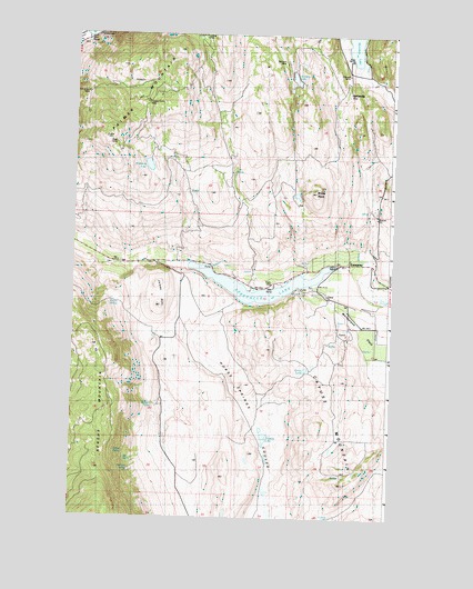
Enterprise, WA USGS Topographic Map
Click on map above to begin viewing in our Map Viewer.

This topographic map contains these locations and features:
Feature Name Type Latitude Longitude GNIS ID View Map
Alice MineMineN48.8463°W119.6095°1515806View Map
Big SpringSpringN48.7652°W119.6042°1528691View Map
Brown SpringSpringN48.8052°W119.6076°1528694View Map
Burbery SpringSpringN48.7793°W119.5934°1528693View Map
Catlin LakeLakeN48.7885°W119.5335°1528689View Map
Cayuse MountainSummitN48.7546°W119.5434°1517521View Map
Chicago MineMineN48.8649°W119.5178°1528698View Map
Copper World MineMineN48.8574°W119.5970°1528699View Map
EnterprisePopulated PlaceN48.8160°W119.5169°1519354View Map
Garret SpringSpringN48.7671°W119.6045°1528692View Map
Hariman SpringSpringN48.7627°W119.6017°1528690View Map
Horse CreekStreamN48.7646°W119.5484°1529761View Map
Horse Spring Coulee DamDamN48.7865°W119.5645°1532503View Map
Ivanhoe MineMineN48.8743°W119.5759°1521278View Map
John Judge MineMineN48.8585°W119.6223°1521405View Map
Jones HillSummitN48.8032°W119.5906°1528695View Map
Palmer MountainSummitN48.8707°W119.5862°1524156View Map
Pinnacle MineMineN48.8629°W119.6231°1524463View Map
Rainbow LakeLakeN48.8637°W119.5392°1524821View Map
Rainbow MineMineN48.8679°W119.5428°1524826View Map
Sonora Point Resort Recreational Vehicle ParkLocaleN48.8087°W119.5548°2608269View Map
Spectacle LakeReservoirN48.8075°W119.5511°1526340View Map
Spectacle Lake CampgroundLocaleN48.8107°W119.5453°1529743View Map
Spectacle Lake Dike DamDamN48.8115°W119.5345°1532274View Map
Spectacle Lake QuarryMineN48.7982°W119.5174°2605760View Map
Spectacle Lake Resort Recreational Vehicle ParkLocaleN48.8096°W119.5326°2608270View Map
Stevens LakeLakeN48.7643°W119.5517°1526551View Map
Washburn LakeLakeN48.8409°W119.5961°1527821View Map
Wehesville (historical)LocaleN48.8596°W119.5178°1528697View Map
White RockSummitN48.8343°W119.5306°1528696View Map
Whitestone DitchCanalN48.8129°W119.5606°1528100View Map

Note: Coordinates in the location and feature list above are referenced to NAD83 datum.


Copyright (C) 2008-2024 Ryan Niemi / Sunset Dynamics ... All Rights Reserved