TopoQuest Logo
Do you find TopoQuest useful?
Help keep TopoQuest running and adding new maps/features by donating!
Bitcoin:  19c7KJd3qBynnjoSw5npx9KScwjBe4ifkT
Litecoin:  LXs6TkuXGGXo1vDsWCkWVdjQX94eUKd6ui
Home View Maps Find Maps Find Places Resources & Links


Blue Goat Mountain, Washington Topographic Map

USGS Map Title: Blue Goat Mountain, WA
USGS Map MRC: 48119F6
DRG (GeoTIFF) Download: o48119f6.tif


Neighboring USGS Topographic Map Quads:


  Duncan Ridge, WA  
48119G7
 

  Loomis, WA  
48119G6
 

  Enterprise, WA  
48119G5
 

  Coxit Mountain, WA  
48119F7
 

  Blue Goat Mountain, WA  
48119F6
 

  Aeneas Lake, WA  
48119F5
 

  Conconully West, WA  
48119E7
 

  Conconully East, WA  
48119E6
 

  Riverside, WA  
48119E5


Map MRC Location:

N49°
W120°
N49°
W119°
H8 H7 H6 H5 H4 H3 H2 H1
G8 G7 G6 G5 G4 G3 G2 G1
F8 F7 F6 F5 F4 F3 F2 F1
E8 E7 E6 E5 E4 E3 E2 E1
D8 D7 D6 D5 D4 D3 D2 D1
C8 C7 C6 C5 C4 C3 C2 C1
B8 B7 B6 B5 B4 B3 B2 B1
A8 A7 A6 A5 A4 A3 A2 A1
N48°
W120°
N48°
W119°

Blue Goat Mountain, WA USGS 1:24K Topographic Map Preview:
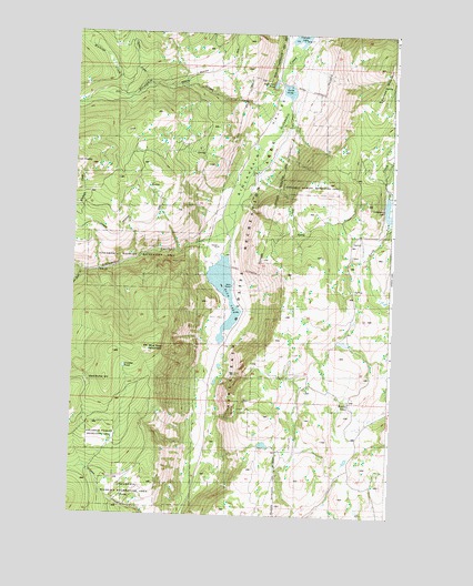
Blue Goat Mountain, WA USGS Topographic Map
Click on map above to begin viewing in our Map Viewer.

This topographic map contains these locations and features:
Feature Name Type Latitude Longitude GNIS ID View Map
Bald ButteSummitN48.6615°W119.7373°1516064View Map
Beeman SchoolSchoolN48.6549°W119.6412°1516377View Map
Blue Goat CreekStreamN48.6879°W119.7481°1516678View Map
Blue Goat MountainSummitN48.6685°W119.7195°1516679View Map
Blue LakeReservoirN48.6827°W119.6910°1516700View Map
Blue Lake DamDamN48.6932°W119.6912°1532353View Map
Chilson CreekStreamN48.7363°W119.7209°1517709View Map
Conners LakeLakeN48.7490°W119.6630°1529030View Map
Crowder PondLakeN48.6634°W119.7297°1528782View Map
Forde LakeLakeN48.7367°W119.6687°1531586View Map
Lemanasky LakeReservoirN48.7047°W119.6276°1522007View Map
Lemansky Lake DamDamN48.7015°W119.6262°1532857View Map
Lower Sinlahekin ImpoundmentReservoirN48.7490°W119.6630°1531948View Map
Reflection PondLakeN48.7371°W119.6728°1529031View Map
Roylance DamDamN48.6715°W119.6428°1533010View Map
Sarsapkin CreekStreamN48.7263°W119.6690°1525437View Map
Sinlahekin Dam Number OneDamN48.7365°W119.6695°1531951View Map
Sinlahekin Dam Number ThreeDamN48.7499°W119.6595°1531947View Map
Sinlahekin Dam Number TwoDamN48.7382°W119.6712°1531949View Map
Sinlahekin Deer Winter Range and Wildlife RefugeParkN48.6618°W119.6827°2765507View Map
Sinlahekin Impoundment Number TwoReservoirN48.7372°W119.6726°1531950View Map
Sinlahekin State Wildlife Recreation AreaParkN48.6824°W119.6837°1531309View Map
Sinlahekin Wildlife Recreation AreaParkN48.6824°W119.6837°1529437View Map
Twin PeaksSummitN48.7157°W119.7445°1527554View Map
Wickiup CreekStreamN48.7332°W119.7329°1528115View Map

Note: Coordinates in the location and feature list above are referenced to NAD83 datum.


Copyright (C) 2008-2024 Ryan Niemi / Sunset Dynamics ... All Rights Reserved