TopoQuest Logo
Do you find TopoQuest useful?
Help keep TopoQuest running and adding new maps/features by donating!
Bitcoin:  19c7KJd3qBynnjoSw5npx9KScwjBe4ifkT
Litecoin:  LXs6TkuXGGXo1vDsWCkWVdjQX94eUKd6ui
Home View Maps Find Maps Find Places Resources & Links


Ester Lake, Minnesota Topographic Map

USGS Map Title: Ester Lake, MN
USGS Map MRC: 48091B1
DRG (GeoTIFF) Download: o48091b1.tif


Neighboring USGS Topographic Map Quads:


  Dutton Lake, MN  
48091B2
 

  Ester Lake, MN  
48091B1
 

  Munker Island, MN  
48090B8
 

  Kekekabic Lake, MN  
48091A2
 

  Ogishkemuncie Lake, MN  
48091A1
 

  Gillis Lake, MN  
48090A8


Map MRC Location:

N49°
W92°
N49°
W91°
H8 H7 H6 H5 H4 H3 H2 H1
G8 G7 G6 G5 G4 G3 G2 G1
F8 F7 F6 F5 F4 F3 F2 F1
E8 E7 E6 E5 E4 E3 E2 E1
D8 D7 D6 D5 D4 D3 D2 D1
C8 C7 C6 C5 C4 C3 C2 C1
B8 B7 B6 B5 B4 B3 B2 B1
A8 A7 A6 A5 A4 A3 A2 A1
N48°
W92°
N48°
W91°

Ester Lake, MN USGS 1:24K Topographic Map Preview:
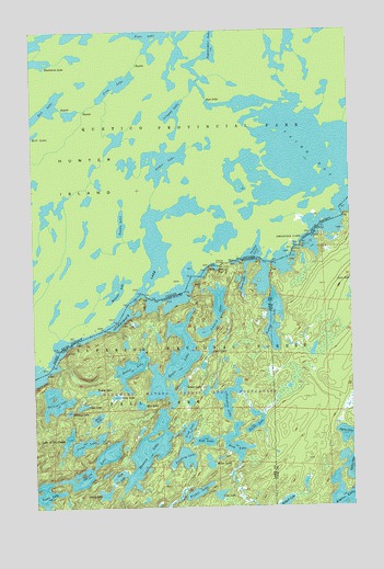
Ester Lake, MN USGS Topographic Map
Click on map above to begin viewing in our Map Viewer.

This topographic map contains these locations and features:
Feature Name Type Latitude Longitude GNIS ID View Map
'R' Lake (historical)LakeN48.1527°W91.1059°659173View Map
Ashdick LakeLakeN48.1763°W91.0536°655165View Map
Baltic LakeLakeN48.1482°W91.1007°655218View Map
Bullfrog LakeLakeN48.1377°W91.0665°655557View Map
Canoe LakeLakeN48.1285°W91.0978°655626View Map
Chaco LakeLakeN48.1668°W91.0555°655692View Map
Cherry LakeLakeN48.1358°W91.1017°655705View Map
Clam LakeLakeN48.1325°W91.0920°655733View Map
Cup LakeLakeN48.1281°W91.0528°655907View Map
Embla LakeLakeN48.1553°W91.1019°656156View Map
Ester LakeLakeN48.1623°W91.0702°656171View Map
Faith LakeLakeN48.1462°W91.0382°656192View Map
Fish LakeLakeN48.1416°W91.0464°656246View Map
Gift LakeLakeN48.1422°W91.0587°656375View Map
Gijikiki LakeLakeN48.1530°W91.1169°656377View Map
Glen LakeLakeN48.1514°W91.1063°656385View Map
Hanson LakeLakeN48.1403°W91.0802°656518View Map
Lake of the CloudsLakeN48.1424°W91.1123°655761View Map
Link LakeLakeN48.1446°W91.0651°657015View Map
Lunar LakeLakeN48.1417°W91.1050°657259View Map
Maze LakeLakeN48.1539°W91.0929°657347View Map
Midas LakeLakeN48.1366°W91.0566°657384View Map
Mist LakeLakeN48.1516°W91.0835°657430View Map
Mud BayBayN48.1874°W91.0534°657501View Map
Nawakwa LakeLakeN48.1533°W91.0488°657570View Map
Ottertrack LakeLakeN48.1693°W91.1044°655915View Map
Pitfall LakeLakeN48.1313°W91.0626°657865View Map
Plume LakeLakeN48.1834°W91.0424°657876View Map
Rabbit LakeLakeN48.1612°W91.0870°657962View Map
Redpoll LakeLakeN48.1258°W91.0270°658007View Map
Rivalry LakeLakeN48.1499°W91.1115°658056View Map
Swamp LakeLakeN48.1866°W91.0322°658565View Map
Swamp PortageLocaleN48.1888°W91.0501°663190View Map
Topaz LakeLakeN48.1276°W91.1237°658717View Map
Totem LakeLakeN48.1567°W91.0666°658724View Map
Trust LakeLakeN48.1494°W91.0388°659171View Map
Zephyr LakeLakeN48.1743°W91.0308°659085View Map

Note: Coordinates in the location and feature list above are referenced to NAD83 datum.


Copyright (C) 2008-2024 Ryan Niemi / Sunset Dynamics ... All Rights Reserved