TopoQuest Logo
Do you find TopoQuest useful?
Help keep TopoQuest running and adding new maps/features by donating!
Bitcoin:  19c7KJd3qBynnjoSw5npx9KScwjBe4ifkT
Litecoin:  LXs6TkuXGGXo1vDsWCkWVdjQX94eUKd6ui
Home View Maps Find Maps Find Places Resources & Links


Ogishkemuncie Lake, Minnesota Topographic Map

USGS Map Title: Ogishkemuncie Lake, MN
USGS Map MRC: 48091A1
DRG (GeoTIFF) Download: o48091a1.tif


Neighboring USGS Topographic Map Quads:


  Dutton Lake, MN  
48091B2
 

  Ester Lake, MN  
48091B1
 

  Munker Island, MN  
48090B8
 

  Kekekabic Lake, MN  
48091A2
 

  Ogishkemuncie Lake, MN  
48091A1
 

  Gillis Lake, MN  
48090A8
 

  Alice Lake, MN  
47091H2
 

  Lake Polly, MN  
47091H1
 

  Kelso Mountain, MN  
47090H8


Map MRC Location:

N49°
W92°
N49°
W91°
H8 H7 H6 H5 H4 H3 H2 H1
G8 G7 G6 G5 G4 G3 G2 G1
F8 F7 F6 F5 F4 F3 F2 F1
E8 E7 E6 E5 E4 E3 E2 E1
D8 D7 D6 D5 D4 D3 D2 D1
C8 C7 C6 C5 C4 C3 C2 C1
B8 B7 B6 B5 B4 B3 B2 B1
A8 A7 A6 A5 A4 A3 A2 A1
N48°
W92°
N48°
W91°

Ogishkemuncie Lake, MN USGS 1:24K Topographic Map Preview:
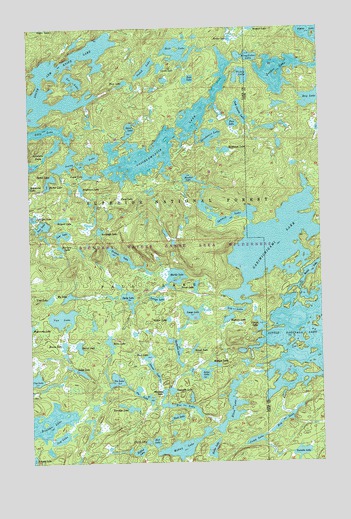
Ogishkemuncie Lake, MN USGS Topographic Map
Click on map above to begin viewing in our Map Viewer.

This topographic map contains these locations and features:
Feature Name Type Latitude Longitude GNIS ID View Map
Agamok LakeLakeN48.0695°W91.0400°655083View Map
Amimi LakeLakeN48.0264°W91.0725°655125View Map
Annie LakeLakeN48.0826°W91.0982°655144View Map
Barter LakeLakeN48.0797°W91.1174°655232View Map
Bewon LakeLakeN48.0337°W91.1109°655348View Map
Birl LakeLakeN48.0059°W91.0720°655407View Map
Boulder LakeLakeN48.0118°W91.1185°655488View Map
Bushman LakeLakeN48.0897°W91.0402°655576View Map
Bushwah LakeLakeN48.0666°W91.0953°655577View Map
Calico LakeLakeN48.0820°W91.1153°655595View Map
Canta LakeLakeN48.1134°W91.0679°640882View Map
Cap LakeLakeN48.0241°W91.1239°655628View Map
Churn LakeLakeN48.0058°W91.0754°655729View Map
Cook County LakeLakeN48.1006°W91.0340°655789View Map
Cookoosh LakeLakeN48.0205°W91.0650°655791View Map
Darlet LakeLakeN48.0333°W91.1042°655933View Map
Eddy LakeLakeN48.0943°W91.1186°656116View Map
Elton LakeLakeN48.0162°W91.0389°656154View Map
Fee LakeLakeN48.0188°W91.0769°656215View Map
Fury LakeLakeN48.0763°W91.0861°656346View Map
Gabimichigami LakeLakeN48.0625°W91.0201°656348View Map
Glitter LakeLakeN48.0411°W91.0659°656388View Map
Hack LakeLakeN48.0130°W91.0624°656494View Map
Harness LakeLakeN48.0618°W91.1119°656525View Map
Hoe LakeLakeN48.0165°W91.0620°656601View Map
Holt LakeLakeN48.1170°W91.0598°656621View Map
Hop LakeLakeN48.0121°W91.0158°656633View Map
Horsefish LakeLakeN48.0323°W91.0624°656644View Map
Hotfoot LakeLakeN48.0032°W91.0791°656662View Map
Image LakeLakeN48.0430°W91.0558°656692View Map
Incus LakeLakeN48.0253°W91.0505°656693View Map
Jasper LakeLakeN48.1121°W91.0166°656775View Map
Jenny LakeLakeN48.0867°W91.1051°656781View Map
Jug LakeLakeN48.0071°W91.1127°656826View Map
Jump LakeLakeN48.0062°W91.0293°656828View Map
Kaiak LakeLakeN48.0327°W91.0550°656846View Map
Kale LakeLakeN48.1101°W91.0557°656847View Map
Kallio LakeLakeN48.0036°W91.0476°656848View Map
Kekekabic PondsLakeN48.0878°W91.1183°656865View Map
Kingfisher LakeLakeN48.1165°W91.0309°656895View Map
Ledge LakeLakeN48.0265°W91.1050°656975View Map
Leg LakeLakeN48.0437°W91.0374°656983View Map
Little Saganaga LakeLakeN48.0343°W91.0011°657119View Map
Loki LakeLakeN48.0658°W91.1107°657170View Map
Lounge LakeLakeN48.0470°W91.0709°657231View Map
Makwa LakeLakeN48.0043°W91.0604°657290View Map
Marble LakeLakeN48.0536°W91.0624°657315View Map
Maymay LakeLakeN48.0199°W91.0682°657346View Map
Median LakeLakeN48.0279°W91.0467°657371View Map
Mueller LakeLakeN48.0816°W91.0555°657521View Map
My LakeLakeN48.0477°W91.1084°657557View Map
Nabek LakeLakeN48.1132°W91.0742°657563View Map
Nave LakeLakeN48.1084°W91.0848°657569View Map
Nectar LakeLakeN48.1217°W91.0378°657574View Map
Ogishkemuncie LakeLakeN48.0935°W91.0667°657659View Map
Pace LakeLakeN48.0305°W91.0747°657719View Map
Paco LakeLakeN48.0973°W91.0371°657721View Map
Pear LakeLakeN48.0682°W91.1195°657760View Map
Porridge LakeLakeN48.0158°W91.0832°657907View Map
Pouch LakeLakeN48.0501°W91.0541°657926View Map
Rapture LakeLakeN48.0412°W91.0402°657981View Map
Rattle LakeLakeN48.0542°W91.0053°657989View Map
Ray LakeLakeN48.1041°W91.0041°657996View Map
Serpent LakeLakeN48.0701°W91.1108°658222View Map
Siren LakeLakeN48.0346°W91.0912°658275View Map
Skindance LakeLakeN48.0937°W91.0468°658291View Map
Spice LakeLakeN48.0955°W91.0817°658388View Map
Sprig LakeLakeN48.0469°W91.0826°658399View Map
Tickle LakeLakeN48.1110°W91.0331°658686View Map
Toe LakeLakeN48.1097°W91.1055°658701View Map
Tradition LakeLakeN48.0778°W91.1022°658732View Map
Travois LakeLakeN48.0586°W91.0839°658738View Map
Twilight LakeLakeN48.0706°W91.1237°658787View Map
Twinkle LakeLakeN48.0015°W91.0098°658797View Map
Van LakeLakeN48.0418°W91.1115°658833View Map
Vee LakeLakeN48.0237°W91.0886°658841View Map
Vierge LakeLakeN48.0394°W91.0265°658852View Map
Your LakeLakeN48.0471°W91.1168°659082View Map

Note: Coordinates in the location and feature list above are referenced to NAD83 datum.


Copyright (C) 2008-2025 Ryan Niemi / Sunset Dynamics ... All Rights Reserved