TopoQuest Logo
Do you find TopoQuest useful?
Help keep TopoQuest running and adding new maps/features by donating!
Bitcoin:  19c7KJd3qBynnjoSw5npx9KScwjBe4ifkT
Litecoin:  LXs6TkuXGGXo1vDsWCkWVdjQX94eUKd6ui
Home View Maps Find Maps Find Places Resources & Links


Exeter, California Topographic Map

USGS Map Title: Exeter, CA
USGS Map MRC: 36119C2
DRG (GeoTIFF) Download: o36119c2.tif


Neighboring USGS Topographic Map Quads:


  Monson, CA  
36119D3
 

  Ivanhoe, CA  
36119D2
 

  Woodlake, CA  
36119D1
 

  Visalia, CA  
36119C3
 

  Exeter, CA  
36119C2
 

  Rocky Hill, CA  
36119C1
 

  Tulare, CA  
36119B3
 

  Cairns Corner, CA  
36119B2
 

  Lindsay, CA  
36119B1


Map MRC Location:

N37°
W120°
N37°
W119°
H8 H7 H6 H5 H4 H3 H2 H1
G8 G7 G6 G5 G4 G3 G2 G1
F8 F7 F6 F5 F4 F3 F2 F1
E8 E7 E6 E5 E4 E3 E2 E1
D8 D7 D6 D5 D4 D3 D2 D1
C8 C7 C6 C5 C4 C3 C2 C1
B8 B7 B6 B5 B4 B3 B2 B1
A8 A7 A6 A5 A4 A3 A2 A1
N36°
W120°
N36°
W119°

Exeter, CA USGS 1:24K Topographic Map Preview:
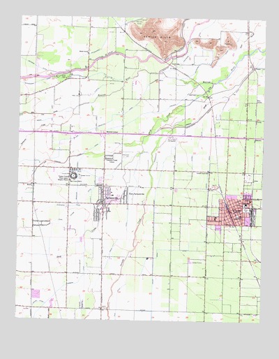
Exeter, CA USGS Topographic Map
Click on map above to begin viewing in our Map Viewer.

This topographic map contains these locations and features:
Feature Name Type Latitude Longitude GNIS ID View Map
AntesPopulated PlaceN36.3086°W119.1307°1656424View Map
Ash Street ParkParkN36.3019°W119.2029°1835555View Map
Calvary Baptist MissionChurchN36.2950°W119.1368°1835556View Map
Cameron Creek ColonyPopulated PlaceN36.3172°W119.2048°1656449View Map
Catron DitchCanalN36.3222°W119.1590°240367View Map
Church of ChristChurchN36.2925°W119.1451°1835557View Map
Church of GodChurchN36.2927°W119.1432°1835559View Map
Church of the NazareneChurchN36.2972°W119.1468°1835563View Map
City of ExeterCivilN36.2940°W119.1459°2410472View Map
City of FarmersvilleCivilN36.3054°W119.2081°2410485View Map
Consolidated Peoples DitchCanalN36.3402°W119.1490°240865View Map
Crocker CutCanalN36.3408°W119.1682°241108View Map
Cutler ParkParkN36.3500°W119.2284°241182View Map
Davis DitchCanalN36.2833°W119.1946°241285View Map
Deep Creek CemeteryCemeteryN36.3175°W119.1969°241348View Map
Deep Creek CutCanalN36.3438°W119.1607°241349View Map
Deep Creek School (historical)SchoolN36.3238°W119.1976°1661891View Map
East FarmersvillePopulated PlaceN36.3016°W119.1948°1656493View Map
East Union SchoolSchoolN36.3077°W119.2240°241791View Map
Elbow Elementary SchoolSchoolN36.3600°W119.2159°241935View Map
Evangelical Methodist ChurchChurchN36.2936°W119.1443°1835569View Map
ExeterPopulated PlaceN36.2961°W119.1421°1652707View Map
Exeter Branch Tulare County LibraryBuildingN36.2938°W119.1393°1835570View Map
Exeter City Athletic ParkParkN36.2963°W119.1343°1835571View Map
Exeter City HallBuildingN36.2969°W119.1423°1835572View Map
Exeter District AmbulanceBuildingN36.2978°W119.1398°2662246View Map
Exeter DivisionCivilN36.3106°W119.1484°1935098View Map
Exeter Fire DepartmentBuildingN36.2969°W119.1424°2623876View Map
Exeter High School FarmLocaleN36.3088°W119.1343°1835574View Map
Exeter Memorial BuildingBuildingN36.3019°W119.1371°1835575View Map
Exeter Memorial HospitalHospitalN36.3000°W119.1323°1835576View Map
Exeter Police DepartmentBuildingN36.2973°W119.1388°2755884View Map
Exeter Post OfficePost OfficeN36.2963°W119.1391°1835577View Map
Exeter Womans ClubBuildingN36.2991°W119.1357°1835578View Map
Extension DitchCanalN36.2986°W119.2157°242124View Map
Exter Golf CourseLocaleN36.2966°W119.1509°1835573View Map
FanePopulated PlaceN36.3699°W119.1346°252890View Map
FarmersvillePopulated PlaceN36.2977°W119.2068°1652709View Map
Farmersville City HallBuildingN36.3044°W119.2071°1835580View Map
Farmersville Fire DepartmentBuildingN36.2973°W119.2154°2623789View Map
Farmersville Junior High SchoolSchoolN36.3027°W119.2121°1835581View Map
Farmersville Police DepartmentBuildingN36.2974°W119.2153°2755899View Map
Farmersville Post OfficePost OfficeN36.3004°W119.2068°1835582View Map
First Assembly of God ChurchChurchN36.2991°W119.1379°1835583View Map
First Assembly of God ChurchChurchN36.3016°W119.2001°1835584View Map
First Baptist ChurchChurchN36.2944°W119.1396°1835585View Map
First Presbyterian ChurchChurchN36.2950°W119.1404°1835586View Map
Fleming DitchCanalN36.3469°W119.2068°242307View Map
Foursquare Gospel ChurchChurchN36.2913°W119.1437°1835587View Map
Free Baptist ChurchChurchN36.2963°W119.1443°1835588View Map
George L Snowden Elementary SchoolSchoolN36.2958°W119.2084°1835589View Map
Giant Oak (historical)Populated PlaceN36.3047°W119.1884°1661894View Map
J E Hester Elementary SchoolSchoolN36.3014°W119.2023°1835592View Map
Jennings ParkParkN36.3013°W119.2090°1835593View Map
Johnson SloughGutN36.3352°W119.1573°244114View Map
Kaweah RiverStreamN36.3366°W119.2232°271849View Map
Ketchum DitchCanalN36.3591°W119.1479°244285View Map
KGYU-FM (Visalia)TowerN36.2861°W119.2484°1663133View Map
KGYU-FM (Visalia)TowerN36.3663°W119.1804°1663134View Map
Lane SloughStreamN36.3580°W119.1396°244572View Map
Lincoln Elementary SchoolSchoolN36.2933°W119.1371°244852View Map
Linnell Camp Census Designated PlaceCensusN36.3089°W119.2226°2585430View Map
Linnell Post OfficePost OfficeN36.3097°W119.2240°1662327View Map
ListPopulated PlaceN36.2761°W119.1279°1656564View Map
Locust Grove DitchCanalN36.2791°W119.1790°244999View Map
Locust Grove SchoolSchoolN36.3113°W119.1534°245000View Map
LortPopulated PlaceN36.3427°W119.1543°252926View Map
MatchinPopulated PlaceN36.3252°W119.1301°1656567View Map
Mineral King RanchLocaleN36.3427°W119.2207°1661904View Map
Mitchell CornerPopulated PlaceN36.3266°W119.2062°1656570View Map
Musk (historical)Populated PlaceN36.3280°W119.1509°1661905View Map
Nickerson School (historical)SchoolN36.2619°W119.2462°1661906View Map
Outside Creek School (historical)SchoolN36.2691°W119.2071°1661909View Map
Packwood CanalCanalN36.3638°W119.1634°247083View Map
Pennebaker DitchCanalN36.3233°W119.1765°247374View Map
RectorPopulated PlaceN36.3052°W119.2429°252964View Map
Rice DitchCanalN36.2580°W119.1990°248161View Map
Roys ParkParkN36.2916°W119.2079°1835598View Map
Sacred Heart Catholic ChurchChurchN36.2927°W119.1384°1835599View Map
Sequoia State Fish HatcheryLocaleN36.3247°W119.1701°1654816View Map
Seventh Day Adventist ChurchChurchN36.2963°W119.1468°1835601View Map
Trinity Lutheran ChurchChurchN36.3191°W119.1373°1835603View Map
Tulare County Farm Labor Supply CenterLocaleN36.3091°W119.2221°1654846View Map
Union Elementary SchoolSchoolN36.2991°W119.2423°1835604View Map
Union High SchoolSchoolN36.2983°W119.1343°250800View Map
United Pentecostal Church of ExeterChurchN36.2966°W119.1476°1835605View Map
Venice CoveValleyN36.3738°W119.1912°250971View Map
Venice HillsRangeN36.3736°W119.1812°250973View Map
Venice SchoolSchoolN36.3555°W119.1712°250974View Map
VenidaPopulated PlaceN36.3327°W119.1301°1656648View Map
West End Pentecostal TabernacleChurchN36.2916°W119.1532°1835609View Map
West VenidaPopulated PlaceN36.3411°W119.1298°1656655View Map
Wilson Elementary SchoolSchoolN36.2927°W119.1496°251794View Map
Yokohl CreekStreamN36.3502°W119.1454°274594View Map

Note: Coordinates in the location and feature list above are referenced to NAD83 datum.


Copyright (C) 2008-2025 Ryan Niemi / Sunset Dynamics ... All Rights Reserved