TopoQuest Logo
Do you find TopoQuest useful?
Help keep TopoQuest running and adding new maps/features by donating!
Bitcoin:  19c7KJd3qBynnjoSw5npx9KScwjBe4ifkT
Litecoin:  LXs6TkuXGGXo1vDsWCkWVdjQX94eUKd6ui
Home View Maps Find Maps Find Places Resources & Links


Cairns Corner, California Topographic Map

USGS Map Title: Cairns Corner, CA
USGS Map MRC: 36119B2
DRG (GeoTIFF) Download: o36119b2.tif


Neighboring USGS Topographic Map Quads:


  Visalia, CA  
36119C3
 

  Exeter, CA  
36119C2
 

  Rocky Hill, CA  
36119C1
 

  Tulare, CA  
36119B3
 

  Cairns Corner, CA  
36119B2
 

  Lindsay, CA  
36119B1
 

  Tipton, CA  
36119A3
 

  Woodville, CA  
36119A2
 

  Porterville, CA  
36119A1


Map MRC Location:

N37°
W120°
N37°
W119°
H8 H7 H6 H5 H4 H3 H2 H1
G8 G7 G6 G5 G4 G3 G2 G1
F8 F7 F6 F5 F4 F3 F2 F1
E8 E7 E6 E5 E4 E3 E2 E1
D8 D7 D6 D5 D4 D3 D2 D1
C8 C7 C6 C5 C4 C3 C2 C1
B8 B7 B6 B5 B4 B3 B2 B1
A8 A7 A6 A5 A4 A3 A2 A1
N36°
W120°
N36°
W119°

Cairns Corner, CA USGS 1:24K Topographic Map Preview:
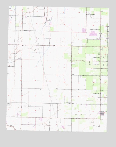
Cairns Corner, CA USGS Topographic Map
Click on map above to begin viewing in our Map Viewer.

This topographic map contains these locations and features:
Feature Name Type Latitude Longitude GNIS ID View Map
Ankeridge DairyLocaleN36.2453°W119.1744°2681427View Map
Bliss DitchCanalN36.1750°W119.2454°239481View Map
Bos Farms DairyLocaleN36.1642°W119.2353°2701874View Map
Cairns CornerPopulated PlaceN36.2125°W119.1357°1660407View Map
Central School (historical)SchoolN36.2250°W119.1371°1661886View Map
Church of the BrethrenChurchN36.1569°W119.1343°1661887View Map
Creekside DairyLocaleN36.1692°W119.2481°2681514View Map
Davis SloughStreamN36.2028°W119.2430°1988112View Map
Exeter AirportAirportN36.2428°W119.1503°1653441View Map
Farmers DitchCanalN36.2425°W119.2454°242175View Map
Fernjo DairyLocaleN36.2075°W119.2433°2681520View Map
Gray DitchCanalN36.2366°W119.1984°242965View Map
Heritage DairyLocaleN36.1361°W119.2203°2702219View Map
Highstreet DairyLocaleN36.2233°W119.2256°2702221View Map
Hilarides DairyLocaleN36.2283°W119.1589°2702222View Map
Hutchinson DitchCanalN36.1605°W119.2434°243752View Map
Lewis CreekStreamN36.2127°W119.1848°272022View Map
Lindsay DivisionCivilN36.2051°W119.1254°1935169View Map
Mancebo DairyLocaleN36.2089°W119.2375°2702229View Map
Oak Bend DairyLocaleN36.2153°W119.2011°2702268View Map
Pacheco and Fagundes DairyLocaleN36.2144°W119.1689°2681635View Map
PlainviewPopulated PlaceN36.1441°W119.1340°1661238View Map
Plainview Census Designated PlaceCensusN36.1422°W119.1374°2585439View Map
Porter SloughStreamN36.1277°W119.2409°247699View Map
Prairie Center SchoolLocaleN36.1536°W119.1740°247768View Map
R and S DairyLocaleN36.1422°W119.2175°2702271View Map
Rancho Terrisita DairyLocaleN36.1847°W119.2261°2702272View Map
Rosedale School (historical)SchoolN36.1963°W119.1682°1661913View Map
Rynsburger DairyLocaleN36.1333°W119.1539°2702305View Map
Sierra Vista DairyLocaleN36.1422°W119.2258°2681677View Map
Spinks CornerPopulated PlaceN36.2119°W119.2332°1661490View Map
Tulare County Fire Department Battalion 1 Lindsay Fire Station 15BuildingN36.2032°W119.1354°2624440View Map
Vander Kooi DairyLocaleN36.2436°W119.2192°2701865View Map
Vander Tuig DairyLocaleN36.1528°W119.2092°2702320View Map

Note: Coordinates in the location and feature list above are referenced to NAD83 datum.


Copyright (C) 2008-2024 Ryan Niemi / Sunset Dynamics ... All Rights Reserved