TopoQuest Logo
Do you find TopoQuest useful?
Help keep TopoQuest running and adding new maps/features by donating!
Bitcoin:  19c7KJd3qBynnjoSw5npx9KScwjBe4ifkT
Litecoin:  LXs6TkuXGGXo1vDsWCkWVdjQX94eUKd6ui
Home View Maps Find Maps Find Places Resources & Links


Eyraud Lakes, Montana Topographic Map

USGS Map Title: Eyraud Lakes, MT
USGS Map MRC: 47112H1
DRG (GeoTIFF) Download: o47112h1.tif


Neighboring USGS Topographic Map Quads:


  Agawam North, MT  
48112A2
 

  Gallup City, MT  
48112A1
 

  Conrad SW, MT  
48111A8
 

  Agawam South, MT  
47112H2
 

  Eyraud Lakes, MT  
47112H1
 

  Collins NW, MT  
47111H8
 

  Choteau, MT  
47112G2
 

  Choteau SE, MT  
47112G1
 

  T L Gap, MT  
47111G8


Map MRC Location:

N48°
W113°
N48°
W112°
H8 H7 H6 H5 H4 H3 H2 H1
G8 G7 G6 G5 G4 G3 G2 G1
F8 F7 F6 F5 F4 F3 F2 F1
E8 E7 E6 E5 E4 E3 E2 E1
D8 D7 D6 D5 D4 D3 D2 D1
C8 C7 C6 C5 C4 C3 C2 C1
B8 B7 B6 B5 B4 B3 B2 B1
A8 A7 A6 A5 A4 A3 A2 A1
N47°
W113°
N47°
W112°

Eyraud Lakes, MT USGS 1:24K Topographic Map Preview:
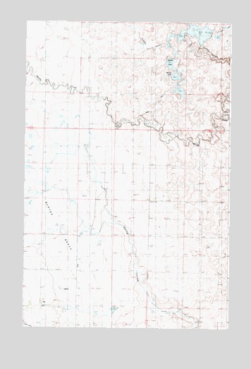
Eyraud Lakes, MT USGS Topographic Map
Click on map above to begin viewing in our Map Viewer.

This topographic map contains these locations and features:
Feature Name Type Latitude Longitude GNIS ID View Map
25N04W02B___01 WellWellN47.9525°W112.0872°825276View Map
25N04W02C___01 WellWellN47.9452°W112.0872°825251View Map
25N04W03____01 WellWellN47.9488°W112.1034°825262View Map
25N04W03____02 WellWellN47.9488°W112.1034°825263View Map
25N04W03____03 WellWellN47.9488°W112.1034°825264View Map
25N04W03____04 WellWellN47.9488°W112.1034°825265View Map
25N04W03____05 WellWellN47.9488°W112.1034°825266View Map
25N04W03____06 WellWellN47.9488°W112.1034°825267View Map
25N04W03____07 WellWellN47.9488°W112.1034°825268View Map
25N04W03D___01 WellWellN47.9452°W112.0981°825252View Map
25N04W03D___02 WellWellN47.9452°W112.0981°825253View Map
25N04W11A___01 WellWellN47.9380°W112.0764°825236View Map
25N04W11C___01 WellWellN47.9305°W112.0872°825221View Map
25N04W11C___02 WellWellN47.9305°W112.0872°825222View Map
25N04W11D___01 WellWellN47.9305°W112.0764°825219View Map
25N04W11D___02 WellWellN47.9305°W112.0764°825220View Map
25N04W23C___01 WellWellN47.9016°W112.0872°825184View Map
25N04W28D___01 WellWellN47.8869°W112.1195°825160View Map
26N04W21D___01 WellWellN47.9891°W112.1184°825376View Map
26N04W23D___01 WellWellN47.9891°W112.0753°825375View Map
26N04W35B___01 WellWellN47.9672°W112.0861°825299View Map
26N04W35C___01 WellWellN47.9600°W112.0861°825287View Map
26N04W36DCDB01 WellWellN47.9572°W112.0559°825282View Map
Arod Lake Fishing Access SiteLocaleN47.9777°W112.0367°1744311View Map
Brady CanalCanalN47.9644°W112.0456°806761View Map
Brady Lakes Number 4 DamDamN47.9700°W112.0292°798459View Map
Burton (historical)Populated PlaceN47.8855°W112.1120°1762135View Map
Burton Post Office (historical)Post OfficeN47.8855°W112.1120°1762143View Map
East Farmington Number 5 School (historical)SchoolN47.8825°W112.1156°799307View Map
Eyraud LakesLakeN47.9955°W112.0166°771273View Map
Middle LakeLakeN47.9835°W112.0373°807033View Map
Round LakeLakeN47.9780°W112.0337°807032View Map
Teton County Waterfowl Production AreaParkN47.9795°W112.0324°2765526View Map
Trinity CemeteryCemeteryN47.8844°W112.0772°777762View Map

Note: Coordinates in the location and feature list above are referenced to NAD83 datum.


Copyright (C) 2008-2024 Ryan Niemi / Sunset Dynamics ... All Rights Reserved