TopoQuest Logo
Do you find TopoQuest useful?
Help keep TopoQuest running and adding new maps/features by donating!
Bitcoin:  19c7KJd3qBynnjoSw5npx9KScwjBe4ifkT
Litecoin:  LXs6TkuXGGXo1vDsWCkWVdjQX94eUKd6ui
Home View Maps Find Maps Find Places Resources & Links


Fair Haven, New York Topographic Map

USGS Map Title: Fair Haven, NY
USGS Map MRC: 43076C6
DRG (GeoTIFF) Download: o43076c6.tif


Neighboring USGS Topographic Map Quads:


  West Ninemile Point, NY  
43076D6
 

  Oswego West, NY  
43076D5
 

  North Wolcott, NY  
43076C7
 

  Fair Haven, NY  
43076C6
 

  Hannibal, NY  
43076C5
 

  Wolcott, NY  
43076B7
 

  Victory, NY  
43076B6
 

  Cato, NY  
43076B5


Map MRC Location:

N44°
W77°
N44°
W76°
H8 H7 H6 H5 H4 H3 H2 H1
G8 G7 G6 G5 G4 G3 G2 G1
F8 F7 F6 F5 F4 F3 F2 F1
E8 E7 E6 E5 E4 E3 E2 E1
D8 D7 D6 D5 D4 D3 D2 D1
C8 C7 C6 C5 C4 C3 C2 C1
B8 B7 B6 B5 B4 B3 B2 B1
A8 A7 A6 A5 A4 A3 A2 A1
N43°
W77°
N43°
W76°

Fair Haven, NY USGS 1:24K Topographic Map Preview:
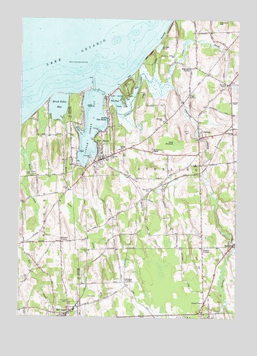
Fair Haven, NY USGS Topographic Map
Click on map above to begin viewing in our Map Viewer.

This topographic map contains these locations and features:
Feature Name Type Latitude Longitude GNIS ID View Map
Anchor Resort and MarinaHarborN43.3155°W76.7157°2598498View Map
Blind Sodus BayLakeN43.3382°W76.7282°944257View Map
Blind Sodus CreekStreamN43.3326°W76.7258°969893View Map
Busters Boat BaseLocaleN43.3273°W76.7044°973935View Map
Calvary ChurchChurchN43.3178°W76.6972°945502View Map
Chinook Harbor MarinaLocaleN43.3167°W76.7172°973933View Map
Community Burial GroundCemeteryN43.2660°W76.7455°950374View Map
CrockettsPopulated PlaceN43.3273°W76.6274°947759View Map
Crocketts Hill FarmLocaleN43.3014°W76.6267°2519326View Map
Duncans CornersLocaleN43.2817°W76.7252°948783View Map
Eldridges PointCapeN43.3176°W76.7094°949465View Map
Fair HavenPopulated PlaceN43.3165°W76.7022°949802View Map
Fair Haven Beach State ParkParkN43.3465°W76.6880°949803View Map
Fair Haven Fire DepartmentBuildingN43.3157°W76.7017°2735025View Map
Fair Haven Post OfficePost OfficeN43.3163°W76.7047°2599619View Map
Fair Haven Public LibraryBuildingN43.3151°W76.7034°2598515View Map
Fair Mount CemeteryCemeteryN43.2566°W76.7217°949817View Map
Fintches CornersPopulated PlaceN43.2798°W76.6444°950080View Map
Forscutt CemeteryCemeteryN43.2912°W76.6957°2517268View Map
Fox PointCapeN43.3245°W76.7077°950579View Map
Grant's Vacation Park Recreational Vehicle and Mobile Home ParkPopulated PlaceN43.3348°W76.7009°2598524View Map
Grass IslandIslandN43.3387°W76.7113°951539View Map
Grays CornersLocaleN43.3434°W76.6530°951610View Map
Gulf HillSummitN43.2734°W76.6461°951920View Map
Harbor View MarinaLocaleN43.3140°W76.7186°973932View Map
Holiday Harbor MarinaLocaleN43.3361°W76.7336°2599596View Map
Juniper HillSummitN43.3320°W76.6677°954355View Map
Juniper PondLakeN43.3636°W76.6704°954358View Map
Kevilles HillSummitN43.2970°W76.6786°954575View Map
Little Sodus BayLakeN43.3303°W76.7094°955697View Map
Livingston CemeteryCemeteryN43.3102°W76.7410°955747View Map
MartvillePopulated PlaceN43.2801°W76.6272°956605View Map
Martville CemeteryCemeteryN43.2756°W76.6342°956606View Map
Martville Post OfficePost OfficeN43.2791°W76.6283°2598474View Map
McArthur CemeteryCemeteryN43.3096°W76.7407°956718View Map
McIntyres BluffCliffN43.3726°W76.6647°956787View Map
McKnight CornersLocaleN43.3548°W76.6522°956821View Map
Meadow CoveBayN43.3273°W76.7158°956874View Map
North Fair HavenPopulated PlaceN43.3328°W76.6997°958778View Map
North VictoryPopulated PlaceN43.2562°W76.6427°958938View Map
Overacre CemeteryCemeteryN43.2779°W76.7106°959656View Map
Pearson PointCapeN43.3287°W76.7050°960059View Map
Phillips CemeteryCemeteryN43.3041°W76.7225°960300View Map
Pond HundredSwampN43.3237°W76.6602°960896View Map
Red Volunteer Creek Fire DepartmentBuildingN43.2544°W76.7208°2700976View Map
Sabin PointCapeN43.3431°W76.6997°973925View Map
School Number 10 (historical)SchoolN43.3156°W76.6261°2105793View Map
School Number 15 (historical)SchoolN43.2508°W76.6792°2105794View Map
School Number 16 (historical)SchoolN43.3236°W76.6469°2105795View Map
School Number 17 (historical)SchoolN43.2961°W76.6828°2105796View Map
School Number 18 (historical)SchoolN43.3325°W76.6656°2105797View Map
School Number 2 (historical)SchoolN43.3481°W76.6308°2105789View Map
School Number 4 (historical)SchoolN43.3547°W76.6525°2105790View Map
School Number 6 (historical)SchoolN43.2647°W76.6894°2105791View Map
School Number 7 (historical)SchoolN43.3222°W76.7256°2106786View Map
School Number 9 (historical)SchoolN43.2853°W76.6569°2105792View Map
Sidmans HillSummitN43.3742°W76.6369°965211View Map
Sitts BluffCliffN43.3603°W76.6763°965315View Map
Springbrook CemeteryCemeteryN43.3205°W76.6740°2105788View Map
Springbrook ChapelChurchN43.3195°W76.6736°966094View Map
Springbrook Greens Golf CourseLocaleN43.3237°W76.6856°2598512View Map
SterlingPopulated PlaceN43.3259°W76.6449°966360View Map
Sterling CreekStreamN43.3373°W76.6950°966363View Map
Sterling Post OfficePost OfficeN43.3258°W76.6464°2598478View Map
Sterling StationLocaleN43.3037°W76.6736°966367View Map
Sterling ValleyPopulated PlaceN43.3481°W76.6305°966368View Map
Sterling Valley CreekStreamN43.3490°W76.6655°970658View Map
The BluffsCliffN43.3576°W76.6794°967205View Map
The Boathouse RampLocaleN43.3451°W76.7113°973926View Map
The MoatSwampN43.3398°W76.6880°967291View Map
The PondLakeN43.3409°W76.6951°967326View Map
The RidgeSummitN43.3420°W76.6794°967331View Map
Town of SterlingCivilN43.3157°W76.6580°979524View Map
Village of Fair HavenCivilN43.3261°W76.7044°2390831View Map
Village of Fair Haven AmbulanceBuildingN43.3159°W76.7018°2719238View Map
Whiting CornersLocaleN43.2648°W76.6883°971172View Map
Wilde HillSummitN43.3206°W76.6925°971255View Map
Zappala FarmsLocaleN43.3125°W76.6500°2542338View Map

Note: Coordinates in the location and feature list above are referenced to NAD83 datum.


Copyright (C) 2008-2024 Ryan Niemi / Sunset Dynamics ... All Rights Reserved