TopoQuest Logo
Do you find TopoQuest useful?
Help keep TopoQuest running and adding new maps/features by donating!
Bitcoin:  19c7KJd3qBynnjoSw5npx9KScwjBe4ifkT
Litecoin:  LXs6TkuXGGXo1vDsWCkWVdjQX94eUKd6ui
Home View Maps Find Maps Find Places Resources & Links


Hannibal, New York Topographic Map

USGS Map Title: Hannibal, NY
USGS Map MRC: 43076C5
DRG (GeoTIFF) Download: o43076c5.tif


Neighboring USGS Topographic Map Quads:


  West Ninemile Point, NY  
43076D6
 

  Oswego West, NY  
43076D5
 

  Oswego East, NY  
43076D4
 

  Fair Haven, NY  
43076C6
 

  Hannibal, NY  
43076C5
 

  Fulton, NY  
43076C4
 

  Victory, NY  
43076B6
 

  Cato, NY  
43076B5
 

  Lysander, NY  
43076B4


Map MRC Location:

N44°
W77°
N44°
W76°
H8 H7 H6 H5 H4 H3 H2 H1
G8 G7 G6 G5 G4 G3 G2 G1
F8 F7 F6 F5 F4 F3 F2 F1
E8 E7 E6 E5 E4 E3 E2 E1
D8 D7 D6 D5 D4 D3 D2 D1
C8 C7 C6 C5 C4 C3 C2 C1
B8 B7 B6 B5 B4 B3 B2 B1
A8 A7 A6 A5 A4 A3 A2 A1
N43°
W77°
N43°
W76°

Hannibal, NY USGS 1:24K Topographic Map Preview:
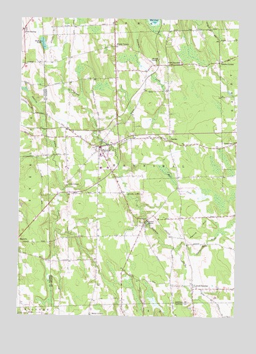
Hannibal, NY USGS Topographic Map
Click on map above to begin viewing in our Map Viewer.

This topographic map contains these locations and features:
Feature Name Type Latitude Longitude GNIS ID View Map
Bethel CemeteryCemeteryN43.2631°W76.5795°943784View Map
Cains CornersPopulated PlaceN43.3053°W76.5969°945438View Map
Carter School (historical)SchoolN43.2733°W76.5794°2106210View Map
Country Haven Mobile Home ParkPopulated PlaceN43.3493°W76.5137°2715155View Map
Crestview Mobile Home ParkPopulated PlaceN43.2616°W76.5044°2715156View Map
DextervillePopulated PlaceN43.3234°W76.5008°948400View Map
Enchantment Acres Flower FarmLocaleN43.3206°W76.5069°2542317View Map
FairdalePopulated PlaceN43.3237°W76.5388°949808View Map
Fairdale Rural CemeteryCemeteryN43.3249°W76.5409°2542510View Map
Fairley SchoolSchoolN43.3121°W76.5741°2713731View Map
HannibalPopulated PlaceN43.3212°W76.5788°952170View Map
Hannibal CemeteryCemeteryN43.3207°W76.5822°2542509View Map
Hannibal CenterPopulated PlaceN43.2901°W76.5522°952171View Map
Hannibal Center CemeteryCemeteryN43.2900°W76.5589°2542508View Map
Hannibal Community ChurchChurchN43.3210°W76.5806°2714744View Map
Hannibal Free LibraryBuildingN43.3222°W76.5786°2715220View Map
Hannibal High SchoolSchoolN43.3177°W76.5782°2713752View Map
Hannibal Hills Mobile Home ParkPopulated PlaceN43.3524°W76.5580°2715165View Map
Hannibal Post OfficePost OfficeN43.3206°W76.5786°2713523View Map
Hannibal Volunteer Fire CompanyBuildingN43.3226°W76.5774°2734955View Map
Harris HillSummitN43.2923°W76.5213°952267View Map
Harris Hill BrookStreamN43.2781°W76.5336°952270View Map
Kenney Middle SchoolSchoolN43.3121°W76.5780°2713747View Map
Kinney CornersLocaleN43.3637°W76.5711°978413View Map
Locus Grove Mobile Home ParkPopulated PlaceN43.3316°W76.5614°2715174View Map
McMullen PondLakeN43.3645°W76.6124°956836View Map
Meadowbrook Manor Assisted Living FacilityBuildingN43.3289°W76.5705°2715552View Map
Metcalf SidingLocaleN43.3578°W76.5461°957036View Map
Mosher CemeteryCemeteryN43.2534°W76.5243°957735View Map
Muck CreekStreamN43.3106°W76.5663°957981View Map
North HannibalPopulated PlaceN43.3559°W76.5405°958804View Map
North SterlingPopulated PlaceN43.3698°W76.6233°972875View Map
Our Lady of the Rosary ChurchChurchN43.3177°W76.5798°2714757View Map
Pember CornersPopulated PlaceN43.3570°W76.5105°960125View Map
Powell Mobile Home ParkPopulated PlaceN43.3246°W76.5455°2715181View Map
School Number 1 (historical)SchoolN43.3536°W76.5978°2106211View Map
School Number 10 (historical)SchoolN43.3094°W76.5075°2106723View Map
School Number 11 (historical)SchoolN43.3697°W76.6239°2105808View Map
School Number 11 (historical)SchoolN43.2614°W76.5247°2106724View Map
School Number 12 (historical)SchoolN43.3042°W76.5667°2106725View Map
School Number 13 (historical)SchoolN43.2831°W76.5292°2106726View Map
School Number 14 (historical)SchoolN43.2781°W76.5967°2106727View Map
School Number 14 (historical)SchoolN43.3717°W76.5944°2106728View Map
School Number 15 (historical)SchoolN43.2928°W76.5072°2106730View Map
School Number 2 (historical)SchoolN43.3583°W76.5103°2106718View Map
School Number 2 (historical)SchoolN43.3522°W76.5700°2106212View Map
School Number 3 (historical)SchoolN43.3556°W76.5400°2106719View Map
School Number 5 (historical)SchoolN43.3239°W76.5375°2106720View Map
School Number 7 (historical)SchoolN43.2911°W76.5503°2106721View Map
School Number 9 (historical)SchoolN43.3061°W76.5967°2106722View Map
South HannibalPopulated PlaceN43.2626°W76.5241°965763View Map
Town of HannibalCivilN43.3095°W76.5516°979044View Map
Village of HannibalCivilN43.3194°W76.5777°2390881View Map
Wiltse's Fruit FarmLocaleN43.3550°W76.5686°2542332View Map
Woodland Mobile Home ParkPopulated PlaceN43.3417°W76.5058°2715192View Map

Note: Coordinates in the location and feature list above are referenced to NAD83 datum.


Copyright (C) 2008-2025 Ryan Niemi / Sunset Dynamics ... All Rights Reserved