TopoQuest Logo
Do you find TopoQuest useful?
Help keep TopoQuest running and adding new maps/features by donating!
Bitcoin:  19c7KJd3qBynnjoSw5npx9KScwjBe4ifkT
Litecoin:  LXs6TkuXGGXo1vDsWCkWVdjQX94eUKd6ui
Home View Maps Find Maps Find Places Resources & Links


Fair Oak Springs, Mississippi Topographic Map

USGS Map Title: Fair Oak Springs, MS
USGS Map MRC: 31090E3
DRG (GeoTIFF) Download: o31090e3.tif


Neighboring USGS Topographic Map Quads:


  Wesson, MS  
31090F4
 

  Stronghope, MS  
31090F3
 

  Oma, MS  
31090F2
 

  Brookhaven, MS  
31090E4
 

  Fair Oak Springs, MS  
31090E3
 

  Nola, MS  
31090E2
 

  Bogue Chitto, MS  
31090D4
 

  Ruth, MS  
31090D3
 

  Topeka, MS  
31090D2


Map MRC Location:

N32°
W91°
N32°
W90°
H8 H7 H6 H5 H4 H3 H2 H1
G8 G7 G6 G5 G4 G3 G2 G1
F8 F7 F6 F5 F4 F3 F2 F1
E8 E7 E6 E5 E4 E3 E2 E1
D8 D7 D6 D5 D4 D3 D2 D1
C8 C7 C6 C5 C4 C3 C2 C1
B8 B7 B6 B5 B4 B3 B2 B1
A8 A7 A6 A5 A4 A3 A2 A1
N31°
W91°
N31°
W90°

Fair Oak Springs, MS USGS 1:24K Topographic Map Preview:
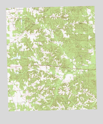
Fair Oak Springs, MS USGS Topographic Map
Click on map above to begin viewing in our Map Viewer.

This topographic map contains these locations and features:
Feature Name Type Latitude Longitude GNIS ID View Map
Bethel Temple ChurchChurchN31.5102°W90.3518°666967View Map
Big Springs ChurchChurchN31.5796°W90.3284°667149View Map
Big Springs School (historical)SchoolN31.5793°W90.3279°707623View Map
Chester Clarke DamDamN31.5618°W90.3568°680764View Map
Clarks LakeReservoirN31.5651°W90.3618°668524View Map
Fair Oak SpringsPopulated PlaceN31.5546°W90.3204°691852View Map
Fair Oak Springs Consolidated School (historical)SchoolN31.5532°W90.3206°707626View Map
Fair RiverPopulated PlaceN31.5460°W90.2693°691853View Map
Fair River ChurchChurchN31.5649°W90.2704°669864View Map
Fair River Hall School (historical)SchoolN31.5529°W90.2959°686219View Map
Fair River Store (historical)LocaleN31.5638°W90.2737°686220View Map
Gravel Pit LakeReservoirN31.6094°W90.3535°670614View Map
HarmonyPopulated PlaceN31.5224°W90.2681°691921View Map
Harmony ChurchChurchN31.5213°W90.2693°686234View Map
Heucks Lookout TowerTowerN31.6129°W90.3043°711244View Map
Heucks RetreatLocaleN31.6227°W90.3584°671143View Map
Heucks Retreat Baptist ChurchChurchN31.6229°W90.3581°686236View Map
Holly Springs ChurchChurchN31.6046°W90.2723°671336View Map
Hopewell ChurchChurchN31.5843°W90.3129°671415View Map
Huecks Retreat Lake DamDamN31.6102°W90.3534°680787View Map
Kees CemeteryCemeteryN31.5629°W90.3106°672075View Map
Kees CreekStreamN31.5510°W90.3215°672076View Map
Lewis Mullens Lake DamDamN31.5452°W90.3601°680754View Map
Little Fair RiverStreamN31.5499°W90.2768°672607View Map
Macedonia CemeteryCemeteryN31.5808°W90.3750°672994View Map
Macedonia ChurchChurchN31.5807°W90.3745°673000View Map
McNair Mill (historical)LocaleN31.5957°W90.3495°686255View Map
Oak Grove School (historical)SchoolN31.5577°W90.3393°686260View Map
Old MalcumLocaleN31.6041°W90.2856°675204View Map
Perch CreekStreamN31.5552°W90.2518°675609View Map
Richey CreekStreamN31.5427°W90.2943°676634View Map
Shadycreek Acres AirportAirportN31.5491°W90.3096°2717366View Map
Smith CemeteryCemeteryN31.6110°W90.3443°677903View Map
Soegaard (historical)LocaleN31.6127°W90.2990°686282View Map
Souls Harbor ChurchChurchN31.5024°W90.3643°677990View Map
Supervisor District 1CivilN31.5330°W90.3458°711962View Map
Turkey BranchStreamN31.5143°W90.2937°678944View Map
Union Baptist ChurchChurchN31.5077°W90.3281°679048View Map
Walkers CreekStreamN31.5210°W90.3056°679280View Map

Note: Coordinates in the location and feature list above are referenced to NAD83 datum.


Copyright (C) 2008-2025 Ryan Niemi / Sunset Dynamics ... All Rights Reserved