TopoQuest Logo
Do you find TopoQuest useful?
Help keep TopoQuest running and adding new maps/features by donating!
Bitcoin:  19c7KJd3qBynnjoSw5npx9KScwjBe4ifkT
Litecoin:  LXs6TkuXGGXo1vDsWCkWVdjQX94eUKd6ui
Home View Maps Find Maps Find Places Resources & Links


Nola, Mississippi Topographic Map

USGS Map Title: Nola, MS
USGS Map MRC: 31090E2
DRG (GeoTIFF) Download: o31090e2.tif


Neighboring USGS Topographic Map Quads:


  Stronghope, MS  
31090F3
 

  Oma, MS  
31090F2
 

  Monticello NE, MS  
31090F1
 

  Fair Oak Springs, MS  
31090E3
 

  Nola, MS  
31090E2
 

  Monticello, MS  
31090E1
 

  Ruth, MS  
31090D3
 

  Topeka, MS  
31090D2
 

  Tilton, MS  
31090D1


Map MRC Location:

N32°
W91°
N32°
W90°
H8 H7 H6 H5 H4 H3 H2 H1
G8 G7 G6 G5 G4 G3 G2 G1
F8 F7 F6 F5 F4 F3 F2 F1
E8 E7 E6 E5 E4 E3 E2 E1
D8 D7 D6 D5 D4 D3 D2 D1
C8 C7 C6 C5 C4 C3 C2 C1
B8 B7 B6 B5 B4 B3 B2 B1
A8 A7 A6 A5 A4 A3 A2 A1
N31°
W91°
N31°
W90°

Nola, MS USGS 1:24K Topographic Map Preview:
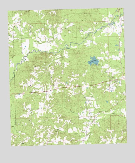
Nola, MS USGS Topographic Map
Click on map above to begin viewing in our Map Viewer.

This topographic map contains these locations and features:
Feature Name Type Latitude Longitude GNIS ID View Map
Bear CreekStreamN31.5941°W90.1837°692493View Map
Carmel ChurchChurchN31.5216°W90.1612°668064View Map
Joseph Neylans SpringSpringN31.5391°W90.1451°687141View Map
Kings CreekStreamN31.5110°W90.1645°672173View Map
Lake Mary CrawfordReservoirN31.5767°W90.1589°673210View Map
Marshall CreekStreamN31.5221°W90.1554°673164View Map
Mary Crawford Lake DamDamN31.5735°W90.1534°680769View Map
Maxwells BranchStreamN31.5696°W90.2456°673254View Map
Mount Pleasant ChurchChurchN31.6071°W90.1923°674222View Map
New Zion ChurchChurchN31.5552°W90.2031°674874View Map
NolaPopulated PlaceN31.6143°W90.2381°674929View Map
Pleasant Grove School (historical)SchoolN31.5027°W90.2481°686267View Map
Rock Hill ChurchChurchN31.5610°W90.1395°676753View Map
RosellaPopulated PlaceN31.6074°W90.1284°692187View Map
Sasser Pond DamDamN31.5568°W90.1884°680762View Map
Supervisor District 1CivilN31.5220°W90.1439°711943View Map
Wilson Lake DamDamN31.5385°W90.1468°680750View Map
WMLC-AM (Monticello)TowerN31.5568°W90.1351°680082View Map

Note: Coordinates in the location and feature list above are referenced to NAD83 datum.


Copyright (C) 2008-2025 Ryan Niemi / Sunset Dynamics ... All Rights Reserved